
Explore Cretas in Spain
Cretas in the region of Aragon with its 564 inhabitants is a town in Spain - some 208 mi or ( 335 km ) East of Madrid , the country's capital city .
Current time in Cretas is now 05:27 PM (Sunday) . The local timezone is named " Europe/Madrid " with a UTC offset of 1 hours. Depending on the availability of means of transportation, these more prominent locations might be interesting for you: Castellón de la Plana, Perpignan, Montpellier, Bordeaux, and Zaragoza. Since you are here already, make sure to check out Castellón de la Plana . We saw some video on the web . Scroll down to see the most favourite one or select the video collection in the navigation. Where to go and what to see in Cretas ? We have collected some references on our attractions page.
Videos
Calaceite vaquillas 2008 Chich 01
Video Calaceite en fiestas 2008, vaquillas peña TEDAX. ..
PEDALES DE LOS PORTS BECEITE
Descubriendo un territorio a pedales www.pedalesdelosports.org ..
Hotel Cresol in Calaceite, Spain
The Hotel Cresol is a small, historic hotel in the rural village of Calaceite, in Aragon, Spain. The magical village Calaceite ("House of Oil") can be found in the region of Matarraña, between Barcelo ..
Escodines Baixes
Iberian stele in Escodines Baixes (Iberian settlement, Matarranya valley, Massalió) ..
Videos provided by Youtube are under the copyright of their owners.
Interesting facts about this location
Matarraña/Matarranya
Matarraña or Matarranya is a comarca in eastern Aragon, bordering the Spanish Autonomous Communities of Catalonia and Valencia. It is located in Teruel Province, in the mountainous Sistema Ibérico area. Its capital is Valderrobres, and it borders the Aragonese comarques of Bajo Aragón-Caspe/Baix Aragó-Casp, and Bajo Aragón, the Catalan comarques of Terra Alta, Baix Ebre, and Montsià, and the Valencian comarques of Baix Maestrat and Ports.
Located at 40.88 0.13 (Lat./Long.); Less than 8 km away
Roques de Benet
Roques de Benet is a compact group of sheer rocky outcrops in the northwestern side of the Ports de Tortosa-Beseit, Catalonia, Spain. The highest summit has an altitude of 1,007.2 metres above sea level.
Located at 40.90 0.33 (Lat./Long.); Less than 10 km away
Serra de l'Espina
Serra de l'Espina is a limestone mountain chain located at the north-eastern end of the Iberian System. It connects the Ports de Tortosa-Beseit mountain massif with the Catalan Pre-Coastal Range. The Serra de l'Espina ridge's highest point is L'Espina (1,181.6 m). Other high peaks are Mola Carrascosa (1.025 m), Cap de la Faixa Blanca (1.023 m), Tossal de Montclí (960 m) and La Moleta d'Alfara (812 m).
Located at 40.88 0.36 (Lat./Long.); Less than 14 km away
Serra dels Pesells
Serra dels Pesells is a mountain chain located near the southern end of the Catalan Pre-Coastal Range between Bot and Arenys de Lledó. The ridge's highest point is 541,3 m. This smooth range runs in a NNE - SSW direction and divides the basins of the Canaletes and Algars rivers. It is one of the isolated hills of the Catalan Central Depression and it is located at its southwestern end. Currently wind turbines are being built on top of the Serra dels Pesells ridge.
Located at 41.02 0.34 (Lat./Long.); Less than 14 km away
Serra de Paüls
Serra de Paüls is a mountain range in the northern side of the Ports de Tortosa-Beseit, Catalonia, Spain. The highest summit, Punta de l'Aigua has an altitude of 1,091.6 metres above sea level. The central part of the range is known as Montsagre de Paüls. This range is named after the town of Paüls, located on its SE side.
Located at 40.95 0.39 (Lat./Long.); Less than 15 km away
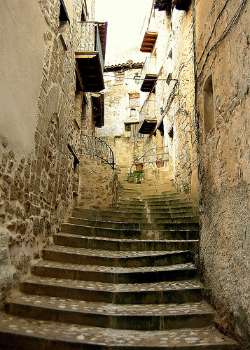
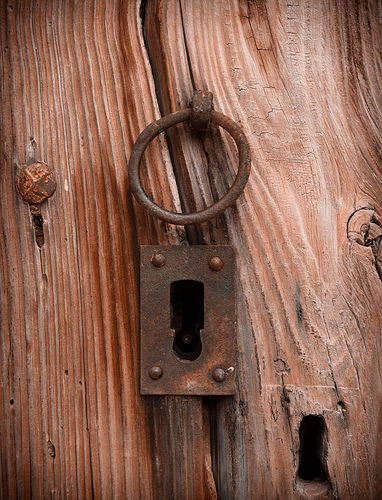
Pictures
Historical Weather
Related Locations
Information of geographic nature is based on public data provided by geonames.org, CIA world facts book, Unesco, DBpedia and wikipedia. Weather is based on NOAA GFS.