-
You are here:
- Homepage »
- Spain »
- Canary Islands » San Nicolas

San Nicolas Destination Guide
Explore San Nicolas in Spain
San Nicolas in the region of Canary Islands with its 7,950 inhabitants is a town in Spain - some 1,099 mi or ( 1769 km ) South-West of Madrid , the country's capital city .
Current time in San Nicolas is now 07:08 AM (Sunday) . The local timezone is named " Atlantic/Canary " with a UTC offset of 0 hours. Depending on the availability of means of transportation, these more prominent locations might be interesting for you: El Aaiún, Teror, Telde, Tegueste, and Santa Cruz de Tenerife. Since you are here already, make sure to check out El Aaiún . We encountered some video on the web . Scroll down to see the most favourite one or select the video collection in the navigation. Where to go and what to see in San Nicolas ? We have collected some references on our attractions page.
Videos
Most beautiful places of Gran Canaria: Forest of Tamadaba
This ancient forest is located 1.500 meters above sea-level. Get to know this place renting a car in one of our Hotels! www.hotelesdunas.com ..
Gran Canaria around on motorcycle part 1 Puerto Rico-Mogan
Riding Suzuki DL650 V-Strom around GranCanaria,abaut 190 km long trip, had battery for only abaut 50 min. of video.Starting at Puerto Rico ,ending on west coast. ..
Gran Canaria: El Balcon to Agete victor parker video
This has to be one of the most spectacular roads anywhere. It drives along a sheer cliff face for a long way before arriving at the NW end of the island and the town of Agete. ..
Stand Islas Canarias World Travel Market 2008
Desde la Consejería de Turismo del Gobierno de Canarias se ha emprendido una profunda renovación de la imagen de las Islas. Dicha renovación pasa también por un nuevo concepto de stand ferial que vio ..
Videos provided by Youtube are under the copyright of their owners.
Interesting facts about this location
El Dedo de Dios
El Dedo de Dios was a famous rock structure in the Atlantic Ocean, located in the northern part of Gran Canaria, one of the Canary Islands. During Tropical Storm Delta in November 2005, the thin top of the rocky monument was broken off and fell into the sea, destroying its unique characteristic that had the shape of a finger (hence the name "God's finger"). It was one of the many natural monuments of the Canary Islands located outside the coastal town of Agaete, at the north of Gran Canaria.
Located at 28.10 -15.71 (Lat./Long.); Less than 14 km away
Mogán, Las Palmas
Mogán is a municipality in the southwestern corner of the island of Gran Canaria, which is one of the three main islands making up the Spanish province of Las Palmas in the Canary Islands. It includes the fishing towns of Puerto de Mogán and Arguineguin. Mogán is the second largest municipality by area on the island. The population is 15,176, its density is 88.17/km² and the area is 172 km². Much of the population lives on the Atlantic coastline.
Located at 27.87 -15.72 (Lat./Long.); Less than 15 km away
Tejeda
Tejeda is a Canarian municipality in the westcentral and the central portion of the island of Gran Canaria in the Las Palmas province in the Canary Islands. Tejeda is the main city of Cumbre and is the second smallest village on the island as well as the highest municipal seat on the island. The population is 2,347, its density is 22.73/km² and the area is 103.29 km². Tejeda is situated in the mountains and the valley area that are mainly covered with greenspaces and forests.
Located at 28.00 -15.62 (Lat./Long.); Less than 16 km away
Roque Nublo
Roque Nublo (Spanish meaning the "Rock Clouded") is a monolith feature that is 80 m tall. It is one of the most famous landmarks on the island of Gran Canaria. The elevation is 1,813 m, ranking it second on the island and one of the tallest in the archipelago. It is municipally located in Tejeda, a few kilometres from the town centre. It was formed by a volcanic eruption around 4.5 million years ago. It can be reached very easily by hiking some 30 minutes from a nearby parking lot.
Located at 27.97 -15.61 (Lat./Long.); Less than 17 km away
Gran Canaria
Gran Canaria (originally meaning 'Great of Dogs') is the second most populous island of the Canary Islands, a Spanish archipelago, with a population of 838,397 which constitutes approximately 40% of the population of the archipelago. Located in the Atlantic Ocean about 150 kilometers (~93 miles) off the northwestern coast of Africa and about 1350 km (~838 miles) from Europe. Gran Canaria was populated by the Canarii (Guanches), who may have arrived as early as 500 BC.
Located at 27.97 -15.60 (Lat./Long.); Less than 18 km away
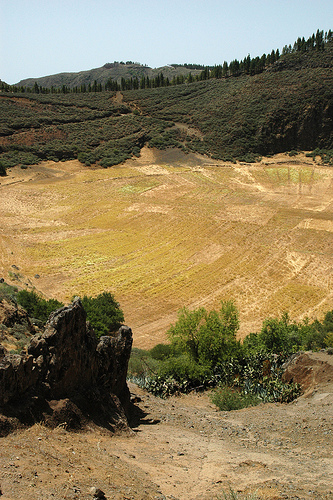
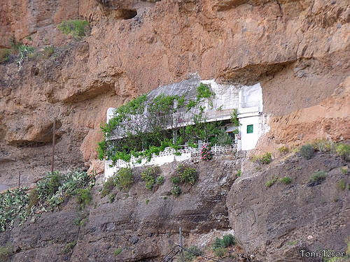
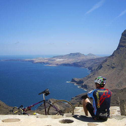
Pictures
Related Locations
Information of geographic nature is based on public data provided by geonames.org, CIA world facts book, Unesco, DBpedia and wikipedia. Weather is based on NOAA GFS.