-
You are here:
- Homepage »
- Switzerland »
- Bern » Eriz

Eriz Destination Guide
Explore Eriz in Switzerland
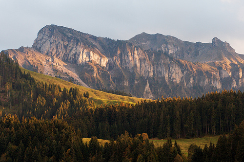
Eriz in the region of Bern with its 504 inhabitants is a town in Switzerland - some 19 mi or ( 30 km ) South-East of Berne , the country's capital city .
Current time in Eriz is now 08:52 AM (Thursday) . The local timezone is named " Europe/Zurich " with a UTC offset of 1 hours. Depending on the availability of means of transportation, these more prominent locations might be interesting for you: Zurich, Thun, Steffisburg, Spiez, and Sage. Since you are here already, make sure to check out Zurich . We encountered some video on the web . Scroll down to see the most favourite one or select the video collection in the navigation. Where to go and what to see in Eriz ? We have collected some references on our attractions page.
Videos
Making of - Mourinho City Ego Collection
deLaCour is proud to announce José Mourinho as their Brand Ambassador and the inspiration of The Mourinho City Ego Collection. José Mourinho's confident and courageous character has been the allegoric ..
Vision 2011 Impressions with Manon, Extrawelt and Sven Väth
Impressions from the Vision 2011. The legendary electronic music festival located in the swiss mountains. ..
Trip to Wengen - Switzerland 18 - 26/12/2011
Filmed with a Sony HDR-CX550 - Raynox HD-3035PRO - Steadicam Merlin Soundtrack : Trentemøller - The Forest ..
Rundsicht von Ringoldswil
Schöner Aussichtspunkt oberhalb Heiligenschwendi, Hünibach, Thun. Ideal zum Biken oder Wandern. Herrliche Rundsicht auf Oberländer Alpen und gegen den Jura und natürlich den Thunersee. ..
Videos provided by Youtube are under the copyright of their owners.
Interesting facts about this location
Chuderhüsi Tower
Chuderhüsi Tower (or "Aussichtsturm Gauchern") is a 42 metre observation tower built of wood at Röthenbach im Emmental, Switzerland. The tower was built in 1998, burnt down in 2001 and was rebuilt in 2002.
Located at 46.87 7.72 (Lat./Long.); Less than 10 km away
Museum für Uhren und Mechanische Musik
The Museum fur Uhren und Mechanische Musik (MUMM, Museum of Timekeeping and Mechanical Music) is located in the village of Oberhofen am Thunersee, and is a museum dedicated to both horology and mechanical music. The museum is housed in the manor house of the historic Wichterheer estate, lakeside on Lake Thun . It is located in the Bernese Oberland, about halfway between the major tourist centers of Bern and Interlaken.
Located at 46.73 7.67 (Lat./Long.); Less than 10 km away
Thunersee–Beatenberg railway
The Thunersee–Beatenberg railway (German: Thunersee–Beatenberg Bahn; TBB) is a funicular in the Swiss Canton of Berne. It links Beatenbucht on Lake Thun, served by shipping services on the lake, to the village of Beatenberg, situated on the plateau above at 1120 metres above sea level. The funicular, opened in 1889, has a length of 1695 metres and overcomes a vertical distance of 556 metres with a maximum gradient of 41%.
Located at 46.69 7.76 (Lat./Long.); Less than 11 km away
Lake Thun
Lake Thun is an Alpine lake in the Bernese Oberland in Switzerland. It took its name from the city of Thun, on its northern shore. Lake Thun's approximately 2,500 km² large catchment area frequently causes local flooding after heavy rainfalls. This occurs because the river Aar, which drains Lake Thun, has only limited capacity to handle the excess runoff.
Located at 46.68 7.72 (Lat./Long.); Less than 12 km away
Harderbahn
The Harderbahn is one of two funiculars that operate from the town of Interlaken to the mountain of Harder Kulm, in Switzerland. This funicular, the longer of the two, runs from a base station (altitude 567m above sea level) to a station near the summit of the Harder Kulm (altitude 1321.31m), Interlaken’s own mountain.
Located at 46.70 7.86 (Lat./Long.); Less than 12 km away
Pictures
Historical Weather
Related Locations
Information of geographic nature is based on public data provided by geonames.org, CIA world facts book, Unesco, DBpedia and wikipedia. Weather is based on NOAA GFS.