-
You are here:
- Homepage »
- Switzerland »
- Graubuenden » Sils-Segl Maria

Sils-Segl Maria Destination Guide
Discover Sils-Segl Maria in Switzerland
Sils-Segl Maria in the region of Graubünden with its 735 habitants is a town located in Switzerland - some 115 mi or ( 186 km ) East of Berne , the country's capital .
Local time in Sils-Segl Maria is now 08:28 PM (Tuesday) . The local timezone is named " Europe/Zurich " with a UTC offset of 1 hours. Depending on your flexibility, these larger cities might be interesting for you: Zurich, Vicosoprano, Samedan, Pontresina, and Muhlen. When in this area, you might want to check out Zurich . We found some clip posted online . Scroll down to see the most favourite one or select the video collection in the navigation. Are you looking for some initial hints on what might be interesting in Sils-Segl Maria ? We have collected some references on our attractions page.
Videos
Magic Winter (long version)
www.engadin.stmoritz.ch Engadin St. Moritz Eine Landschaft wie ein Traum Das tief verschneite Seenplateau, die Weite zwischen den majestätischen Gipfeln und das magische Licht: Die Region Engadin St. ..
Inspiring Mountain Summer (short version)
www.engadin.stmoritz.ch Engadin St. Moritz Eine Landschaft wie ein Traum Diese Berge, diese Seen, dieses Licht! Und dazwischen so viel Platz, um sich aktiv zu erholen: Die Ferienregion Engadin St. Mor ..
Stelvio Pass, Stelvio or Bust 2004
View down to some of the 48 hairpin bends that make up the Stelvio Pass.. Recently voted the best driving road in Europe on Top Gear. On this occasion, 10 New BMW Minis spent 10 days driving across 10 ..
Welcome to Nira Alpina, Switzerland
Nira Alpina, in the Switzerland ski resort of Surlej, is connected to the Corvatsch cable car station via a private walkway. In winter, you have a direct link to the finest skiing in the St. Moritz re ..
Videos provided by Youtube are under the copyright of their owners.
Interesting facts about this location
Val Fex
Val Fex is a side valley from the upper Engadine in Switzerland, located at an altitude of around 1800 to 2000 meters. On one side lies the town of Sils im Engadin/Segl, and on the other side lie mountains, including Piz Glüschaint and Il Chapütschin, as well as the valley's glacier, Vadret da Fex. Two small towns are in the valley, Fex-Platta and Fex-Crasta. The valley is car-free, except for those belonging to residents. There are two small guest houses / hotels in the valley.
Located at 46.41 9.76 (Lat./Long.); Less than 2 km away
Lej da la Tscheppa
Lej da la Tscheppa is a lake above Sils-Maria, in the Engadin valley of the Grisons, Switzerland. Its surface area is 7.96 ha at an elevation of 2616 m. It used to be fed by water from the Crasta-Tscheppa Glacier (melted in 2003).
Located at 46.45 9.75 (Lat./Long.); Less than 3 km away
Lake Sils
Lake Sils is a lake in the Upper Engadine valley, Grisons, Switzerland. It takes its name from the village of Sils im Engadin. The lake lies at an altitude of 1,797 metres above sea level, between Maloja Pass and Lake Silvaplana. With a surface area of 4.1 km², Lake Sils is the largest lake of the Engadine. It is also the largest natural lake in the Alps lying above 1,000 metres. The lake was formed by a prehistoric landslide dam, similarly to Lake Silvaplana.
Located at 46.42 9.73 (Lat./Long.); Less than 3 km away
Lake Silvaplana
Lake Silvaplana is a lake in the Upper-Engadine valley of Grisons, Switzerland. It takes its name from the village of Silvaplana. The lake is also connected to the nearby Lej da Champfèr. Together with its larger neighbour, Lake Sils, it is among the largest lakes of the Grisons. A campsite is located on the Northern end of the lake. The lake is also used heavily for sports, such as kitesurfing and windsurfing in the summertime.
Located at 46.45 9.79 (Lat./Long.); Less than 3 km away
Maloja District
Maloja District (Italian: Distretto di Maloggia) is an administrative district in the canton of Graubünden, Switzerland. It has an area of 973.28 km and has a population of 18,830 (as of 31 December 2011). It is trilingual, with official languages used by municipalities inside the district being, in order of dominance, German, Italian, and Romansh. It consists of two Kreise (sub-districts) and sixteen municipalities:
Located at 46.40 9.69 (Lat./Long.); Less than 6 km away
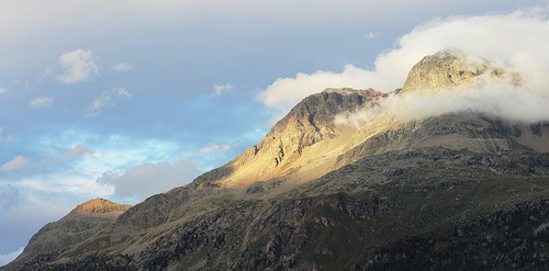
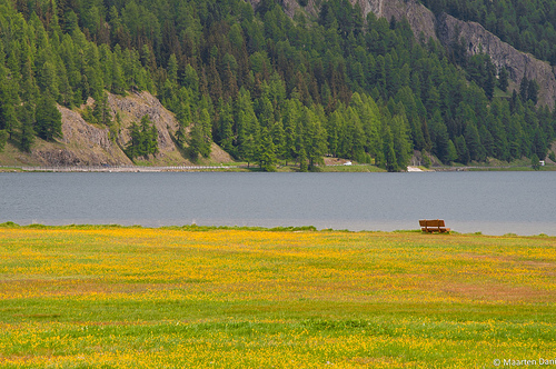
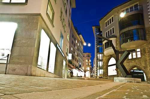
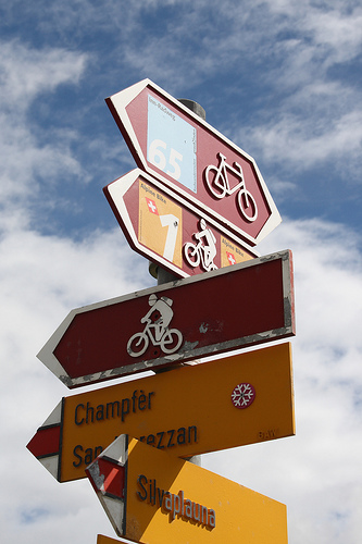
Pictures
Historical Weather
Related Locations
Information of geographic nature is based on public data provided by geonames.org, CIA world facts book, Unesco, DBpedia and wikipedia. Weather is based on NOAA GFS.