-
You are here:
- Homepage »
- United Kingdom »
- England » Charing

Charing Destination Guide
Discover Charing in United Kingdom
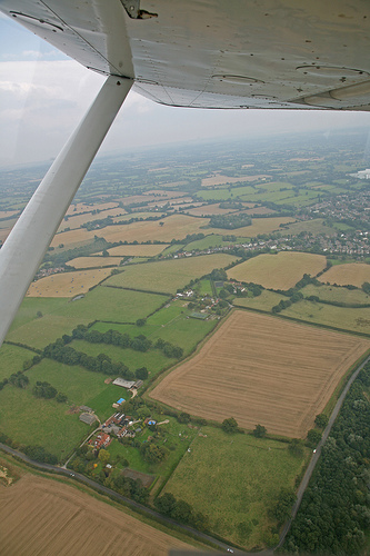
Charing in the region of England is a place located in United Kingdom - some 45 mi or ( 72 km ) South-East of London , the country's capital .
Local time in Charing is now 03:48 AM (Wednesday) . The local timezone is named " Europe/London " with a UTC offset of 0 hours. Depending on your mobility, these larger cities might be interesting for you: Wye, Tenterden, Sittingbourne, Ruckinge, and London. When in this area, you might want to check out Wye . We discovered some clip posted online . Scroll down to see the most favourite one or select the video collection in the navigation. Are you looking for some initial hints on what might be interesting in Charing ? We have collected some references on our attractions page.
Videos
Tour of the lifts at Ashford shopping center
Tour of the lifts at Ashford county sq shopping center. lots of ecodiscs. benobve.110mb.com ..
Snow Joke
Behind the scenes at a snow covered train company. ..
Kent The Garden of England UK Travel Tourism Global News
SBARTSTV News Video Kent The Garden of England UK Travel Tourism Global News ..
Staying Strong
A poem about my journey since being diagnosed as HIV positive, ..
Videos provided by Youtube are under the copyright of their owners.
Interesting facts about this location
Archbishop's Palace, Charing
Archbishop's Palace, Charing an important heritage site first mentioned in the Domesday Book as land held by the Archbishop of Canterbury at 'Meddestane', was redeveloped as a palace in 1348. This was one of a string of medieval palaces at Charing, Otford and Croydon, serving the archbishops travelling between Canterbury and London. The Archbishops' registers indicate that a palace at Charing was in regular use from the time of Archbishop Peckham (1279–1292).
Located at 51.21 0.80 (Lat./Long.); Less than 0 km away
Charing railway station
Charing railway station serves Charing in Kent, England. The station, and all trains serving it, is operated by Southeastern. The ticket office is manned only during part of the day; at other times a PERTIS 'permit to travel' machine, located outside the station building on the 'down' side, suffices. The next station eastwards (towards Ashford) used to be Hothfield, however it was closed in 1959, although it remained a 'request' stop for railway staff throughout the 1960s.
Located at 51.21 0.79 (Lat./Long.); Less than 0 km away
Lenham Heath
Lenham Heath is a hamlet in Kent situated on the southern edge of the North Downs, halfway between Maidstone and Ashford. grid reference TQ910500. The road through Lenham Heath runs parallel, and close to High Speed 1 and the M20 motorway. The Stour Valley Walk passes through the community.
Located at 51.22 0.73 (Lat./Long.); Less than 4 km away
Faversham and Mid Kent (UK Parliament constituency)
Faversham and Mid Kent is a constituency represented in the House of Commons of the UK Parliament since 2001 by Hugh Robertson, a Conservative.
Located at 51.25 0.80 (Lat./Long.); Less than 4 km away
Kent
Kent /ˈkɛnt/ is a county in South East England, and one of the home counties. The ceremonial county boundaries of Kent include the shire county of Kent and the unitary borough of Medway. Kent has a nominal border with France halfway through the Channel Tunnel, as well as a defined boundary with Essex in the middle of the Thames Estuary. The county also borders Greater London to the North West near the towns of Swanley and Dartford, Surrey near Westerham and East Sussex near Tunbridge Wells.
Located at 51.19 0.73 (Lat./Long.); Less than 5 km away
Pictures
Historical Weather
Related Locations
Information of geographic nature is based on public data provided by geonames.org, CIA world facts book, Unesco, DBpedia and wikipedia. Weather is based on NOAA GFS.