-
You are here:
- Homepage »
- United States »
- Florida » Carrabelle

Carrabelle Destination Guide
Delve into Carrabelle in United States
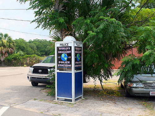
Carrabelle in the region of Florida with its 2,778 residents is located in United States - some 761 mi or ( 1224 km ) South-West of Washington , the country's capital .
Local time in Carrabelle is now 04:31 AM (Thursday) . The local timezone is named " America/New York " with a UTC offset of -4 hours. Depending on your mobility, these larger destinations might be interesting for you: Geneva, Montgomery, Big Blackjack Landing, Curtis Mill, and Jacksonville. While being here, you might want to check out Geneva . We discovered some clip posted online . Scroll down to see the most favourite one or select the video collection in the navigation. Are you curious about the possible sightseeing spots and facts in Carrabelle ? We have collected some references on our attractions page.
Videos
Dog Island Trip 4-21-10
Flight to Dog Island Florida on Apr 21, 2010. Cessna 172. Scouting the island environment and Pelican Inn. Island only accessible by plane or boat. ..
Carrabelle FL - little fishin' and shrimpin' town on Gulf coast
Small town USA. Shrimping and fishing on the Gulf of Mexico, the people impacted by BP oil spill and the after effects. This restaurants was awesome, right on the bay, friendly people, shrimping boats ..
REhab 08-- Cribs
A look inside the unique "Cribs" of REhab 08, Origin's trip to Destin Florida. www.bgavideo.wordpress.com ..
Lessons From The Road
Returning from Florida in the first trip of our new Roadtrek motor home ..
Videos provided by Youtube are under the copyright of their owners.
Interesting facts about this location
Carrabelle River
Carrabelle River is located in Carrabelle, Florida and flows into St. George Sound and the Gulf of Mexico. The area has been a base for commercial fishermen. It is home to a river festival. It is crossed by the Carrabelle River Bridge on Highway 98. Upstream the Carrabelle forks into the New River and Crooked River (Florida).
Located at 29.84 -84.66 (Lat./Long.); Less than 2 km away
New River (Carrabelle River)
New River is in the Florida Panhandle. It originates in the far north of the Apalachicola National Forest and joins with the Crooked River (Florida) above Carrabelle, Florida to become the Carrabelle River, which opens onto St. George Sound and the Gulf of Mexico. The New River watershed drains a large part of Liberty County, Florida with the Apalachicola River to the west and the Wakulla River to the east.
Located at 29.86 -84.68 (Lat./Long.); Less than 2 km away
McKissack Ponds
Mckissack Ponds is a lake in Franklin County, Florida, near Carrabelle, Florida. It is owned by Franklin County.
Located at 29.84 -84.69 (Lat./Long.); Less than 2 km away
Tyndall Air Force Base
Tyndall Air Force Base is a United States Air Force Base located 12 miles east of Panama City, Florida. The base was named in honor of World War I pilot 1st Lt Frank Benjamin Tyndall. The base operating unit and host wing is the 325th Fighter Wing (325 FW) of the Air Combat Command (ACC). The base is delineated as a census-designated place and had a resident population of 2,994 at the 2010 census.
Located at 29.87 -84.63 (Lat./Long.); Less than 3 km away
Crooked River Light
The Crooked River Light, also known as the Carrabelle Light, was built in 1895 to replace the Dog Island Light on Dog Island, which had been destroyed in 1875 by a hurricane. The location on the mainland allowed the light to serve as the rear range light for the channel to the west of Dog Island, used by ships in the lumber trade.
Located at 29.83 -84.70 (Lat./Long.); Less than 5 km away
Pictures
Related Locations
Information of geographic nature is based on public data provided by geonames.org, CIA world facts book, Unesco, DBpedia and wikipedia. Weather is based on NOAA GFS.