-
You are here:
- Homepage »
- United States »
- Massachusetts » Pocasset

Pocasset Destination Guide
Explore Pocasset in United States
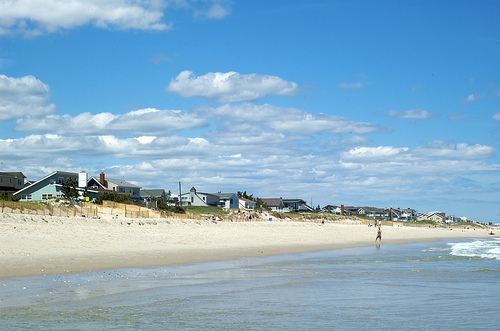
Pocasset in the region of Massachusetts with its 2,851 inhabitants is a town in United States - some 389 mi or ( 626 km ) North-East of Washington , the country's capital city .
Current time in Pocasset is now 07:31 AM (Wednesday) . The local timezone is named " America/New York " with a UTC offset of -4 hours. Depending on the availability of means of transportation, these more prominent locations might be interesting for you: East Falmouth, Hartford, Barlows Landing, Barnstable, and Boston. Since you are here already, make sure to check out East Falmouth . We encountered some video on the web . Scroll down to see the most favourite one or select the video collection in the navigation. Where to go and what to see in Pocasset ? We have collected some references on our attractions page.
Videos
How To Make Lego Mario
READ DESCRIPTION BEFORE COMMENTING!!! Due to a request from another video I made, I decided to make a simple tutorial which slows down the process of how to build a Lego version of Nintendo's greatest ..
1260 on trampoline
Short minute video with tons of tricks. ..
Sonesta Hotels, Resorts & Nile Cruises
The Sonesta Collection of hotels, resorts, and cruise ships offers upscale accommodations to savvy travelers in select locations throughout the world. When you travel to any of our locations, you will ..
Ghost tours Plymouth, Ma.
Ghosts Plymouth, Ma. 1725 Captain Taylor House, Trask Museum ..
Videos provided by Youtube are under the copyright of their owners.
Interesting facts about this location
Pocasset, Massachusetts
Pocasset is a census-designated place (CDP) in the town of Bourne in Barnstable County, Massachusetts, United States, located on Buzzards Bay. The population was 2,671 at the 2000 census.
Located at 41.69 -70.63 (Lat./Long.); Less than 1 km away
Bassetts Island
Bassetts Island is a propeller-shaped island within Pocasset Harbor and Red Brook Harbor, in Bourne, Massachusetts, USA. The island is geographically separated into four portions, the central, northeast, southeast, and the western. The island is inhabited (perhaps only seasonally); there is one house on the western portion and five houses on the northeast portion. Also, there is a minor path that runs throughout the island, except for most of its southern portion.
Located at 41.68 -70.64 (Lat./Long.); Less than 2 km away
Wings Neck
Wings Neck is a peninsula that juts out into Buzzards Bay on the south side of the Cape Cod Canal, in Bourne, Massachusetts, USA. The southwestern tip of the neck is home to the Wings Neck Lighthouse, which operated from 1889 to 1945 (now a private residence).
Located at 41.69 -70.64 (Lat./Long.); Less than 2 km away
Amrita Island
Amrita Island is a small inhabited island in Squeteague Harbor in the village of Cataumet in the town of Bourne, in Barnstable County, Massachusetts. Several residential homes are located on the island. Baxendale Road is the only road and it connects the island to the mainland from Megansett Road. Apart from the stone bridge that connects the island to the mainland, the "Love is Eternal" tomb at the end of the island is one of the most beautiful island features.
Located at 41.66 -70.62 (Lat./Long.); Less than 3 km away
Massachusetts National Cemetery
Massachusetts National Cemetery is a U.S. National Cemetery located in Bourne, Massachusetts, in Barnstable County on Cape Cod, approximately 65 miles (105 km) southeast of Boston, Massachusetts and adjacent to the Otis Air National Guard Base. As of fiscal year 2008, 46,380 have been interred there.
Located at 41.67 -70.58 (Lat./Long.); Less than 3 km away
Pictures


Related Locations
Information of geographic nature is based on public data provided by geonames.org, CIA world facts book, Unesco, DBpedia and wikipedia. Weather is based on NOAA GFS.