-
You are here:
- Homepage »
- United States »
- Texas » Volente

Volente Destination Guide
Touring Volente in United States
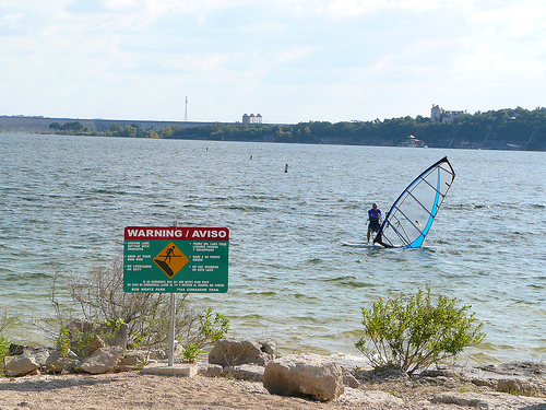
Volente in the region of Texas with its 520 citizens is located in United States - some 1,318 mi or ( 2121 km ) South-West of Washington , the country's capital city .
Time in Volente is now 04:22 AM (Saturday) . The local timezone is named " America/Chicago " with a UTC offset of -5 hours. Depending on your budget, these more prominent places might be interesting for you: Anderson Mill, Austin, Barton Creek, Belton, and Cedar Park. Being here already, consider visiting Anderson Mill . We collected some hobby film on the internet . Scroll down to see the most favourite one or select the video collection in the navigation. Check out our recommendations for Volente ? We have collected some references on our attractions page.
Videos
Happy Birthday America!! Fireworks in HD 4th of July
Taped at Carlos and Charlies Austin Texas ..
The Travis Lake House
Sleeps up to 14 people Private dock on deep water in No Wake Zone One level home provides easy access for elderly Kid friendly environment with great back yard This private, luxurious and peaceful Lak ..
Quick Tour of my Grandparent's RV
I was hanging out with my grandparents and decided to give a quick tour of their 2008 Holiday Rambler Imperial. ..
With lake levels remaining low, lake cleanup efforts continue
Whippoorwill Cove, near Windy Point on Lake Travis, seems like any other small cove on the lake with a few docks and a steep rock face. A look past those boat docks, however, reveals that trash, mostl ..
Videos provided by Youtube are under the copyright of their owners.
Interesting facts about this location
Volente, Texas
Volente is a village in Travis County, Texas. Located on the north shore of Lake Travis, the village was incorporated in 2003. The population was 520 at the 2010 census.
Located at 30.43 -97.90 (Lat./Long.); Less than 0 km away
Hudson Bend, Texas
Hudson Bend is a census-designated place (CDP) in Travis County, Texas, United States. The population was 2,981 at the 2010 census.
Located at 30.42 -97.92 (Lat./Long.); Less than 3 km away
Hippie Hollow Park
Hippie Hollow Park (originally known as McGregor County Park) is a park located on the shore of Lake Travis in northwest Austin {{#invoke:Coordinates|coord}}{{#coordinates:30.413|N|97.882|W||||| | |name= }}. It is the only legally recognized clothing-optional public park in the State of Texas. Though the land is owned by the Lower Colorado River Authority, it is leased to Travis County, whose Parks Department has administered the park since 1985.
Located at 30.41 -97.88 (Lat./Long.); Less than 3 km away
Oasis Restaurant
The The Oasis on Lake Travis is a popular restaurant on the western edge of Austin, Texas. The restaurant promotes itself as the "Sunset Capital of Texas" with its terraced views looking west over Lake Travis. The thirty thousand square foot restaurant sits on a bluff 450 feet above the lake and is the largest outdoor restaurant in Texas.
Located at 30.41 -97.88 (Lat./Long.); Less than 4 km away
Mansfield Dam
Mansfield Dam (formerly Marshall Ford Dam) is a dam located across a canyon at Marshall Ford on the Colorado River, 13 miles northwest of Austin, Texas. Construction of the dam began in 1937 and was completed in 1941 as a joint project by the Lower Colorado River Authority (LCRA) and the United States Bureau of Reclamation, with the company Brown and Root the prime contractor. Originally called Marshall Ford Dam, the name was changed in 1941 in honor of United States Representative J.J.
Located at 30.39 -97.91 (Lat./Long.); Less than 5 km away
Pictures

Related Locations
Information of geographic nature is based on public data provided by geonames.org, CIA world facts book, Unesco, DBpedia and wikipedia. Weather is based on NOAA GFS.