-
You are here:
- Homepage »
- United States »
- Washington » SeaTac

SeaTac Destination Guide
Explore SeaTac in United States
SeaTac in the region of Washington with its 26,909 inhabitants is a town in United States - some 2,320 mi or ( 3734 km ) West of Washington , the country's capital city .
Current time in SeaTac is now 05:49 PM (Saturday) . The local timezone is named " America/Los Angeles " with a UTC offset of -7 hours. Depending on the availability of means of transportation, these more prominent locations might be interesting for you: Eugene, Portland, Salem, Auburn, and Everett. Since you are here already, make sure to check out Eugene . We encountered some video on the web . Scroll down to see the most favourite one or select the video collection in the navigation. Where to go and what to see in SeaTac ? We have collected some references on our attractions page.
Videos
Travel Light, Seattle's New Light Rail Train
A sampling of the ride offered by Seattle's new light rail train. The clips start out in Tukwilla Station, move up along I-5, travel along Martin Luther King Jr. Way, and finish off in the Beacon Hill ..
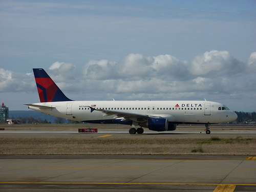
Northwest Airlines flight A330-200 Schiphol - Sea-Tac
Scheduled Northwest Airlines flight # 034 on March 4th 2009 from AMS to SEA. Equipment: Airbus A330-200, registration N853NW. Approaching Seattle Tacoma International Airport from north at Runway 16C. ..
Alaska Airlines Seattle Departure
Recorded on July 24, 2009 using a Flip Video camcorder. ..
SeaTac Airport Time Lapse
Time lapse of King5's SeaTac cam from July 31, 2008 to August 15, 2008. Shots are 5 minutes apart at 10 frames per second, which equals 50 minutes per second. 4592 shots made this video; a couple were ..
Videos provided by Youtube are under the copyright of their owners.
Interesting facts about this location
SeaTac, Washington
SeaTac is an American city in southern King County, Washington, and an outlying suburb of Seattle, Washington. "SeaTac" is a portmanteau of Seattle and Tacoma. The City of SeaTac is 10 square miles in area and has a population of 26,909 according to the 2010 census. The City boundaries surround the Seattle–Tacoma International Airport (approximately 3 square miles in area), which is owned and operated by the Port of Seattle.
Located at 47.44 -122.29 (Lat./Long.); Less than 1 km away
Tyee Educational Complex
Tyee Educational Complex is a public high school campus located in SeaTac, Washington, USA. It was founded originally as Tyee High School, a single public high school, in 1962. It is operated by the Highline School District. Starting in the 2005-06 academic year, it was split from a single school into three smaller high schools as a part of the small schools movement. It is also a member of the Coalition of Essential Schools.
Located at 47.44 -122.28 (Lat./Long.); Less than 2 km away
Angle Lake
Angle Lake is an L-shaped lake in SeaTac, Washington, United States, occupying 90 acres between Interstate 5 and State Route 99. On the western shore is a 10-acre park, Angle Lake Park, administered by the City of SeaTac Parks and Recreation department. The remainder of the shoreline is ringed with private homes. The lake is stocked with rainbow trout by the Washington Department of Fish and Wildlife. It is also home to kokanee, largemouth bass, crappie, catfish, and yellow perch.
Located at 47.43 -122.29 (Lat./Long.); Less than 2 km away
Westfield Southcenter
Westfield Southcenter, formerly known as Southcenter Mall, is a shopping mall located in Tukwila, Washington, USA. It is currently anchored by JC Penney, Macy's, Nordstrom, and Sears and owned by the Westfield Group. A Rainforest Cafe is also at the mall. It is the largest shopping center in Washington and the Pacific Northwest.
Located at 47.46 -122.26 (Lat./Long.); Less than 3 km away
Highline High School
Highline High School is a high school in Burien, Washington, United States, located about 3.5 highway miles from Seattle-Tacoma International Airport. Highline High School, the flagship high school of the Highline School District, opened its doors in 1924 and served the cities of Burien, Des Moines, and an area south of Seattle now known as White Center. Today those cities all have their own area high schools, but at the time Highline was the only high school in the area.
Located at 47.47 -122.33 (Lat./Long.); Less than 3 km away
Pictures


Related Locations
Information of geographic nature is based on public data provided by geonames.org, CIA world facts book, Unesco, DBpedia and wikipedia. Weather is based on NOAA GFS.