-
You are here:
- Homepage »
- France »
- Midi-Pyrenees » Cauterets

Cauterets Destination Guide
Discover Cauterets in France
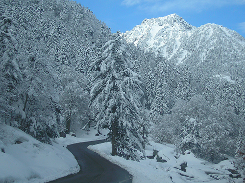
Cauterets in the region of Midi-Pyrénées with its 1,080 habitants is a place located in France - some 429 mi or ( 691 km ) South of Paris , the country's capital .
Local time in Cauterets is now 06:39 AM (Sunday) . The local timezone is named " Europe/Paris " with a UTC offset of 1 hours. Depending on your mobility, these larger cities might be interesting for you: Vizos, Viey, Tarbes, Sireix, and Pierrefitte-Nestalas. When in this area, you might want to check out Vizos . We discovered some clip posted online . Scroll down to see the most favourite one or select the video collection in the navigation. Are you looking for some initial hints on what might be interesting in Cauterets ? We have collected some references on our attractions page.
Videos
Ouverture Cirque du Lys 12-13
Le cirque du lys à Cauterets dans les hautes pyrénées a ouvert ses pistes pour la saison 2012/2013 le 6 décembre 2012. Après la sécurisation des pistes grâce aux déclenchements d'avalanches depuis l'h ..
Helicoptero de rescate en Gavarnie (FRANCIA)
Helicoptero de rescate Frances ..
Cauterets ( Lourdes Pirineos-7ªParte )
Pequeña ruta por los Pirineos Franceses ..
Bungee jump - Napoleon bridge 90m
Bungee jumping - Napoleon bridge, Luz Saint Sauveur - August 2009 ..
Videos provided by Youtube are under the copyright of their owners.
Interesting facts about this location
Pont d'Espagne
Pont d'Espagne is a stone-built bridge that spans the Gave de Marcadau at the point where it meets the Gave de Gaube, near one of its sources high in the French Pyrenees. The Pont d'Espagne is at an altitude of approx 1500m. The name translates as Spanish Bridge. Google Satellite Map There is a car park nearby and it is possible to get to Lac de Gaube by ski lift. The nearest towns are Cauterets and Lourdes.
Located at 42.85 -0.14 (Lat./Long.); Less than 4 km away
Luz Ardiden
Luz Ardiden is a ski resort in the Pyrenees. It is situated in the Hautes-Pyrénées department, in the Midi-Pyrénées. The ski resort, which lies at a height of 1720 meters, opened on January 16, 1975. In more recent times, the road to Luz Ardiden has served as an occasional stage finish in Tour de France.
Located at 42.89 -0.06 (Lat./Long.); Less than 5 km away
Lac Bleu d'Ilhéou
Lac Bleu d'Ilhéou is a lake in Hautes-Pyrénées, France. At an elevation of 1976 m, its surface area is 0.113 km².
Located at 42.86 -0.18 (Lat./Long.); Less than 5 km away
Gaube Lake
Gaube Lake is a lake in the French Pyrenees, in the department of the Hautes-Pyrénées, near the town of Cauterets.
Located at 42.83 -0.14 (Lat./Long.); Less than 6 km away
Lac du Barbat
Lac du Barbat is a lake in Hautes-Pyrénées, France.
Located at 42.88 -0.20 (Lat./Long.); Less than 7 km away
Pictures
Historical Weather
Related Locations
Information of geographic nature is based on public data provided by geonames.org, CIA world facts book, Unesco, DBpedia and wikipedia. Weather is based on NOAA GFS.