-
You are here:
- Homepage »
- France »
- Poitou-Charentes » Dolus-d'Oleron

Dolus-d'Oleron Destination Guide
Delve into Dolus-d'Oleron in France
Dolus-d'Oleron in the region of Poitou-Charentes with its 3,114 residents is a city in France - some 264 mi or ( 425 km ) South-West of Paris , the country's capital .
Current time in Dolus-d'Oleron is now 04:21 PM (Saturday) . The local timezone is named " Europe/Paris " with a UTC offset of 1 hours. Depending on your travel modalities, these larger destinations might be interesting for you: Saintes, Saint-Denis-d'Oleron, Ronce-les-Bains, Paris, and Niort. While being here, make sure to check out Saintes . We encountered some video on the web . Scroll down to see the most favourite one or select the video collection in the navigation. Are you curious about the possible sightseeing spots and facts in Dolus-d'Oleron ? We have collected some references on our attractions page.
Videos
Ile d'Oléron
L'ile d'oléron ..
Coucher de Soleil : Rayon Vert et Rayon Bleu - Green & Blue Flashs at Sun Set
Coucher de soleil : Rayon Vert et rayon Bleu Le 20 aout 2010 à 21h05 sur la plage de Grand Village - Ile d'Oleron Rayon vert à 55" et bleu à 57" "oh ! on la vu ! ...... Oh il était trop beau ! "... ..
camping la brande Yann's driving Chris's caravan.mpg
le bon esprit d'entraide au camping la brande. Chris arrive d'Angleterre et très fatigué n'arrive plus à manoeuvrer sa "grande" caravane dans les allées du camping. Yann se propose alors de prendre le ..
camping la brande le clip
présentation fun du camping la brande ..
Videos provided by Youtube are under the copyright of their owners.
Interesting facts about this location
Oléron
Île d'Oléron is an island off the Atlantic coast of France (due west of Rochefort), on the southern side of the Pertuis d'Antioche strait. It is the second largest French island after Corsica.
Located at 45.90 -1.30 (Lat./Long.); Less than 3 km away
Boyardville
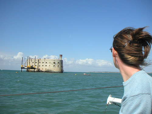
Boyardville is a district in the city of Saint-Georges-d'Oléron on the eastern part of the island of Oléron (Île d'Oléron) in Charente-Maritime, France. The community has a small beach resort, fishing port, and marina, and its shore is a popular spot for surfing. The name of the district derives from Fort Boyard, a famous Napoleonic ocean fortress located a few kilometers offshore.
Located at 45.98 -1.33 (Lat./Long.); Less than 9 km away
Île Madame
Île Madame is an island in the River Charente estuary on the Atlantic coast of France joined to the mainland by a causeway. The island has an area of four square miles and is unpopulated. Hundreds of Catholic priests were held prisoner on the island during anti-clerical persecution in 1794. A total of 254 died before the survivors were allowed to leave. The priests who were held prisoner and those who died on the island are commemorated during a pilgrimage there each August.
Located at 45.96 -1.11 (Lat./Long.); Less than 13 km away
Basque Roads
Basque Roads is a sheltered bay on the Biscay shore of the Charente-Maritime département of France, bounded by the Île d'Oléron to the west and the Île de Ré to the north. The port of La Rochelle stands at the northeast corner of the roads, and the town of Rochefort is near the mouth of the Charente River to the south. It is most famous as the site of the British naval victory over a French fleet at the 1809 Battle of Basque Roads.
Located at 46.04 -1.21 (Lat./Long.); Less than 15 km away
Charente (river)
The Charente is a 381 km long river in southwestern France. Its source is in the Haute-Vienne département at Chéronnac, a small village near Rochechouart. It flows through the departments of Haute-Vienne, Charente, Vienne and Charente-Maritime. The river flows into the Atlantic Ocean near Rochefort.
Located at 45.96 -1.08 (Lat./Long.); Less than 15 km away
Pictures

Related Locations
Information of geographic nature is based on public data provided by geonames.org, CIA world facts book, Unesco, DBpedia and wikipedia. Weather is based on NOAA GFS.