-
You are here:
- Homepage »
- France »
- Poitou-Charentes » Saint-Pierre-d'Oleron

Saint-Pierre-d'Oleron Destination Guide
Discover Saint-Pierre-d'Oleron in France
Saint-Pierre-d'Oleron in the region of Poitou-Charentes is a town located in France - some 264 mi or ( 425 km ) South-West of Paris , the country's capital .
Local time in Saint-Pierre-d'Oleron is now 03:49 PM (Saturday) . The local timezone is named " Europe/Paris " with a UTC offset of 1 hours. Depending on your flexibility, these larger cities might be interesting for you: Saint-Trojan-les-Bains, Saint-Denis-d'Oleron, Ronce-les-Bains, Paris, and Niort. When in this area, you might want to check out Saint-Trojan-les-Bains . We found some clip posted online . Scroll down to see the most favourite one or select the video collection in the navigation. Are you looking for some initial hints on what might be interesting in Saint-Pierre-d'Oleron ? We have collected some references on our attractions page.
Videos
fete foraine : impulsion à luna park
éjection depuis une boule avec des elastique ..
Ile d'Oléron
L'ile d'oléron ..
VUE D'EN HAUT ......OLERON
baptême de l'air ..
camping oleron tout le confort du camping sur l'ile d'Oleron
le camping sur l'ile d'Oleron, c'est tout l'éventail de conforts dans un environnement paysager de qualité. ..
Videos provided by Youtube are under the copyright of their owners.
Interesting facts about this location
Oléron
Île d'Oléron is an island off the Atlantic coast of France (due west of Rochefort), on the southern side of the Pertuis d'Antioche strait. It is the second largest French island after Corsica.
Located at 45.90 -1.30 (Lat./Long.); Less than 5 km away
Basque Roads
Basque Roads is a sheltered bay on the Biscay shore of the Charente-Maritime département of France, bounded by the Île d'Oléron to the west and the Île de Ré to the north. The port of La Rochelle stands at the northeast corner of the roads, and the town of Rochefort is near the mouth of the Charente River to the south. It is most famous as the site of the British naval victory over a French fleet at the 1809 Battle of Basque Roads.
Located at 46.04 -1.21 (Lat./Long.); Less than 13 km away
Île Madame
Île Madame is an island in the River Charente estuary on the Atlantic coast of France joined to the mainland by a causeway. The island has an area of four square miles and is unpopulated. Hundreds of Catholic priests were held prisoner on the island during anti-clerical persecution in 1794. A total of 254 died before the survivors were allowed to leave. The priests who were held prisoner and those who died on the island are commemorated during a pilgrimage there each August.
Located at 45.96 -1.11 (Lat./Long.); Less than 15 km away
Seudre
The Seudre is a river in the Charente-Maritime département, southwestern France, flowing into the Atlantic Ocean. Its source is near Saint-Genis-de-Saintonge. It flows northwest through Saint-André-de-Lidon, Saujon and La Tremblade. It flows into the Atlantic Ocean near Marennes. The lower course of the Seudre is brackish, and is used for oyster farming.
Located at 45.80 -1.14 (Lat./Long.); Less than 20 km away
Pertuis d'Antioche
The Pertuis d'Antioche ("Passage of Antioch") is a strait on the Atlantic coast of Western France, between two islands, Île de Ré and Île d'Oléron, on the one side, and on the other side the continental coast between the cities of La Rochelle and the naval arsenal of Rochefort.
Located at 46.11 -1.44 (Lat./Long.); Less than 21 km away
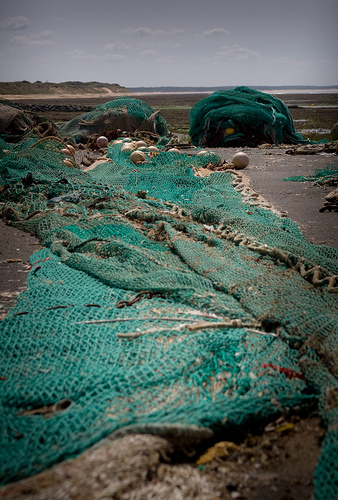
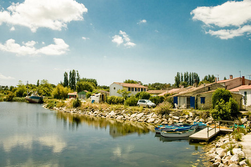
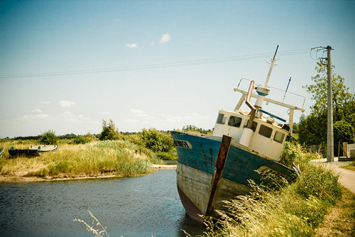
Pictures
Related Locations
- Saint-Pierre-du-Mesnil (Haute-Normandie)
- Saint-Pierre-du-Lorouer (Pays de la Loire)
- Saint-Pierre-du-Jonquet (Basse-Normandie)
- Saint-Pierre-du-Fresne (Basse-Normandie)
- Saint-Pierre-du-Chemin (Pays de la Loire)
- Saint-Pierre-du-Champ (Auvergne)
- Saint-Pierre-du-Bu (Basse-Normandie)
- Saint-Pierre-du-Bosguerard (Haute-Normandie)
- Saint-Pierre-d'Irube (Aquitaine)
- Saint-Pierre-d'Eyraud (Aquitaine)
- Saint-Pierre-d'Exideuil (Poitou-Charentes)
- Saint-Pierre-de-Vassols (Provence-Alpes-Côte d'Azur)
- Saint-Pierre-de-Varennes (Bourgogne)
- Saint-Pierre-de-Varengeville (Haute-Normandie)
- Saint-Pierre-de-Trivisy (Midi-Pyrénées)
- Saint-Pierre-des-Tripiers (Languedoc-Roussillon)
Information of geographic nature is based on public data provided by geonames.org, CIA world facts book, Unesco, DBpedia and wikipedia. Weather is based on NOAA GFS.