-
You are here:
- Homepage »
- United Kingdom »
- England » Bembridge

Bembridge Destination Guide
Explore Bembridge in United Kingdom
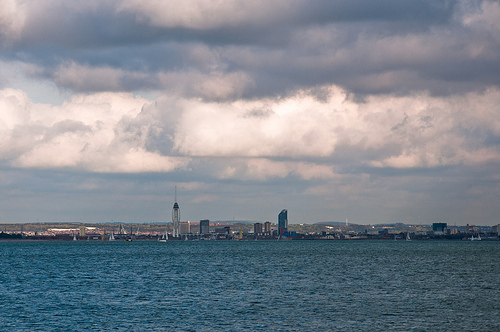
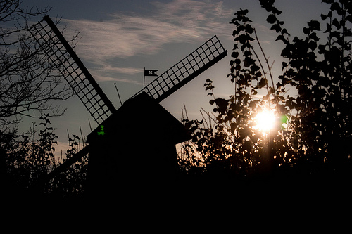
Bembridge in the region of England with its 3,570 inhabitants is a town in United Kingdom - some 70 mi or ( 113 km ) South-West of London , the country's capital city .
Current time in Bembridge is now 01:32 AM (Wednesday) . The local timezone is named " Europe/London " with a UTC offset of 0 hours. Depending on the availability of means of transportation, these more prominent locations might be interesting for you: Ventnor, Southampton, Seaview, Sandown, and St Helens. Since you are here already, make sure to check out Ventnor . We encountered some video on the web . Scroll down to see the most favourite one or select the video collection in the navigation. Where to go and what to see in Bembridge ? We have collected some references on our attractions page.
Videos
Trains on the Beach - Isle of Wight Railway
Trains on the beach - they said it couldn't be done - they said it shouldn't be done - loikes a challenge we does... Trains by Bachmann PSU by Paul Chambers Railway by the Solent ..
The Rockin' Berries - Live 2006
A few funny bits from a full live show produced for television. Recorded in the Isle of Wight. January 2006 ..
Practical Wireless 144 MHz QRP Contest June 2010
My portable set-up for an Amateur Radio Contest, run by Practical Wireless Magazine 13 June 2010. I Packed up with still 3 or so hours to go, although wx was sunny the wind was starting to get on my n ..
Time-Lapse Limpet Gripping Rock,No Ads
Ever wondered what the underside of a Limpet looks like? I filmed this one in Rock Pools near Bembridge on the Isle of Wight. Extract from en.wikipedia.org Limpet is a common name for a number of diff ..
Videos provided by Youtube are under the copyright of their owners.
Interesting facts about this location
Bembridge School
Bembridge School was an independent school in Bembridge on the Isle of Wight founded in 1919 by social reformer and Liberal MP John Howard Whitehouse. Set in over 100 acres on the eastern most tip of the Isle of Wight Bembridge was a public school intended to challenge the traditional concept of education. Many of the radical ideas first employed by Whitehouse, such as teaching of woodwork, American history and modern languages, were not to become mainstream for half a century..
Located at 50.69 -1.07 (Lat./Long.); Less than 1 km away
Foreland
Foreland is the easternmost point of the Isle of Wight. It is located three miles (five kilometres) east of the town of Brading, and due south of the city of Portsmouth on the British mainland. It is characterised by a pub called the Crab and Lobster and various beach huts plus a beach cafe and a coast guard lookout. In the sea are the reefs of Bembridge Ledge which is rich in edible crabs, lobsters and spider crabs and shoals of mackerel.
Located at 50.69 -1.07 (Lat./Long.); Less than 1 km away
Bembridge School And Cliffs SSSI
Bembridge School And Cliffs SSSI is a 12.58 hectare geological Site of Special Scientific Interest near Bembridge on the Isle of Wight, notified in 1999. It is listed in the Geological Conservation Review. This site consists of the coastral strip in the northern part of Whitecliff Bay. Steyne Wood Clays containing fossils from the Quaternary period are found at the site.
Located at 50.67 -1.09 (Lat./Long.); Less than 1 km away
Eastern Yar
The River Yar on the Isle of Wight, England, rises in a chalk coomb in St. Catherine's Down near Niton, close to the southern point of the island. It flows across the Lower Cretaceous rocks of the eastern side of the island before finding its way through the gap in the central Upper Cretaceous chalk ridge of the Island at Yarbridge, Brading across the now drained Brading Haven to Bembridge Harbour and Spithead, near the eastern end of the Island.
Located at 50.69 -1.11 (Lat./Long.); Less than 2 km away
St Helens Fort
St Helens Fort is a sea fort in the Solent close to the Isle of Wight, one of the Palmerston Forts near Portsmouth. It was built between 1867 and 1880 as a result of the Royal Commission to protect the St Helens anchorage. It suffered badly from subsidence which forced many changes to the plans, ending up with two 10-inch 18-ton rifled muzzle loading (RML) guns to landward and one 12.5-inch 38-ton RML gun to seaward. The fort is now in private hands and not open to the public.
Located at 50.71 -1.08 (Lat./Long.); Less than 2 km away
Pictures
Related Locations
Information of geographic nature is based on public data provided by geonames.org, CIA world facts book, Unesco, DBpedia and wikipedia. Weather is based on NOAA GFS.