-
You are here:
- Homepage »
- United Kingdom »
- England » St Helens

St Helens Destination Guide
Explore St Helens in United Kingdom
St Helens in the region of England is a town in United Kingdom - some 70 mi or ( 113 km ) South-West of London , the country's capital city .
Current time in St Helens is now 07:16 AM (Wednesday) . The local timezone is named " Europe/London " with a UTC offset of 0 hours. Depending on the availability of means of transportation, these more prominent locations might be interesting for you: Ventnor, Southampton, Seaview, St Helens, and Ryde. Since you are here already, make sure to check out Ventnor . We saw some video on the web . Scroll down to see the most favourite one or select the video collection in the navigation. Where to go and what to see in St Helens ? We have collected some references on our attractions page.
Videos
Trains on the Beach - Isle of Wight Railway
Trains on the beach - they said it couldn't be done - they said it shouldn't be done - loikes a challenge we does... Trains by Bachmann PSU by Paul Chambers Railway by the Solent ..
The Rockin' Berries - Live 2006
A few funny bits from a full live show produced for television. Recorded in the Isle of Wight. January 2006 ..
Fort Holiday Park
Holiday park next to Sandown Bay on the Isle of Wight ..
Fairway Holiday Park, Sandown, Isle of Wight, UK - Video 1
Fairway Holiday Park is situated in Sandown, on the beautiful Isle of Wight. The island itself is acknowledged as being one of the sunniest places in Britain with magnificent beaches and breathtaking ..
Videos provided by Youtube are under the copyright of their owners.
Interesting facts about this location
St Helens (Isle of Wight) railway station
St Helen's with its 232-foot-long single platform was the only intermediate stop on the 2+⁄4-mile branch line that connected Brading to the coast at Bembridge. Opened in 1882, when the area was the Island's main port, it ran with ever dwindling passengers until 1953. Pomeroy described the station thus: An imposing structure with tall chimneys and elegant dormers, particularly pleasing to the eye.
Located at 50.69 -1.11 (Lat./Long.); Less than 0 km away
Eastern Yar
The River Yar on the Isle of Wight, England, rises in a chalk coomb in St. Catherine's Down near Niton, close to the southern point of the island. It flows across the Lower Cretaceous rocks of the eastern side of the island before finding its way through the gap in the central Upper Cretaceous chalk ridge of the Island at Yarbridge, Brading across the now drained Brading Haven to Bembridge Harbour and Spithead, near the eastern end of the Island.
Located at 50.69 -1.11 (Lat./Long.); Less than 1 km away
Priory Woods
Priory Woods is a 2.94 hectare geological Site of Special Scientific Interest near the town of Bembridge, Isle of Wight, notified in 1998. It is a National Trust property and is served by a public footpath. Concealed within it is "The Priory Oyster" - an oyster bar attached to the Priory Bay Hotel and open only in the height of summer. It has significant recent archaeology with the remains of a sea wall and rusted iron railings.
Located at 50.71 -1.10 (Lat./Long.); Less than 1 km away
Bembridge railway station
Bembridge was the terminus of the 2¾ mile branch line that connected it to the main line at Brading. On holiday Saturdays the sector table revolved continuously because the station area was too small to contain points. Opened in 1882, when the area contained the Island's main port, it ran with ever-dwindling passengers until 1953. The station is long since demolished and a new development (Harbour Strand) in place.
Located at 50.69 -1.09 (Lat./Long.); Less than 2 km away
St Helens Fort
St Helens Fort is a sea fort in the Solent close to the Isle of Wight, one of the Palmerston Forts near Portsmouth. It was built between 1867 and 1880 as a result of the Royal Commission to protect the St Helens anchorage. It suffered badly from subsidence which forced many changes to the plans, ending up with two 10-inch 18-ton rifled muzzle loading (RML) guns to landward and one 12.5-inch 38-ton RML gun to seaward. The fort is now in private hands and not open to the public.
Located at 50.71 -1.08 (Lat./Long.); Less than 2 km away
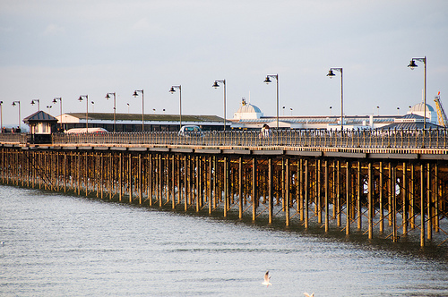
Pictures

Related Locations
Information of geographic nature is based on public data provided by geonames.org, CIA world facts book, Unesco, DBpedia and wikipedia. Weather is based on NOAA GFS.