-
You are here:
- Homepage »
- United Kingdom »
- England » Hinderwell

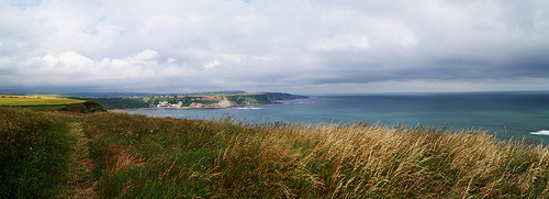
Hinderwell Destination Guide
Explore Hinderwell in United Kingdom
Hinderwell in the region of England is a town in United Kingdom - some 211 mi or ( 340 km ) North of London , the country's capital city .
Current time in Hinderwell is now 03:20 PM (Friday) . The local timezone is named " Europe/London " with a UTC offset of 0 hours. Depending on the availability of means of transportation, these more prominent locations might be interesting for you: York, Whitby, Sleights, Skinningrove, and Sheffield. Since you are here already, make sure to check out York . We encountered some video on the web . Scroll down to see the most favourite one or select the video collection in the navigation. Where to go and what to see in Hinderwell ? We have collected some references on our attractions page.
Videos
Abandoned Tunnel Exploration, Sandsend, Whitby, North Yorkshire, UK
Further info Linky: www.urbexforums.co.uk Video explore of the long closed Sandsend railway Tunnel on the North Sea Coast area North of Whitby. A picturesque coastal route which sees the permanent way ..
Sentinel Steam Bus in Whitby part 7
A trip up The Khyber Pass in Whitby in Elizabeth with driver Vernon Smith. This video was taken in Whitby on 16th February 2010 and it shows Elizabeth; a six wheeled Sentinel steam bus. Elizabeth was ..
North York Moors Railway August Bank Holiday 2009 part 1
During Bank holiday weekend I visited NYMR on two days, this is the first part of the first days visit, we see Schools Class 30926 "REPTON" starting of the action, followed by S&D 53809, then over to ..
Whitby Holiday Park - Saltwick Bay
- Taken at 10:58 PM on January 08, 2008 - cameraphone upload by ShoZu ..
Videos provided by Youtube are under the copyright of their owners.
Interesting facts about this location
Boulby Mine
Boulby Mine is a 200-hectare site run by Cleveland Potash Limited, located just southeast of the village of Boulby, on the northeast coast of the North York Moors in Redcar and Cleveland, England. It is Europe's second deepest mine at 1,400 metres —Pyhäsalmi Mine in Finland is even deeper, being 1,448 metres deep—producing half of the UK's output of potash, an agricultural fertilizer.
Located at 54.55 -0.82 (Lat./Long.); Less than 4 km away
Sandsend Tunnel
Sandsend Tunnel is a tunnel on the former Whitby, Redcar and Middlesbrough Union Railway that was opened in 1883 and closed in 1958. The rail line that ran through it was originally intended to travel along the top of the cliffs, however some of the cliff fell into the sea whilst construction was suspended so the NER constructed two tunnels, the Sandsend tunnel and the Kettleness tunnel. The Sandsend Tunnel is the longer of two tunnels being 1,652 yards in length.
Located at 54.52 -0.70 (Lat./Long.); Less than 5 km away
Easington, North Yorkshire
Easington is a village in the unitary authority of Redcar and Cleveland and the ceremonial county of North Yorkshire, England. It is located on the A174 near Loftus and inside the North York Moors National Park. It has a pub - the "Tiger Inn" and a church (All Saints).
Located at 54.55 -0.85 (Lat./Long.); Less than 5 km away
Mulgrave Castle
Mulgrave Castle refers to one of three structures on the same property in Lythe, near Whitby, Yorkshire, England. One of these, known as the "old" or "ancient" castle, was by legend founded by Wada, a 6th century ruler of Hälsingland. The second castle, caput of the feudal barony of Mulgrave, was of Norman construction and remained active until destroyed by order of Parliament in 1647.
Located at 54.49 -0.71 (Lat./Long.); Less than 7 km away
Eskdale, North Yorkshire
Eskdale is a valley running west to east from Westerdale on the North York Moors to Whitby on the east coast of England. Formed during the last major ice age, it has a classic U-shaped valley formation caused by the action of glaciers carving away the rock. Eskdale carries the River Esk from the "Esklets" above Westerdale to the sea.
Located at 54.48 -0.79 (Lat./Long.); Less than 7 km away
Pictures
Related Locations
Information of geographic nature is based on public data provided by geonames.org, CIA world facts book, Unesco, DBpedia and wikipedia. Weather is based on NOAA GFS.