-
You are here:
- Homepage »
- United Kingdom »
- England » Mulbarton

Mulbarton Destination Guide
Explore Mulbarton in United Kingdom
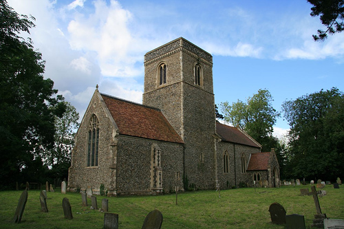
Mulbarton in the region of England with its 2,702 inhabitants is a place in United Kingdom - some 93 mi or ( 149 km ) North-East of London , the country's capital city .
Time in Mulbarton is now 11:59 AM (Wednesday) . The local timezone is named " Europe/London " with a UTC offset of 0 hours. Depending on your budget, these more prominent locations might be interesting for you: Yervilton, Trowse Newton, Tivetshall Saint Margaret, Thorpe Saint Andrew, and Swainsthorpe. Since you are here already, consider visiting Yervilton . We saw some hobby film on the internet . Scroll down to see the most favourite one or select the video collection in the navigation. Where to go and what to see in Mulbarton ? We have collected some references on our attractions page.
Videos
Setting up Camp with a Teardrop Trailer
Setting up camp with a teardrop trailer whilst making a cup of tea. ..
Ipswich Town Vs Norwich City 04/11/2007 - We're Loaded!
Tractor Boys giving it some at Carrow Road! ..
Norwich Elephant with balls gets its own back and no rubber chickens
some kind of system to protect the Norwich Elephants,,.Two vandals try to damage the Norwich elephant. promote the The work goelephants.com and Norwich city council and doing.....that's our excuse and ..
Mitosis
Animation of how cells multiply by dividing, a process called "mitosis". Made by City College Norwich AS Biology students Oliver and Andy ..
Videos provided by Youtube are under the copyright of their owners.
Interesting facts about this location
RAF Hethel
Royal Air Force Station Hethel or more simply RAF Hethel is a former Royal Air Force station which was used by both the United States Army Air Forces (USAAF) and the Royal Air Force (RAF) during the Second World War. The airfield is located 7 miles south west of Norwich, Norfolk, England and is now owned by Lotus Cars.
Located at 52.56 1.17 (Lat./Long.); Less than 4 km away
Ashwellthorpe railway station
Ashwellthorpe was a railway station that existed in the village of Ashwellthorpe, Norfolk on a cut off line between Forncett and Wymondham. It was opened in 1881, and closed in 1939. The line, originally single track, was used for main line diversion trains during the floods of 1912. It was doubled for military purposes during the First World War.
Located at 52.53 1.18 (Lat./Long.); Less than 4 km away
A140 road
The A140 is an 'A-class' road in Norfolk and Suffolk, East Anglia, England partly following the route of the Roman Pye Road. It runs from the A14 near Needham Market to the A149 south of Cromer. It is of primary status for the entirety of its route. It is approximately 56 miles (90 km) in length. There are 33 road junctions, and many driveway accesses to private dwellinghouses, and the route is crossed by 37 footpaths and bridleways and 3 designated cycle routes.
Located at 52.52 1.26 (Lat./Long.); Less than 5 km away
Venta Icenorum
Venta Icenorum, probably meaning "Market Town of the Iceni", located at modern-day Caistor St Edmund in the English county of Norfolk, was the civitas or capital of the Iceni tribe, who inhabited the flatlands and marshes of that county and who revolted against Roman rule under their queen Boudica (or Boadicea) in the winter of 61 CE. The town, which is mentioned in the Ravenna Cosmography, and the Antonine Itinerary, was a settlement near the village of Caistor St.
Located at 52.58 1.29 (Lat./Long.); Less than 5 km away
Caistor St. Edmund Chalk Pit
Caistor St. Edmund Chalk Pit is a 23.8 hectare geological Site of Special Scientific Interest in Norfolk, England, notified in 1968.
Located at 52.59 1.30 (Lat./Long.); Less than 6 km away
Pictures

Historical Weather
Related Locations
Information of geographic nature is based on public data provided by geonames.org, CIA world facts book, Unesco, DBpedia and wikipedia. Weather is based on NOAA GFS.