-
You are here:
- Homepage »
- United States »
- California » Bodega Bay

Bodega Bay Destination Guide
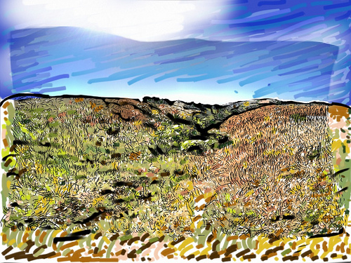
Explore Bodega Bay in United States
Bodega Bay in the region of California with its 1,077 inhabitants is a town in United States - some 2,457 mi or ( 3955 km ) West of Washington , the country's capital city .
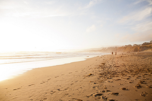
Current time in Bodega Bay is now 04:14 AM (Tuesday) . The local timezone is named " America/Los Angeles " with a UTC offset of -7 hours. Depending on the availability of means of transportation, these more prominent locations might be interesting for you: Alliance Redwood, Bridgehaven, Dillon Beach, Duncans Mills, and Fairfield. Since you are here already, make sure to check out Alliance Redwood . We encountered some video on the web . Scroll down to see the most favourite one or select the video collection in the navigation. Where to go and what to see in Bodega Bay ? We have collected some references on our attractions page.
Videos
Nickel Creek - The House of Tom Bombadil
This is footage I shot on vacation with my wife. I love this Nickel Creek album, and this song is great. Enjoy the California Coast. I will be posting a scenic shot of just waves crashing 6 to 8 minut ..
Small round jellyfish wash up on beach at Bodega Bay, California. Baby?
Interesting jellyfish found on the beach at Doran City Park near Bodega Bay on the California North Coast. Looks to be either baby jellyfish or small spherical jellyfish washing up on the shore as the ..
Kiteboarding Lessons Bay Area
www.norcalkites.com & http Beginner through advanced lessons available at bodega bay starting early spring-fall. Call Joe Del Gallo For package prices (Kite gear & lessons) 707-849-5865 ..
Kitesurfing near Bodega Bay, California (2 of 2)
Shots of a man kitesurfing at Salmon Creek, near Bodega Bay on the Sonoma Coast, April 9, 2008. ..
Videos provided by Youtube are under the copyright of their owners.
Interesting facts about this location
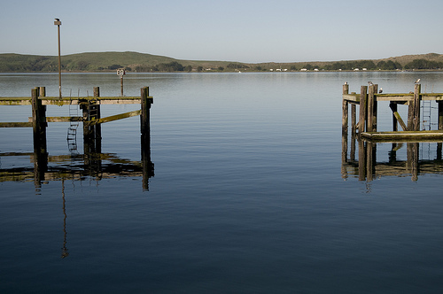
Bodega Harbor
Bodega Harbor is a small shallow natural harbor on the Pacific coast of northern California in the United States, approximately 40 mi (64 km) northwest of San Francisco. The harbor is approximately 2 square miles (5 square km) in area.
Located at 38.32 -123.05 (Lat./Long.); Less than 1 km away
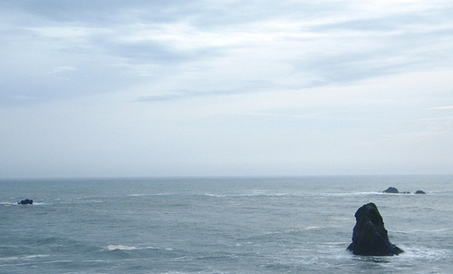
Bodega Head State Marine Reserve & Bodega Head State Marine Conservation Area
Bodega Head State Marine Reserve (SMR) and Bodega Head State Marine Conservation Area (SMCA) are two adjoining marine protected areas off Bodega Bay in Sonoma County on California’s north central coast. The combined area of these marine protected areas is 21.64 square miles, with 9.3 square miles in the SMR, and 12.34square miles in the SMCA. Bodega Head SMR prohibits the take of all living marine resources.
Located at 38.33 -123.07 (Lat./Long.); Less than 2 km away
Doran Regional Park
Doran Regional Park is a regional park south of Bodega Bay, California, U.S.A. that is maintained by the Sonoma County Regional Parks Department. It covers an area of 127 acres . It is located at {{#invoke:Coordinates|coord}}{{#coordinates:38.314|-123.0428|type:landmark_source:gnis-222519_region:US-CA|||||| |primary |name= }} on the sand spit separating Bodega Harbor from Bodega Bay. The park address is 201 Doran Beach Road, Bodega Bay, CA.
Located at 38.31 -123.04 (Lat./Long.); Less than 2 km away
Sonoma Coast State Marine Conservation Area
Sonoma Coast State Marine Conservation Area is a protected area along the coast of northern California, part of the North Central Coast Study Region. It is bounded by the mean high tide line, the 3-fathom depth contour, and several points along 3 miles of coast between Mussel Point and Schoolhouse Beach in Sonoma County. Within this Area, the recreational taking of all marine aquatic plants and some invertebrates is prohibited. Commercial taking of giant kelp and bull kelp is also prohibited.
Located at 38.35 -123.07 (Lat./Long.); Less than 2 km away
Salinian Block
The Salinian Block or Salinian terrane is a geologic terrane which lies west of the main trace of the San Andreas Fault system in California. It is bounded on the south by the Big Pine Fault in Ventura County, and on the west by the Nacimiento Fault. The block was named for the Salinas Valley in Monterey County, California.
Located at 38.31 -123.07 (Lat./Long.); Less than 3 km away
Pictures


Related Locations
Information of geographic nature is based on public data provided by geonames.org, CIA world facts book, Unesco, DBpedia and wikipedia. Weather is based on NOAA GFS.