-
You are here:
- Homepage »
- United States »
- California » Truckee

Truckee Destination Guide
Explore Truckee in United States
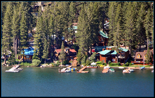
Truckee in the region of California with its 16,180 inhabitants is a town in United States - some 2,291 mi or ( 3687 km ) West of Washington , the country's capital city .
Current time in Truckee is now 02:57 AM (Sunday) . The local timezone is named " America/Los Angeles " with a UTC offset of -7 hours. Depending on the availability of means of transportation, these more prominent locations might be interesting for you: Alpine Meadows, Auburn, Carnelian Bay, Fresno, and Kings Beach. Since you are here already, make sure to check out Alpine Meadows . We saw some video on the web . Scroll down to see the most favourite one or select the video collection in the navigation. Where to go and what to see in Truckee ? We have collected some references on our attractions page.
Videos
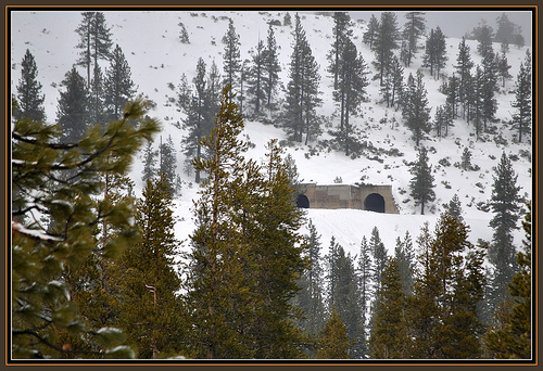
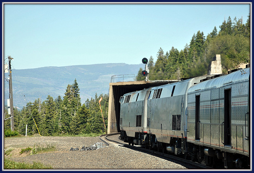
Amtrak on Donner Pass, May, 2004
Amtrak #5, is westbound coming down from the summit in May, 2004. See more at www.railroad-crossing.com. ..
Train Video Report: San Francisco - Denver
detailing the scenic Amtrak "California Zephyr" train ride, which is travelling from Emeryville (San Francisco) to Denver alongside the Pacific Ocean, Palmes, Deserts and snowy Ski Slopes ..
Manifest Destiny put on ice?
philfiles.net : My cross-country trip with a Wall Street Journal reporter turns harrowing at I-80, where chains are required on a certain Donner Pass, named after the Donner family who, after getting ..
highway 80 truckee california chain up
extreme condition road truckee california ..
Videos provided by Youtube are under the copyright of their owners.
Interesting facts about this location
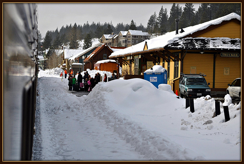
Truckee (Amtrak station)
The Truckee Amtrak station is a train station in Truckee, California, served by Amtrak, the national railroad passenger system. It is currently served by one daily passenger train in each direction, the California Zephyr. The westbound train arrives in the morning from Chicago and Denver heading for Sacramento and Emeryville with the eastbound train calling in mid-afternoon.
Located at 39.33 -120.19 (Lat./Long.); Less than 0 km away
Truckee, California
Truckee (originally, Coburn Station) is an incorporated town in Nevada County, California, United States. The population was 16,180 at the 2010 census, up from 13,864 at the 2000 census.
Located at 39.34 -120.20 (Lat./Long.); Less than 2 km away
Truckee Tahoe Airport
Truckee Tahoe Airport is a public use airport located two nautical miles (3.7 km) east of the central business district of Truckee, California, United States. The airport is situated in both Nevada County and Placer County. It is owned by Truckee Tahoe Airport District, a bi-county special district. According to the FAA's National Plan of Integrated Airport Systems for 2009–2013, it is categorized as a general aviation airport. Although many U.S.
Located at 39.32 -120.14 (Lat./Long.); Less than 4 km away
Martis Valley
Martis Valley is a geographic area of 70 square miles in the United States, extending northward from the North Shore of Lake Tahoe, California, to the west of the California-Nevada border. It is located in Placer and Nevada Counties and is bisected by Martis Creek which flows north to the Truckee River.
Located at 39.35 -120.12 (Lat./Long.); Less than 6 km away
Prosser Creek Dam
Prosser Creek Dam (National ID # CA10179) is a dam in Placer County, California. The earthen and rockfill dam was constructed from 1959 to 1962 by the United States Bureau of Reclamation with a height of 163 feet and 1830 feet long at its crest. It impounds Prosser Creek for irrigation storage and winter and spring flood control, part of the Bureau's larger Washoe Project in the Tahoe region. The dam is owned and operated by the Bureau.
Located at 39.38 -120.14 (Lat./Long.); Less than 7 km away
Pictures


Related Locations
Information of geographic nature is based on public data provided by geonames.org, CIA world facts book, Unesco, DBpedia and wikipedia. Weather is based on NOAA GFS.