-
You are here:
- Homepage »
- United States »
- Idaho » Horseshoe Bend

Horseshoe Bend Destination Guide
Explore Horseshoe Bend in United States
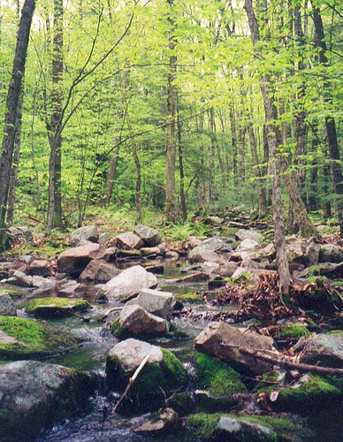
Horseshoe Bend in the region of Idaho with its 707 inhabitants is a town in United States - some 2,039 mi or ( 3282 km ) West of Washington , the country's capital city .
Current time in Horseshoe Bend is now 09:04 PM (Wednesday) . The local timezone is named " America/Boise " with a UTC offset of -6 hours. Depending on the availability of means of transportation, these more prominent locations might be interesting for you: Boise, Brownlee, Caldwell, Emmett, and Montour. Since you are here already, make sure to check out Boise . We saw some video on the web . Scroll down to see the most favourite one or select the video collection in the navigation. Where to go and what to see in Horseshoe Bend ? We have collected some references on our attractions page.
Videos
Trevor Hattabaugh Ski 2009
Trevor Hattabaugh trains, competes & hangs with his ski buddies at slopes from Utah & Idaho to New Hampshire, competes in the DNA rail jam in Las Vegas & rides the Trikke Skki. ..
Zip Idaho Zipline video with The Jeremiah James Gang music
Horseshoe Bend holds a key to the Idaho outdoors and a thrill for a lifetime. Zip-lining has been growing for years and Zip Idaho has the longest Zips in Idaho. 1700' and 1800' are two of the 6 zips y ..
The Open Road Part 2
On manual control with a little gravity assist I continue the descent towards Boise on ID 55. It's all downhill from here. Honda Goldwing GL1800 pulling Hannigan trailer riding in Idaho. It's a hazy s ..
The Open Road
Very little traffic going my way with two lanes all to myself. About a 6 to 7 percent grade up this hill and the same down the other side. Tripod on a Goldwing view. Honda Goldwing GL1800 motorcycle r ..
Videos provided by Youtube are under the copyright of their owners.
Interesting facts about this location
Horseshoe Bend, Idaho
Horseshoe Bend is the largest city in rural Boise County, in the southwestern part of the U.S. state of Idaho. Its population of 707 at the 2010 census was the largest in the county, though down from 770 in 2000. It is part of the Boise City–Nampa, Idaho Metropolitan Statistical Area. It is named for its location at the horseshoe-shaped U-turn of the Payette River, whose flow direction changes from south to north before heading west to the Black Canyon Reservoir.
Located at 43.91 -116.20 (Lat./Long.); Less than 0 km away
Horseshoe Bend High School
Horseshoe Bend High School is a high school in Horseshoe Bend, Idaho.
Located at 43.91 -116.20 (Lat./Long.); Less than 1 km away
Sweet, Idaho
Sweet is an unincorporated community in Gem County, Idaho, United States. It is located in open countryside approximately 16 miles (26 km) northeast of Emmett, along a county highway 8 miles due north of its intersection with State Highway 52. Founded in 1885 by Ezekiel Sweet, the community initially was a supply location and post office for farmers and ranchers in the nearby Lower Squaw Creek Valley.
Located at 43.97 -116.32 (Lat./Long.); Less than 12 km away
Bogus Basin
Bogus Basin Mountain Recreation Area is a ski area in the western United States, located in southwest Idaho in Boise County, 16 miles north-northeast of the city of Boise. Bogus is operated by the Bogus Basin Recreation Association, a non-profit organization, on private and leased land in the Boise National Forest. Ski season generally runs from Thanksgiving weekend until the weekend preceding April 15, depending on snow conditions.
Located at 43.76 -116.10 (Lat./Long.); Less than 18 km away
KBOI-TV
KBOI-TV is the CBS-affiliated television station for Idaho's Treasure Valley licensed to Boise. It broadcasts a high definition digital signal on VHF channel 9 from a transmitter at the Bogus Basin ski area summit in unincorporated Boise County. The station can also be seen on Cable One channel 8 and in high definition on digital channel 460.
Located at 43.76 -116.10 (Lat./Long.); Less than 19 km away
Pictures
Related Locations
Information of geographic nature is based on public data provided by geonames.org, CIA world facts book, Unesco, DBpedia and wikipedia. Weather is based on NOAA GFS.