
Touring Mole Creek in Australia
Mole Creek in the region of Tasmania with its 686 citizens is a city located in Australia - some 458 mi or ( 736 km ) South of Canberra , the country's capital city .
Time in Mole Creek is now 05:15 PM (Tuesday) . The local timezone is named " Australia/Hobart " with a UTC offset of 11 hours. Depending on your travel resources, these more prominent places might be interesting for you: West Kentish, Weegena, Needles, Melbourne, and Mayberry. Being here already, consider visiting West Kentish . We collected some hobby film on the internet . Scroll down to see the most favourite one or select the video collection in the navigation. Check out our recommendations for Mole Creek ? We have collected some references on our attractions page.
Videos
Tasmania Devil 塔斯曼尼亞魔鬼
Tasmania Devil 塔斯曼尼亞魔鬼 ..
Trip to Tasmania Day 2 driving Sheffield to the Western Tiers:Using FinePix HS10
Lots of jittering going on with the camera but it gives an idea of what its like to drive in the Western Tiers part of Tasmania ..
MF135 Staverton Tassie.MOV
Tasmania, best place in the world, freshest air, spectacular scenery, pure paradise! The worlds best kept secret... ..
Tassie Devil Group Feed at Trowunna.mp4
The Tasmanian devils and Trowunna Wildlife Sanctuary guide, Paul, put on a great show for our clients Phil & Karen from the USA in September 2011. Pepper Bush Adventures' clients thoroughly enjoy thei ..
Videos provided by Youtube are under the copyright of their owners.
Interesting facts about this location
Mole Creek, Tasmania
Mole Creek is a town in the upper Mersey Valley, in the central north of Tasmania, Australia. At the 2006 census, Mole Creek had a population of 223. The town primary school also services the surrounding districts including Chudleigh and Caveside. The nearest high school and regional centre is Deloraine. Mole Creek is well known for its honey and accounts for about 35 percent of Tasmania's honey production including Leatherwood Honey which is unique to Tasmania and sold internationally.
Located at -41.55 146.40 (Lat./Long.); Less than 1 km away
Caveside, Tasmania
Caveside, Tasmania, Australia, is a small rural town at the base of the Great Western Tiers, around 8 kilometres south of Mole Creek and less than an hour's drive from Launceston. The town lies in an area of limestone and the ground is pitted with sinkholes, a danger to the cattle that graze the fields. To the west are two undeveloped cave complexes, Wet Caves and Honeycomb Caves, which are an attraction to cavers. Caveside Post Office opened on 1 November 1887 and closed in 1980.
Located at -41.62 146.42 (Lat./Long.); Less than 7 km away
Meander Valley Council
The Meander Valley Council is a local government area of Tasmania. As its name suggests, it covers a large area of the Meander River in the central north of the state, which flows through the municipality's major centre of Deloraine. The council from the merger of Westbury and Deloraine municipalities in 1993. Smaller towns in the area include Carrick, Hagley, Hadspen, Mole Creek, Meander, Deloraine and Westbury.
Located at -41.54 146.52 (Lat./Long.); Less than 10 km away
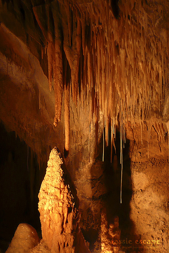
Mole Creek Karst National Park
Mole Creek Karst is a national park in Tasmania, Australia, 168 km northwest of Hobart. It is the only national park in Tasmania created specifically to protect karst landforms. It is part of the Tasmanian Wilderness World Heritage Site. The national park was declared in 1996 to provide protection for an extensive system of over 300 known caves and sinkholes, including Marakoopa and King Solomons Cave.
Located at -41.60 146.29 (Lat./Long.); Less than 11 km away
Beulah, Tasmania
Beulah (Australian postcode 7306) is a small township on the north-west coast of Tasmania south of Devonport, Tasmania, under the foothills of Mount Roland, Tasmania. The closest town of consequence is Sheffield, Tasmania. The hamlet of Lower Beulah lies, perversely, higher up the foothills of Mount Roland, to the south of the main township. Beulah has one of the oldest cricket clubs in Tasmania.
Located at -41.45 146.38 (Lat./Long.); Less than 12 km away
Pictures
Historical Weather
Related Locations
Information of geographic nature is based on public data provided by geonames.org, CIA world facts book, Unesco, DBpedia and wikipedia. Weather is based on NOAA GFS.