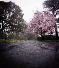
Explore Doncaster East in Australia
Doncaster East in the region of Victoria is a town in Australia - some 281 mi or ( 451 km ) South-West of Canberra , the country's capital city .
Current time in Doncaster East is now 11:40 AM (Wednesday) . The local timezone is named " Australia/Melbourne " with a UTC offset of 11 hours. Depending on the availability of means of transportation, these more prominent locations might be interesting for you: Richmond, Notting Hill, Mulgrave, Melbourne, and Greensborough. Since you are here already, make sure to check out Richmond . We encountered some video on the web . Scroll down to see the most favourite one or select the video collection in the navigation. Where to go and what to see in Doncaster East ? We have collected some references on our attractions page.
Videos
GOAL - Best Free Kick by an 11 year old boy !
Fantastic free kick by an 11 year old boy 30 seconds before the end of the match. Final Result: 1 all draw. Match was played at Wembley Park, Box Hill, Melbourne. www.boxhillunited.com.au ..
Australian Railways : X'trapolis EMU's at Mitcham
A few X'trapolis trains on the steep grade between Mitcham and Heatherdale to the east of Melbourne ..
healing guided meditation 22 min long version
I wonder if you can imagine yourself... as you go through a day...as a different animal... perhaps a fish... or a bird... or a butterfly... or perhaps as a leaf on a majestic oak tree, breathing deepl ..
Rancilio Silvia Thermostat Reset
Please come and check out my website www.coffee-a-roma.com.au ..
Videos provided by Youtube are under the copyright of their owners.
Interesting facts about this location
Doncaster East, Victoria
Doncaster East is a suburb of Melbourne, Victoria, Australia, 18 km north-east from Melbourne's Central Business District. Its Local Government Area is the City of Manningham. At the 2011 Census, Doncaster East had a population of 27,047. It is located in the hills between the Koonung Creek and the Mullum Mullum Creek.
Located at -37.79 145.16 (Lat./Long.); Less than 1 km away
Westfield Doncaster
Westfield Doncaster (formerly Doncaster Shoppingtown) is a shopping centre 50% owned by the Westfield Group and 50% owned by LaSalle Investment Management (as of August 2007) located in Doncaster, a suburb of Melbourne, Victoria, Australia. It is located on the corner of Williamsons Road and Doncaster Road in the Doncaster Hill precinct, an ongoing planning initiative by the local Manningham council. It is located 20 minutes east of the CBD and is one of the biggest shopping centres in Victoria.
Located at -37.78 145.13 (Lat./Long.); Less than 2 km away
Doncaster, Victoria
Doncaster is a suburb of Melbourne, Victoria, Australia, 16 km north-east of Melbourne's Central Business District. Its local government area is the City of Manningham. At the 2011 Census, Doncaster had a population of 18,359. The suburb, locally known as 'Donny', just as its name sake in the UK, is situated on 8.9 km² of land, around the top of the 120m high Doncaster Hill.
Located at -37.79 145.12 (Lat./Long.); Less than 2 km away
Kerrimuir, Victoria
Kerrimuir is a locality within the suburb of Box Hill North in Melbourne, Victoria, Australia. It is in the City of Whitehorse in Melbourne's eastern suburbs, approximately 15 kilometres from the CBD. The area is mostly referred to as Box Hill North. Kerrimuir has a small shopping strip, Kerrimuir Primary School, and Kerrimuir Neighbourhood House. Kerrimuir is named after Kirriemuir in Angus, Scotland. The logo for Kerrimuir Primary School is a Thistle, one of Scotland's national emblems.
Located at -37.81 145.14 (Lat./Long.); Less than 2 km away
Donvale, Victoria
Donvale is a suburb of Melbourne, Victoria, Australia, 20 km east from Melbourne's Central Business District. Its Local Government Area is the City of Manningham. At the 2011 Census, Donvale had a population of 11,795. A major Melbourne road, Springvale Road, ends in Donvale.
Located at -37.80 145.18 (Lat./Long.); Less than 3 km away
Pictures
Historical Weather
Related Locations
Information of geographic nature is based on public data provided by geonames.org, CIA world facts book, Unesco, DBpedia and wikipedia. Weather is based on NOAA GFS.


