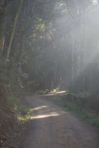
Explore Menzies Creek in Australia
Menzies Creek in the region of Victoria is a town in Australia - some 275 mi or ( 443 km ) South-West of Canberra , the country's capital city .
Current time in Menzies Creek is now 02:20 PM (Thursday) . The local timezone is named " Australia/Melbourne " with a UTC offset of 11 hours. Depending on the availability of means of transportation, these more prominent locations might be interesting for you: Woori Yallock, Warrandyte South, Wandin North, Silvan, and Menzies Creek. Since you are here already, make sure to check out Woori Yallock . We saw some video on the web . Scroll down to see the most favourite one or select the video collection in the navigation. Where to go and what to see in Menzies Creek ? We have collected some references on our attractions page.
Videos
Parrots in Australia
Mostly crimson rosellas, king parrots and sulfur crested cockatoos, but also galahs and corellas. Filmed in the Dandenongs. Music loop from Adobe final cut suite. ..
Exotic Birds - Crimson Rosella
Up close and personal with one of Australia's favorite birds ..
Tree Cutting and Tree lopping with Boom truck cherry picker
www.acetree.com.au dropping a big tree head out at 45m high in a boom truck cherry picker by tree arborist. This Video demonstrates felling trees with different tree felling techniques and cutting dow ..
Doolans Heavy Haulage Train Move
Doolans Heavy Haulage moved 3 steam trains from Menzies Creek in Victoria to the Bellerine Peninsula railway near Geelong.This shows the crew moving the biggest of the engines from Puffing Billy's yar ..
Videos provided by Youtube are under the copyright of their owners.
Interesting facts about this location
Menzies Creek, Victoria
Menzies Creek is a township in Melbourne, Victoria, Australia, 42 km south-east of Melbourne's central business district. Its local government area is the Shire of Yarra Ranges. At the 2011 Census, Menzies Creek had a population of 911. Menzies' Creek Post Office opened on 2 May 1887 and closed in 1980. Menzies Creek railway station opened on 18 December 1900 with the opening of the Gembrook line.
Located at -37.93 145.40 (Lat./Long.); Less than 2 km away
The Patch, Victoria
The Patch is a suburb in Melbourne, Victoria, Australia, 39 km east from Melbourne's central business district. Its local government area is the Shire of Yarra Ranges. At the 2006 Census, The Patch had a population of 793.
Located at -37.89 145.39 (Lat./Long.); Less than 3 km away
Selby, Victoria
Selby is a suburb in Melbourne, Victoria, Australia, 37 km south-east from Melbourne's central business district. Its local government area is the Shire of Yarra Ranges. At the 2006 Census, Selby had a population of 1396. The town hosts the second station on the narrow-gauge railway to Gembrook.
Located at -37.91 145.37 (Lat./Long.); Less than 3 km away
Emerald, Victoria
Emerald is a town and semi-rural locality in the Greater Melbourne area, Victoria, Australia, 44 km south-east from Melbourne's central business district, outside the urban area. Its local government areas are the Shires of Cardinia and Yarra Ranges. At the 2011 Census, Emerald had a population of 5,813. Emerald also includes Cardinia Reservoir, Melbourne's second largest reservoir.
Located at -37.93 145.44 (Lat./Long.); Less than 4 km away
Belgrave, Victoria
Belgrave is a suburb in Melbourne, Victoria, Australia, 35 km east from Melbourne's central business district. Its local government area is the Shire of Yarra Ranges. At the 2006 Census, Belgrave had a population of 4094. Belgrave is only 16 years younger than Melbourne CBD.
Located at -37.91 145.36 (Lat./Long.); Less than 4 km away
Pictures
Historical Weather
Related Locations
Information of geographic nature is based on public data provided by geonames.org, CIA world facts book, Unesco, DBpedia and wikipedia. Weather is based on NOAA GFS.


