-
You are here:
- Homepage »
- Australia »
- Western Australia » Lancelin

Lancelin Destination Guide
Delve into Lancelin in Australia
Lancelin in the region of Western Australia with its 666 residents is located in Australia - some 1,967 mi or ( 3166 km ) West of Canberra , the country's capital .
Local time in Lancelin is now 02:56 AM (Monday) . The local timezone is named " Australia/Perth " with a UTC offset of 8 hours. Depending on your mobility, these larger destinations might be interesting for you: and Perth. While being here, you might want to check out Perth . We discovered some clip posted online . Scroll down to see the most favourite one or select the video collection in the navigation. Are you curious about the possible sightseeing spots and facts in Lancelin ? We have collected some references on our attractions page.
Videos
Fanging It in Lancelin Part 1
This was one of my entries for ABC's Fanging It competition. I went to Lancelin to take a repaired beach buggy rim for my brother Cliff, and some Frangipani cuttings for his wife, Alysa. The deal was ..
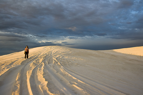
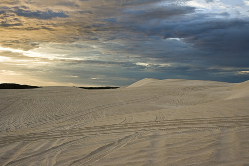
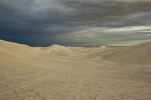
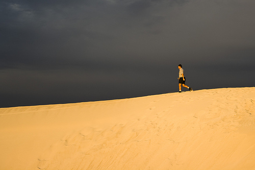
Lancelin Sand Dune Fun
Highlights of out latest trip to the Lancelin sand dunes ..
Lancelin Surf coach Robin
Surf coach Robin Johnson hailing from the great town of Hastings giving a long and enthralling discussion on the Lancelin sunset. Everyone was thrilled. ..
Windy Isolated Lancelin Julesandjames's photos around Lancelin, Australia (public bbq lancelin)
Preview of Julesandjames's blog at TravelPod. Read the full blog here: www.travelpod.com This blog preview was made by TravelPod using the TripAdvisor™ TripWow slideshow creator. Learn more about thes ..
Videos provided by Youtube are under the copyright of their owners.
Interesting facts about this location
Lancelin, Western Australia
Lancelin is a small fishing and tourist town 110 km north of Perth, Western Australia. It is located in the Shire of Gingin at the end of Wanneroo Road (State Route 60), and a few kilometres from the start of the Indian Ocean Drive. The area in which Lancelin is located is close to the shipwreck site of the Vergulde Draeck or Gilt Dragon that was wrecked on rocks close to shore in 1656. The town's name originates from Lancelin Island that is located nearby which was named after P.J.
Located at -31.01 115.33 (Lat./Long.); Less than 1 km away
Ledge Point, Western Australia
Ledge Point is a small coastal township 105 km north of Perth, Western Australia. It was established to service the local fishing and crayfishing industries. The town's name originates from the nearby coastal feature of the same name, a series of rocky ledges on the point that was first described in an 1875 hydrographic survey. The Gingin Road Board requested that land be set aside in the area in 1937 for camping and recreation purposes.
Located at -31.11 115.38 (Lat./Long.); Less than 10 km away
Vergulde Draeck
The Vergulde Draeck (Gilt Dragon) was a Dutch East India Company ship of the seventeenth century. She sailed from Texel bound for Batavia (now Jakarta), under Pieter Albertsz and was carrying trade goods and eight chests of silver worth 78,6000 guilders. On 28 April 1656 the Gilt Dragon was wrecked just south of Ledge Point, 107 km north of what is now Perth, Western Australia.
Located at -31.22 115.36 (Lat./Long.); Less than 22 km away
Wedge Island (Western Australia)
Wedge Island is located north of Lancelin and South of Cervantes on the Western Australian coast. The name mainly refers to the mainland settlement but also refers to a 400 metres long wedge shaped island located just south of "the point". The island itself is a declared nature reserve. The settlement of Grey is about 15km. north-west. Both are within the Shire of Dandaragan. One of the first pioneers of the settlement was Mr. W.R. (Bob) Wedge in 1937.
Located at -30.82 115.19 (Lat./Long.); Less than 26 km away
Pictures


Historical Weather
Related Locations
Information of geographic nature is based on public data provided by geonames.org, CIA world facts book, Unesco, DBpedia and wikipedia. Weather is based on NOAA GFS.