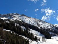
Discover Patsch in Austria
Patsch in the region of Tyrol is a town located in Austria - some 241 mi or ( 387 km ) West of Vienna , the country's capital .
Local time in Patsch is now 05:56 AM (Thursday) . The local timezone is named " Europe/Vienna " with a UTC offset of 1 hours. Depending on your flexibility, these larger cities might be interesting for you: Telfes im Stubai, Tarzens, Steinach am Brenner, Hall in Tirol, and Sillwerk. When in this area, you might want to check out Telfes im Stubai . We found some clip posted online . Scroll down to see the most favourite one or select the video collection in the navigation. Are you looking for some initial hints on what might be interesting in Patsch ? We have collected some references on our attractions page.
Videos
Sommerrodelbahn Mieders im Stubaital
40 Steilkurven, steilste Alpenachterbahn, max. Geschw. 42km/h, 2,8km Länge, 640m Höhenunterschied, Start: 1620m, Ziel: 980m SAUGEIL! ..
Tram line 6 connects Innsbruck and the mountain village Igls
La linea tranviaria 6 connette la città di Innsbruck con il villaggio di Igls. Il percorso abbandona immediatamente la città e attraversa la foresta a binario unico in un paesaggio molto suggestivo e ..
Rodel WeltCup Igls 2007 — Luge World Cup
Rodel WeltCup Igls 2007 — FIL World Luge Championships 2007 English (Deutsch Unten): The FIL World Luge Championships 2007 took place February 2-4, 2007 at the bobsleigh, luge, and skeleton track ("Ol ..
Schispringen Bergisel - Austria HD
www.myvideomedia.de English see below [dt.] Das Schigymnasium Stams ist Österreichs Elite-Kaderschmiede für Wintersport Athleten. Viel bekannte Namen sind hier hervorgegangen. Trainiert wird nicht nur ..
Videos provided by Youtube are under the copyright of their owners.
Interesting facts about this location
Innsbruck-Land District
The Bezirk Innsbruck Land is an administrative district in Tyrol, Austria. It encloses the Statutarstadt Innsbruck, and borders Bavaria in the north, the district Schwaz in the east, South Tyrol in Italy to the south, and the district of Imst in the west. Area of the district is 1,986.45 km², with a population of 167,339 (January 1, 2012), and population density of 84 persons per km². Administrative center of the district is Innsbruck.
Located at 47.20 11.40 (Lat./Long.); Less than 1 km away
Ruetz
The Ruetz River flows from the glacier area of the valley to the Wipptal in north-east direction. Near the famous "Europe bridge" it merges with the Sill River after a route length of appr. 25 km. The river crosses straight the village of Fulpmes providing a nearby power station of the Austrian Railway Services with electricity. As a typical rapid-river the Ruetz is pretty dangerous and full of rapids. Before several defence structures had been constructed, it was quite feared due to floods.
Located at 47.22 11.40 (Lat./Long.); Less than 2 km away
Patscherkofel
Patscherkofel is a mountain and ski area in Tyrol in western Austria, 7 km (4 mi. ) south of Innsbruck. The peak rises to a summit elevation of 7639 feet (2246 m) above sea level During the 1964 and 1976 Winter Olympics, the mountain was the venue of the men's downhill race, along with the bobsleigh and luge competitions in neighboring Igls. The other five alpine skiing events were held at Axamer Lizum.
Located at 47.21 11.46 (Lat./Long.); Less than 3 km away
Lake Lans
The Lake Lans or Lanser See is a lake for bathing near Lans located on the southern highlands above Innsbruck. The lake can be reached by Streetcar Line 6 from Innsbruck easily. The Lake is very popular due to its green environment, and it is used for ice-skating during the winter. The Lake belongs to the city area of Innsbruck. Thanks to its fen water the Lanser See has an excellent water quality; in Summer it is affected due to the many guests though.
Located at 47.24 11.42 (Lat./Long.); Less than 4 km away
Lanser Moor
The Fen of Lans also: Lanser Moor or Water Lily Pond is located north above Lake Lans on an altitude of 582 metres in the Paschberg forest. With an area size of 8000 m² the Lake is much smaller than its larger brother is with a depth of 3 metres. To keep his natural beauty intact, bathing and swimming was already forbidden by the city administration of Innsbruck very early. The Lake is under nature conservation.
Located at 47.24 11.42 (Lat./Long.); Less than 5 km away
Pictures
Historical Weather
Related Locations
Information of geographic nature is based on public data provided by geonames.org, CIA world facts book, Unesco, DBpedia and wikipedia. Weather is based on NOAA GFS.


