-
You are here:
- Homepage »
- Bahrain »
- Central Governorate » Sitrah

Sitrah Destination Guide
Delve into Sitrah in Bahrain
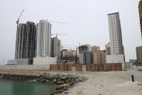
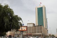
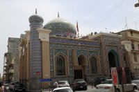
Sitrah in the region of Central Governorate with its 37,657 residents is a city in Bahrain - some 5 mi or ( 8 km ) South-East of Manama , the country's capital .
Current time in Sitrah is now 12:08 PM (Wednesday) . The local timezone is named " Asia/Bahrain " with a UTC offset of 3 hours. Depending on your travel modalities, these larger destinations might be interesting for you: Riyadh, Dammam, Shiraz, Bushehr, and Kuwait City. While being here, make sure to check out Riyadh . We encountered some video on the web . Scroll down to see the most favourite one or select the video collection in the navigation. Are you curious about the possible sightseeing spots and facts in Sitrah ? We have collected some references on our attractions page.
Videos
Bahrain Bay Development
Bahrain Bay is a master plan development set off the north-eastern shore of Manama with a vision to create a vibrant and authentic metropolis inspiring opportunity, shared responsibility and a legacy ..
علي شلهوب موال عتابا 21
ali chalhoub sinager ataba 21 علي شلهوب موال عتابا facebook.com www.alichalhoub.com http tel:0096170854174 lebanon ..
Lost Paradise in Bahrain Shadocg's photos around Manama, Bahrain (from manama to lost paradise)
Preview of Shadocg's blog at TravelPod. Read the full blog here: www.travelpod.com This blog preview was made by TravelPod using the TripAdvisor™ TripWow slideshow creator. Learn more about these vide ..
AL-Dar Islands in Bahrain
Al Dar Islands is Bahrain newest island retreat, a heven of peace and relaxation, ..
Videos provided by Youtube are under the copyright of their owners.
Interesting facts about this location
Nuwaidrat
Nuwaidrat is a village located in Bahrain, close to Sitra; it was formerly part of the Sitra Municipality. Location of Nuwaidrat NuwaidratNuwaidrat Location of Nuwaidrat
Located at 26.13 50.60 (Lat./Long.); Less than 3 km away
Sanad, Bahrain
Sanad is a town in Bahrain. Location of Sanad SanadSanad Location of Sanad The town neighbors Isa Town, Riffa and Jurdab. Sanad is mainly a residential area dotted with mansions, gardens, and restaurants. Some of the restaurants located in Sanad are Fuddruckers, Hardee's, Dairy Queen, McDonald's, KFC, Papa Johns, and Yum Yum Tree.
Located at 26.15 50.58 (Lat./Long.); Less than 4 km away
Tubli Bay
Tubli Bay (also known as the Gulf of Tubli) is a bay in the east of Bahrain, between Bahrain Island and Sitra island. The body of water is directly south of the Manama peninsula. The island of Nabih Saleh lies in the bay. The area was known for its rich marine and bird life, and the mangrove forests around its borders. The mangroves thrived on the run-off of water of freshwater springs after it passed through farms into the bay. The bay is a major breeding ground for shrimp and fishes.
Located at 26.18 50.59 (Lat./Long.); Less than 4 km away
Naval Support Activity Bahrain
Naval Support Activity Bahrain (or NSA Bahrain) is a United States Navy base, situated in the Kingdom of Bahrain and is home to U.S. Naval Forces Central Command and United States Fifth Fleet. It is the primary base in the region for the naval and marine activities in support of Operation Enduring Freedom (OEF) and formerly Operation Iraqi Freedom (OIF), to include when the latter was changed to Operation New Dawn (OND) until the end of the Iraq War.
Located at 26.21 50.61 (Lat./Long.); Less than 6 km away
Riffa Fort
Built as a fort during the reign of Shaikh Salman bin Ahmed Al Khalifa in 1812, while another source claim that it was built during the rule of the Persian Safavid Empire of Iran over Bahrain during the 17th century, the fort was converted into a residence in the 19th century for Shaikh Salman Bin Ahmed (Al Fateh) Al Khalifa. Riffa Fort or it is now named (Shaikh Salman bin Ahmed Fort) offers a splendid view across the Hunanaiya valley.
Located at 26.12 50.56 (Lat./Long.); Less than 7 km away
Pictures
Historical Weather
Related Locations
Information of geographic nature is based on public data provided by geonames.org, CIA world facts book, Unesco, DBpedia and wikipedia. Weather is based on NOAA GFS.


