-
You are here:
- Homepage »
- Germany »
- Baden-Wuerttemberg » Todtnau

Todtnau Destination Guide
Explore Todtnau in Germany
Todtnau in the region of Baden-Württemberg with its 5,072 inhabitants is a town in Germany - some 404 mi or ( 651 km ) South-West of Berlin , the country's capital city .
Current time in Todtnau is now 01:05 AM (Friday) . The local timezone is named " Europe/Berlin " with a UTC offset of 1 hours. Depending on the availability of means of transportation, these more prominent locations might be interesting for you: Zurich, Berne, Basel, Brussels, and Wittnau. Since you are here already, make sure to check out Zurich . We encountered some video on the web . Scroll down to see the most favourite one or select the video collection in the navigation. Where to go and what to see in Todtnau ? We have collected some references on our attractions page.
Videos
Todtnauer Hinterwaldabfahrt - Feldberg nach Todtnau
Vorstellung der längen Ski Abfahrt im Schwarzwald. Fahren Sie auf dem Ski oder dem Snowboard vom Feldberg nach Todtnau. Die Abfahrt mit 9,3 km länge ist ein Spaß für die ganze Familie. ..
Todtnauberg Stübenwasen 2
Skiing Stübenwasen at sunset ..
Hasencoaster am Hasenhorn in Todtnau/Schwarzwald
..
Hasenhorn Coaster POV Video
Point of view video of the "Hasenhorn Alpine Coaster" at Todtnau in Germany. The video was taken with permission. Onride Video vom "Hasenhorn Alpine Coaster" in Todtnau in Deutschland. Das Video wurde ..
Videos provided by Youtube are under the copyright of their owners.
Interesting facts about this location
Hasenhorn
Hasenhorn is a mountain of Baden-Württemberg, Germany.
Located at 47.82 7.95 (Lat./Long.); Less than 1 km away
Stübenwasen
Stübenwasen is a mountain of Baden-Württemberg, Germany.
Located at 47.87 7.97 (Lat./Long.); Less than 4 km away
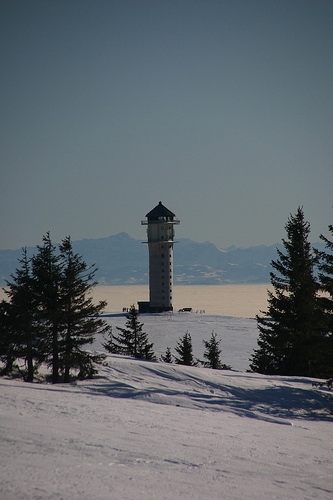
Sender Feldberg/Black Forest
The Sender Feldberg/Black Forest (transmitter Black Forest) is a transmission facility for FM and TV on Feldberg, Black Forest, Germany. It has an old and a new transmission tower: The old transmission tower was built at {{#invoke:Coordinates|coord}}{{#coordinates:47|51|52|N|8|01|20|E|type:landmark_region:DE | |name= }}. It is a 75 metre high concrete tower with an observation deck in a height of 36 metres and a diameter of 9.1 metres, which is nowadays closed.
Located at 47.86 8.02 (Lat./Long.); Less than 7 km away
Alb (Southern Black Forest)
The Alb is a river in the Black Forest. It arises from two headwaters, the Menzenschwander Alb and Bernauer Alb and flows in a southerly direction. It ends after 42.8 km at a confluence with the High Rhine at Albbruck.
Located at 47.86 8.03 (Lat./Long.); Less than 7 km away
Hochkopf (Südschwarzwald)
Hochkopf (Südschwarzwald) is a mountain of Baden-Württemberg, Germany.
Located at 47.77 7.99 (Lat./Long.); Less than 8 km away
Pictures
Historical Weather
Related Locations
Information of geographic nature is based on public data provided by geonames.org, CIA world facts book, Unesco, DBpedia and wikipedia. Weather is based on NOAA GFS.