
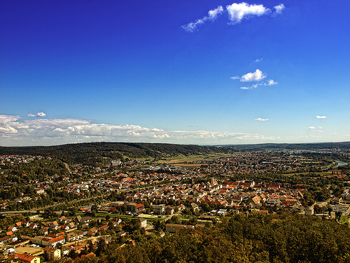
Delve into Ihrlerstein in Germany
Ihrlerstein in the region of Bavaria with its 4,419 residents is located in Germany - some 257 mi or ( 414 km ) South of Berlin , the country's capital .
Local time in Ihrlerstein is now 12:00 AM (Friday) . The local timezone is named " Europe/Berlin " with a UTC offset of 1 hours. Depending on your mobility, these larger destinations might be interesting for you: Salzburg, Regensburg, Palmberg, Oberau, and Nittendorf. While being here, you might want to check out Salzburg . We discovered some clip posted online . Scroll down to see the most favourite one or select the video collection in the navigation. Are you curious about the possible sightseeing spots and facts in Ihrlerstein ? We have collected some references on our attractions page.
Videos
KLOSTER WELTENBURG.mp4
Il monastero di Weltenburg si trova in Baviera su una penisola del Danubio.Fondato all'inizio del 600 da monaci scozzesi e irlandesi,e' ritenuto il piu' antico monastero in Baviera.La chiesa in stile ..
Spaziergang 28ter Dezember 2008 Bayern Essing
Spaziergang durch Essing Bayern Altmühltal. Zu jeder Jahreszeit ist der Naturpark Altmühltal eine Reise wert. Es wurden schöne Motive festgehalten. Mehr Infos auf ferienwohnung-rottler.de ..
Donau runter bis Weltenburg - AL1200GS
Saisonauftakt 2012! Ein strahlend schöner Märztag. Eine erste kleine Tour führt von Neuburg bis zum Kloster Weltenburg am Donaudurchbruch mit Musik von Eluveitie. Schaut einfach mal rein ... ..
Viaggio in Baviera - Kloster Weltenburg - Germania 2009
Viaggio in Baviera - Kloster Weltenburg - Germania 2009 ..
Videos provided by Youtube are under the copyright of their owners.
Interesting facts about this location
Alcimoennis
Alcimoennis (aka Alkimoennis) was a Celtic Oppidum, or hill fort, located on the Michelsberg hill, dominating the peninsula between the Danube and Altmühl rivers in northern Bavaria, Germany, above the modern city of Kelheim. Although the peninsula has been more or less constantly inhabited since 13,000 BCE, the city as the Celts built it was founded around 500 BCE and abandoned again some time before Roman arrival in the area during the 1st century BCE.
Located at 48.92 11.86 (Lat./Long.); Less than 2 km away
Befreiungshalle
The Befreiungshalle ("Hall of Liberation") is a historical classical monument upon Mount Michelsberg above the city of Kelheim in Bavaria, Germany. It stands upstream of Regensburg on the river Danube at the confluence of the Danube and the Altmühl, i.e. the Rhine-Main-Danube Canal.
Located at 48.92 11.86 (Lat./Long.); Less than 2 km away
Michelsberg (Kelheim)
Michelsberg (Kelheim) is a mountain of Bavaria, Germany.
Located at 48.92 11.86 (Lat./Long.); Less than 2 km away
Kleines Schulerloch inscription
The runic inscription found in the Kleines Schulerloch cave, Altmühltal, near Essing, Bavaria was discovered in 1937. It reads birg : leub : selbrade, probably meaning "Birg, beloved of Selbrad", next to a drawing of an ibex or stag. From the 1950s the inscription had been considered a hoax by many scholars.
Located at 48.93 11.82 (Lat./Long.); Less than 4 km away
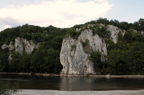
Altmühl
The Altmühl is a river in Bavaria, Germany. It is a left tributary of the River Danube and is approximately 230 kilometres in length.
Located at 48.91 11.91 (Lat./Long.); Less than 4 km away
Pictures

Historical Weather
Related Locations
Information of geographic nature is based on public data provided by geonames.org, CIA world facts book, Unesco, DBpedia and wikipedia. Weather is based on NOAA GFS.