Delve into Ubersee in Germany
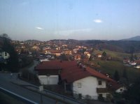
Ubersee in the region of Bavaria with its 4,896 residents is a city in Germany - some 328 mi or ( 528 km ) South of Berlin , the country's capital .
Current time in Ubersee is now 06:21 PM (Saturday) . The local timezone is named " Europe/Berlin " with a UTC offset of 1 hours. Depending on your travel modalities, these larger destinations might be interesting for you: Salzburg, Innsbruck, Vachendorf, Traunreut, and Stegenhauser. While being here, make sure to check out Salzburg . We encountered some video on the web . Scroll down to see the most favourite one or select the video collection in the navigation. Are you curious about the possible sightseeing spots and facts in Ubersee ? We have collected some references on our attractions page.
Videos
Chiemgau .::. Bayerns Lächeln! [long version]
Die Ferien- & Urlaubsregion Chiemgau stellt sich vor. Übrigens - der Chiemgau liegt in Bayern und bietet neben dem Bayerischen Meer (Chiemsee) eines der besten Radwege- und Wandernetze Deutschlands. ..
FRAUENINSEL
Bellissima isola del Chiem sulla quale e' sita una antica abbazia femminile. ..
Riesenrutsche im Märchen- und Familienpark Ruhpolding
Die Aufnahmen entstanden im Jahr 2005. Die Hintergrundmusik ist "Metropolis Part 1" von Dream Theater. ..
Frauenchiemsee
Stille und schön ..
Videos provided by Youtube are under the copyright of their owners.
Interesting facts about this location
Chiemgau
Chiemgau is the common name of a geographic area in Upper Bavaria. It refers to the foothills of the Alps between the rivers Inn and Traun, with lake Chiemsee at its center. The political districts that contain the Chiemgau are Rosenheim and Traunstein. Wendelstein is the name of a famous mountain close by but not strictly in the Chiemgau, while Kampenwand is actually the most inviting peak south of Chiemsee.
Located at 47.82 12.43 (Lat./Long.); Less than 4 km away
Marquartstein
Marquartstein is a municipality in the southeastern part of Bavaria, Germany and is part of the Verwaltungsgemeinschaft Marquartstein and Staudach-Egerndach. It is situated in a region called Chiemgau, approximately 10 km south of Lake Chiemsee between Munich and Salzburg, and 30 km west of Salzburg. Most of the area is situated in the valley of the river Tiroler Achen, which separates the village into two parts. Marquartstein is at the edge of the Alps.
Located at 47.77 12.47 (Lat./Long.); Less than 6 km away
Schnappenberg
Schnappenberg is a mountain of Bavaria, Germany.
Located at 47.76 12.48 (Lat./Long.); Less than 6 km away
Frauenchiemsee
The island Frauenchiemsee (often called Fraueninsel) is the second largest of the three islands in Chiemsee, Germany. It belongs to the municipality of Chiemsee in Upper Bavarian district of Rosenheim, which is the smallest municipality in all of Bavaria. The 15.5-hectare large and car free Fraueninsel houses 300 permanent residents as well as an active Benedictine convent.
Located at 47.87 12.43 (Lat./Long.); Less than 7 km away
Tüttensee
The Tüttensee (Lake Tütten) is a small lake in the Bavarian Alpine foothills of the Traunstein district, within the municipalities of Grabenstätt and Vachendorf. With an area of 10.8 ha (~ 27 acres) and a maximum depth of 17.3 m it is one of many Kettle-Lakes in the alpine foothills, that resulted from remnants of dead-ice after a glacier retreated. The lake is partly surrounded by well preserved Kame terraces and drains to the north west into the tiny Marwanger Creek to the Chiemsee.
Located at 47.85 12.57 (Lat./Long.); Less than 7 km away
Pictures
Historical Weather
Related Locations
Information of geographic nature is based on public data provided by geonames.org, CIA world facts book, Unesco, DBpedia and wikipedia. Weather is based on NOAA GFS.


