Explore Bhubaneswar in India
Bhubaneswar in the region of Orissa with its 762,243 inhabitants is a place in India - some 793 mi or ( 1277 km ) South-East of New Delhi , the country's capital city .
Time in Bhubaneswar is now 11:18 PM (Wednesday) . The local timezone is named " Asia/Kolkata " with a UTC offset of 5.5 hours. Depending on your budget, these more prominent locations might be interesting for you: Sankataras, Sanakanti, Renghalo, Ranchi, and Pipili. Since you are here already, consider visiting Sankataras . We saw some hobby film on the internet . Scroll down to see the most favourite one or select the video collection in the navigation. Where to go and what to see in Bhubaneswar ? We have collected some references on our attractions page.
Videos
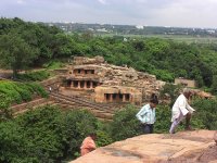
temple in Bhubaneswar
#1: Drink the holy name! #2: kids of Bhubaneswar ..
PANDIT BIRJU MAHARAJ WITH SPIC MACAY ODISHA CHAPTER-05 DEC 2010
INTERACTION WITH PANDIT BIRJU MAHARAJ AND LAUNCH OF NATCON 2011 BROCHURE-ORISSA SPIC MACAY CHAPTER-05 DEC 2010 1.SPIC MACAY aims to preserve,promote and advance our glorious legacy and conserve Indian ..
debasish naik--Tour to SHANTI STUPA ,Dhauli Giri,Orissa,india
Dhauli hills are located on the banks of the river Daya, 8 km south of Bhubaneswar in Orissa (India). It is a hill with vast open space adjoining it, and has major Edicts of Ashoka engraved on a mass ..
Taking off from Bhubaneswar
Back in 2009, I was taking off from Bhubaneswar's Biju Patnaik Airport on a JetLite CRJ-200 bound for Delhi. Odisha is one of the greenest and one beautiful states of India. Even though the plane turn ..
Videos provided by Youtube are under the copyright of their owners.
Interesting facts about this location
Sisupalgarh
Sisupalgarh or Sishupalgarh are a ruined fortification in Khurda District in Odisha, India. It is one of the largest and best preserved early historic fortification in India.
Located at 20.23 85.85 (Lat./Long.); Less than 2 km away
College of Agricultural Engineering & Technology, Bhubaneswar
College of Agricultural Engineering and Technology is one of the constituent colleges of Orissa University of Agriculture and Technology established in 1966. This college ranks in the top five leading colleges under SAU-ICAR system, is imparting education, research and extension in the field of Agricultural Engineering. It provides highly qualified technical and managerial human resources to the public and industrial sector through its B. Tech and M. Tech Programmes.
Located at 20.26 85.81 (Lat./Long.); Less than 4 km away
Orissa University of Agriculture and Technology
Orissa University of Agriculture and Technology (OUAT) was established in Bhubaneswar, Odisha, India in 1962. It is the second oldest agricultural university in the country. It is dedicated to agriculture related research, extension and education. At present, the University has 8 constituent colleges. The University has separate wings for research, extension services and planning, monitoring & evaluation, etc.
Located at 20.26 85.81 (Lat./Long.); Less than 4 km away
National Institute of Science Education and Research
The National Institute of Science Education and Research (Hindi: राष्ट्रीय विज्ञान शिक्षा एवं अनुसंधान संस्थान, NISER) is a research institution in Bhubaneswar, Odisha, India. The Prime Minister of India laid the foundation stone on August 28, 2006, establishing the institute along the lines of the IISc in Bangalore, and its five sister institutions, the IISERs that are being established at Pune, Mohali, Kolkata, Bhopal and Thiruvanthapuram in India.
Located at 20.27 85.84 (Lat./Long.); Less than 4 km away
Jajpur derailment
The Jajpur derailment was a passenger train derailment that occurred at 19:45 local time near Jajpur in the eastern state of Odisha, India, on 13 February 2009. Nine people were killed and 150 people were injured in the incident. Twelve carriages belonging to the Howrah–Chennai Coromandel Express are believed to have derailed following the train's departure from Jajapur Road station near Jajapur. The cause of the accident is currently unknown.
Located at 20.27 85.84 (Lat./Long.); Less than 4 km away
Pictures
Historical Weather
Related Locations
Information of geographic nature is based on public data provided by geonames.org, CIA world facts book, Unesco, DBpedia and wikipedia. Weather is based on NOAA GFS.


