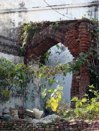
Discover Nurpur Kalan in India
Nurpur Kalan in the region of Punjab with its 9,437 habitants is a town located in India - some 180 mi or ( 290 km ) North of New Delhi , the country's capital .
Local time in Nurpur Kalan is now 08:10 AM (Thursday) . The local timezone is named " Asia/Kolkata " with a UTC offset of 5.5 hours. Depending on your flexibility, these larger cities might be interesting for you: Sialkot, Narowal, Lahore, Islamabad, and Srinagar. When in this area, you might want to check out Sialkot . We found some clip posted online . Scroll down to see the most favourite one or select the video collection in the navigation. Are you looking for some initial hints on what might be interesting in Nurpur Kalan ? We have collected some references on our attractions page.
Videos
Holla Mohalla on my ride
standin on my ride in d shores of satluj river near Anandpur Sahib ..
Gatka : Indian Martial Arts of Sikhs
They live in a huge organic horse farm and playing Gatka as their spiritual practice. Song : Mitra ..
LMTSOM, Survey @ Anandpur Sahib
Thats the survey which we, myself and Anil, conducted in Anandpur Sahib for our B-Plan project proposal. ..
Anandpur Sahib Gurudwara - Outside And Inside View & Virasat-e-khalsa - Outside View [In 1080p HD]
Sri Anandpur Sahib Takht Sri Keshgarh Sahib or Anandpur Sahib is one of the most important sacred places of the Sikhs and is closely linked with their religious traditions and history. It is located o ..
Videos provided by Youtube are under the copyright of their owners.
Interesting facts about this location
Ropar Wetland
Ropar Wetland, also named Ropar Lake, is a man-made freshwater riverine and lacustrine wetland. The area has at least 9 mammal, 154 bird (migratory and local), 35 fish, 9 arthropod, 11 rotifer, 9 crustacean and 10 protozoan species, making it biologically diverse.
Located at 31.02 76.50 (Lat./Long.); Less than 16 km away
2008 Naina Devi temple stampede
A human stampede at the Hindu temple of Naina Devi occurred on 3 August 2008 in the Indian state of Himachal Pradesh. 162 people died when they were crushed, trampled, or forced over the side of a ravine by the movement of a large panicking crowd. Witness accounts suggest that events were initiated after a rain shelter collapsed, which worshipers mistakenly took to be a landslide.
Located at 31.36 76.49 (Lat./Long.); Less than 21 km away
Indian Institute of Technology Ropar
The Indian Institute of Technology Ropar (IIT Ropar), sometimes referred to as Indian Institute of Technology Punjab (IIT Punjab), is an engineering and technology higher education institute located in Rupnagar, Punjab, India.
Located at 30.98 76.54 (Lat./Long.); Less than 22 km away
Rupnagar
Rupnagar, also spelled Ropar or Rupar, is a city and a municipal council in Rupnagar district in the Indian state of Punjab. The ancient town of Rupnagar is said to have been named by a Raja called Rokeshar, who ruled during the 11th century and named it after his son Rup Sen. It is also one of the bigger sites belonging to the Indus Valley Civilization.
Located at 30.97 76.53 (Lat./Long.); Less than 22 km away
Rayat Institute of Engineering & Information Technology
The Rayat Institute of Engineering and Information Technology (RIEIT) is an engineering institute located 6 km from Rupnagar in Punjab, India, on the Chandigarh-Ropar-Jalandhar Highway. It offers engineering studies at the bachelors and masters levels. It is part of the Rayat Bhara group of colleges
Located at 30.97 76.53 (Lat./Long.); Less than 23 km away
Pictures
Historical Weather
Related Locations
Information of geographic nature is based on public data provided by geonames.org, CIA world facts book, Unesco, DBpedia and wikipedia. Weather is based on NOAA GFS.


