-
You are here:
- Homepage »
- India »
- Tamil Nadu » Saint Thomas Mount

Saint Thomas Mount Destination Guide
Touring Saint Thomas Mount in India
Saint Thomas Mount in the region of Tamil Nādu with its 43,223 citizens is a city located in India - some 1,097 mi or ( 1766 km ) South of New Delhi , the country's capital city .
Time in Saint Thomas Mount is now 10:16 AM (Monday) . The local timezone is named " Asia/Kolkata " with a UTC offset of 5.5 hours. Depending on your travel resources, these more prominent places might be interesting for you: Vandalur, Thrissur, Saint Thomas Mount, Saidapet, and Puducherry. Being here already, consider visiting Vandalur . We collected some hobby film on the internet . Scroll down to see the most favourite one or select the video collection in the navigation. Check out our recommendations for Saint Thomas Mount ? We have collected some references on our attractions page.
Videos
Naaka Mukka Original Music Video : A Day in the Life of Chennai
THE TIMES OF INDIA presents a short sattire on the life of a giant cardboard cutout character, through the course of one day in the life of Chennai. A roller coaster of a journey through the ups and d ..
Guindy Kathipara - an eagle's eye view
This was taken while I was returning from Mumbai in jet airways.. The view of Kathipara junction - Guindy from the flight was some really awesome.. such a great landmark in Chennai... ..
Kathipara Junction - All lanes open - Diwali special
I shot this video using my mobile as I realised the Kathipara was open to traffic. This is just a day after all the lanes were opened. I was entering from guindy and going towards Ekkaduthangal/Vadapa ..
chennai and mamallapuram
some clips of the first few days in india ..
Videos provided by Youtube are under the copyright of their owners.
Interesting facts about this location
Britto School
Britto School is a school in Adambakkam, Chennai, India.
Located at 13.00 80.20 (Lat./Long.); Less than 0 km away
Charnockite, St. Thomas Mount
Charnockite, St. Thomas Mount, located to the south of the Chennai city, in Pallavaram suburb, Tamil Nadu, is a characteristically profuse exposure of quartz–feldspar–hypersthene rock, illustrated by occurrence of two pyroxene facies metamorphism. The name "Charnockite, St. Thomas Mount" originated from the use of the rocks quarried from a central band in the St. Thomas Mount for the tombstone of Job Charnock, the founder of Kolkata in 1679.
Located at 13.00 80.20 (Lat./Long.); Less than 0 km away
Adambakkam
Adambakkam is a neighbourhood in Chennai, a city located on the east coast of South India. It is a thickly populated area close to the St. Thomas Mount Railway Station. Adambakkam is surrounded by Alandur, Palavanthangal, Nanganallur, Vanuvampet, Puzhuthivakkam, Velachery and Guindy. Before October 2011, one part of Adambakkam used to come under Chennai Corporation while the other under Alandur Municipality. From October 2011, the entire area was merged with Chennai Corporation.
Located at 12.99 80.20 (Lat./Long.); Less than 1 km away
Kathipara Junction
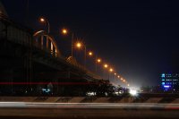
Kathipara Junction is an important road junction in Chennai, India. It is located at Alandur, (St. Thomas Mount), south of Guindy, at the intersection of the Grand Southern Trunk Road (NH 45), Inner Ring Road, Anna Salai and the Mount-Poonamallee Road. Kathipara flyover is the largest cloverleaf flyover in the whole of Asia.
Located at 13.01 80.20 (Lat./Long.); Less than 1 km away
Velachery Lake
Velachery Lake is one of the lakes inside Chennai, in the Indian state of Tamil Nadu, with a good stock of water all through the year. Since Velachery is a low lying area, the monsoon rain water from the neighbouring areas are drained into this lake. CHENNAI: In an unexpected turn of events, the Chennai Corporation has decided to put on hold the proposal for boat rides and other tourist facilities on the Velachery lake, one of the few water bodies still alive in the city.
Located at 12.99 80.21 (Lat./Long.); Less than 1 km away
Pictures
Historical Weather
Related Locations
Information of geographic nature is based on public data provided by geonames.org, CIA world facts book, Unesco, DBpedia and wikipedia. Weather is based on NOAA GFS.


