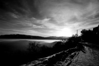
Discover Santo Stefano di Sessanio in Italy
Santo Stefano di Sessanio in the region of Abruzzo with its 118 habitants is a place located in Italy - some 67 mi or ( 108 km ) North-East of Rome , the country's capital .
Local time in Santo Stefano di Sessanio is now 07:02 PM (Wednesday) . The local timezone is named " Europe/Rome " with a UTC offset of 1 hours. Depending on your mobility, these larger cities might be interesting for you: Villa Santa Lucia degli Abruzzi, Tussio, Trieste, Teramo, and Santa Croce. When in this area, you might want to check out Villa Santa Lucia degli Abruzzi . We discovered some clip posted online . Scroll down to see the most favourite one or select the video collection in the navigation. Are you looking for some initial hints on what might be interesting in Santo Stefano di Sessanio ? We have collected some references on our attractions page.
Videos
ROCCA CALASCIO - medioevo LadyHawke
Grazie a Fabio x la musica. ..
Sagra della Patata Barisciano (AQ)
Sagra della Patata a Barisciano il 26 Agosto 2006 ..
Rocca Calascio - il volo di Ladyhawke
Rocca Calascio é, tra i molti luoghi suggestivi che popolano l'Abruzzo, forse uno di quelli "cinematograficamente" più interessanti. Il Team Cine Pilots ha realizzato una serie di aero-riprese a bassa ..
Barisciano, sagra della patata ( Parte 2° )
Alcune mmagini più recenti delle edizioni della Sagra della Patata in comune di Barisciano. ..
Videos provided by Youtube are under the copyright of their owners.
Interesting facts about this location
Rocca Calascio
Rocca Calascio is a mountaintop fortress or rocca in the Province of L'Aquila in Abruzzo, Italy. At an elevation of 1,460 metres, Rocca Calascio is the highest fortress in the Apennines. Built of stone and masonry exclusively for military purposes and intended only to accommodate troops and never as residence for nobles, the fortress overlooks the Plain of Navelli at one of the highest points in the ancient Barony of Carapelle.
Located at 42.33 13.69 (Lat./Long.); Less than 4 km away
Peltuinum
Peltuinum was a Roman town of the Vestini, on the ancient Via Claudia Nova, 20 km east of L'Aquila, Italy, between the modern-day settlements of Prata d'Ansidonia and Castelnuovo. It was apparently the chief town of that portion of the Vestini who dwelt west of the main Apennine chain. Remains of the town walls, of an amphitheatre, and of other buildings still exist. The city was the birthplace of Gnaeus Domitius Corbulo, a Roman general from the age of Nero.
Located at 42.29 13.62 (Lat./Long.); Less than 7 km away
Ripa (rione of Rome)
Ripa is the XII rione of Rome. The logo is a white rudder on a red background, to remind the port of Ripa Grande, placed in Trastevere, but facing the rione.
Located at 42.27 13.57 (Lat./Long.); Less than 11 km away
Bominaco
Bominaco is a frazione in the Province of L'Aquila in the Abruzzo region of Italy.
Located at 42.24 13.66 (Lat./Long.); Less than 11 km away
Campo Imperatore
Campo Imperatore is a mountain grassland or alpine meadow formed by a high basin shaped plateau located in the Province of L'Aquila in the Abruzzo region of Italy in the Gran Sasso massif. It is the largest plateau of the Apennine ridge. Known as Italy's "Little Tibet", it is located in the Gran Sasso e Monti della Laga National Park. Campo Imperatore has a tectonic origin shaped by alluviums and glaciers.
Located at 42.44 13.59 (Lat./Long.); Less than 12 km away
Pictures
Historical Weather
Related Locations
Information of geographic nature is based on public data provided by geonames.org, CIA world facts book, Unesco, DBpedia and wikipedia. Weather is based on NOAA GFS.


