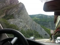
Discover Pragelato in Italy
Pragelato in the region of Piedmont is a place located in Italy - some 352 mi or ( 566 km ) North-West of Rome , the country's capital .
Local time in Pragelato is now 02:21 PM (Sunday) . The local timezone is named " Europe/Rome " with a UTC offset of 1 hours. Depending on your mobility, these larger cities might be interesting for you: Geneva, Grenoble, Clermont-Ferrand, Chambéry, and Besançon. When in this area, you might want to check out Geneva . We discovered some clip posted online . Scroll down to see the most favourite one or select the video collection in the navigation. Are you looking for some initial hints on what might be interesting in Pragelato ? We have collected some references on our attractions page.
Videos
CORSO SCI BY GOLDEN TEAM CECCARELLI
Più di un Team, una famiglia folgorata dalla stessa passione. 4 allenatori federali 3°, di cui 3 istruttori nazionali e una campionessa olimpica. Daniela Ceccarelli, Davide Ceccarelli, Valentina Friso ..
Piemonte Assietta
Wiinerwaldgang goes Piemonte Assietta Kammstrasse ..
Videocartolina da Sestriere
Uno sguardo alla località protagonista delle Olimpiadi invernali Torino 2006. (settembre 2005) ..
sestriere 2011
Scorribanda sciistica al Sestriere febbraio 2011 ..
Videos provided by Youtube are under the copyright of their owners.
Interesting facts about this location
Stadio del Trampolino
Stadio del Trampolino is a ski jumping hill located in Pragelato, Italy. During the 2006 Winter Olympics, it hosted the ski jumping and the ski jumping part of the Nordic combined events.
Located at 45.01 6.94 (Lat./Long.); Less than 1 km away
Fenestrelle Fort
The Fortress of Fenestrelle overlooks the tiny city of Fenestrelle, Piedmont, northern Italy. It is by far the largest Alpine fortification in Europe, having a surface area of approximately 1,350,000 m². It guards the access to Turin via the Chisone valley, with its lowest defences at around 1,100 metres altitude while the highest part extends to the summit of Mount Pinai at nearly 1,800 metres. The overall length is some three and a half kilometres.
Located at 45.03 7.06 (Lat./Long.); Less than 10 km away
Rhuilles
Rhuilles is a frazione of the Italian comune of Cesana Torinese, located at 1,675 metres above sea level in the Val Thuras. It is a tiny Alpine hamlet (pop. 4 in 2006) with characteristic grange (ancient agricultural baite in wood and stone). An old communal stone bread oven is to be found and a seventeenth-century chapel with a well-preserved wooden altarpiece.
Located at 44.91 6.83 (Lat./Long.); Less than 15 km away
Susa Valley
The Susa Valley (Italian: Val di Susa, French: Val de Suse) is a valley in the Piedmont region of northern Italy, located between the Graian Alps in the north and the Cottian Alps in the south. It is the longest valley in Italy. It extends over 50 km in an east-west direction from the French border to the outskirts of Turin. The valley takes its name from the city of Susa which lies in the valley. The Dora Riparia river, a tributary of the Po, flows through the valley.
Located at 45.13 7.05 (Lat./Long.); Less than 16 km away
Susa Cathedral
Susa Cathedral (Italian: Cattedrale di San Giusto, or Duomo di Susa) is a Roman Catholic cathedral in Susa, Piedmont, in northern Italy. It is the seat of the Bishop of Susa and is dedicated to Saint Justus of Novalesa. In origin it was the church of the Benedictine Abbey of St. Justus, established in 1029 by Marchese Olderico Manfredi to house the newly-discovered relics of Saint Justus. The church was built around 1100 and has since been refurbished and restored several times.
Located at 45.14 7.04 (Lat./Long.); Less than 16 km away
Pictures
Historical Weather
Related Locations
Information of geographic nature is based on public data provided by geonames.org, CIA world facts book, Unesco, DBpedia and wikipedia. Weather is based on NOAA GFS.


