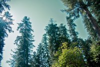
Explore Badia Prataglia in Italy
Badia Prataglia in the region of Tuscany is a town in Italy - some 134 mi or ( 216 km ) North of Rome , the country's capital city .
Current time in Badia Prataglia is now 01:51 PM (Wednesday) . The local timezone is named " Europe/Rome " with a UTC offset of 1 hours. Depending on the availability of means of transportation, these more prominent locations might be interesting for you: Rome, Rimini, Ravenna, Pratovecchio, and Prato. Since you are here already, make sure to check out Rome . We encountered some video on the web . Scroll down to see the most favourite one or select the video collection in the navigation. Where to go and what to see in Badia Prataglia ? We have collected some references on our attractions page.
Videos
Foreste Casentinesi, Camaldoli e La Verna - Linea Verde in Casentino 16/01/2011 [1/8]
www.casentinesi.it - Linea Verde (Rai1) è in Casentino, vallata in provincia di Arezzo (Toscana) a ridosso degli Appenini. Prima parte Foreste Casentinesi, Camaldoli e La Verna ..
Estate 2009 - Cammino di San Francesco
Estate '09. Cammino di San Francesco. Circa 200 km a piedi (25/30 km al giorno) dal santuario de La Verna fino ad Assisi. Musica: Gordon Peterson "Hard Sun" ..
Ferienwohnungen in der Toskana
Ferienwohnungen in der Toskana - www.toskana-fewo.com - Ferienwohnungen, Ferienhäuser und Villen in der traumhaften Toskana von privat. Wir freuen uns über Ihren Besuch! Musik: Mendelssohn, Venezianis ..
Sketches from La Verna Sanctuary
tuscany.podtravels.tv ..
Videos provided by Youtube are under the copyright of their owners.
Interesting facts about this location
Foreste Casentinesi, Monte Falterona, Campigna National Park
The Parco Nazionale delle Foreste Casentinesi, Monte Falterona, Campigna is a national park in Italy. Created in 1993, it covers an area of about 368 square kilometres, on the two sides of the Apennine watershed between Romagna and Tuscany, and is divided between the provinces of Forlì Cesena, Arezzo and Florence.
Located at 43.84 11.79 (Lat./Long.); Less than 9 km away
Santa Maria del Sasso
Santa Maria del Sasso, also known as the Sanctuary of Santa Maria del Sasso is a Renaissance church near Bibbiena in Tuscany, Italy. The first church on the site was constructed in 1347 following a reported appearance of the Virgin Mary on 23 June 1347. The current building was commissioned by Lorenzo de' Medici and constructed by Giuliano da Maiano starting in 1486. Following a visit by Savonarola in 1495 the work was expanded to include a convent and sanctuary.
Located at 43.70 11.83 (Lat./Long.); Less than 10 km away
Ridracoli
Ridracoli is a frazione of the comune of Bagno di Romagna, province of Forlì-Cesena, Emilia-Romagna. In the nearby is a 103.5 m-high dam on the Bidente river, with a lake. It is part of the Foreste Casentinesi, Monte Falterona, Campigna National Park.
Located at 43.83 11.97 (Lat./Long.); Less than 10 km away
La Verna
La Verna, in Latin Alverna and geographically known as Monte Penna, is a locality on Mount Penna, an isolated mountain of 1,283 m situated in the centre of the Tuscan Apennines, rising above the valley of the Casentino, central Italy. The place is known especially for its association with Saint Francis of Assisi (he is said to have received the stigmata here) and for the Sanctuary of La Verna, which grew up in his honour.
Located at 43.71 11.93 (Lat./Long.); Less than 10 km away
Casentino
The Casentino is the valley in which the first tract of the river Arno flows to Subbiano, Italy. It is one of the four valleys in which the Province of Arezzo is divided. Mount Falterona, from which the Arno starts, represents the northern boundary between the Casentino and Romagna. On the east of the valley are the Alpe di Serra and the Alpe di Catenaia, which separate the Casentino from the highest tract of the Val Tiberina.
Located at 43.70 11.82 (Lat./Long.); Less than 10 km away
Pictures
Historical Weather
Related Locations
Information of geographic nature is based on public data provided by geonames.org, CIA world facts book, Unesco, DBpedia and wikipedia. Weather is based on NOAA GFS.


