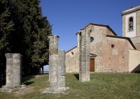
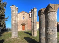
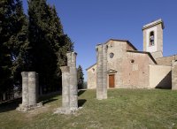
Touring Barberino Val d'Elsa in Italy
Barberino Val d'Elsa in the region of Tuscany with its 3,871 citizens is a city located in Italy - some 132 mi or ( 212 km ) North-West of Rome , the country's capital city .
Time in Barberino Val d'Elsa is now 07:54 AM (Monday) . The local timezone is named " Europe/Rome " with a UTC offset of 1 hours. Depending on your travel resources, these more prominent places might be interesting for you: San Casciano in Val di Pesa, Rome, Ravenna, Prato, and Pisa. Being here already, consider visiting San Casciano in Val di Pesa . We collected some hobby film on the internet . Scroll down to see the most favourite one or select the video collection in the navigation. Check out our recommendations for Barberino Val d'Elsa ? We have collected some references on our attractions page.
Videos
Giao's Space
www.myspace.com/forcatronic ..
IL PARETAIO riding holiday 2012
Impressions of the riding holiday at IL PARETAIO, Dressage and Country Riding Club in Barberino val d'Elsa , Tuscany, Italy. Content: Impressions of various riding lessons (single dressage, group, bas ..
Isole e Olena & Paolo De Marchi
The edited version of a very long conversation with Paolo about his estate, and the evolution of modern Chianti. ..
Villa San Filippo in Barberino Val D'Elsa, Italy
Are you in need of a romantic vacation far away from the stresses and strains of everyday problems? Then the 4 star country house hotel "Villa San Filippo" should be just your kind of thing: this gues ..
Videos provided by Youtube are under the copyright of their owners.
Interesting facts about this location
Semifonte
Semifonte was a fortified city in Tuscany, Italy, built during the late 12th century and destroyed after a siege by Florence in 1202. Its remains are within the modern comune of Barberino Val d'Elsa. It was sited mid-way between Florence and Siena on a hill overlooking the Elsa valley and the intersection of the two main routes in the area, the Via Francigena and the Via Chiantigiana, so enabling it to control trade in Tuscany. This dominant position proved to be its downfall.
Located at 43.54 11.13 (Lat./Long.); Less than 3 km away
Stadio Stefano Lotti
The Stadio Comunale Stefano Lotti is a football stadium in Poggibonsi, Italy. It is the home of Unione Sportiva Poggibonsi. The Stadium has a full capacity of 3600 and it have 2513 seats, all of which are numbered and divided into six areas. VIP forum Central tribune North side forum South side forum Stairs local Stairs guest The peloton has dimensions of 105 x 62 meters and is surrounded on the lawn, lighting requirements for a set of Pro League athletics.
Located at 43.47 11.15 (Lat./Long.); Less than 8 km away
Militia Templi
The Militia Templi (English: Militia of the Temple), also called the Order of the Poor Knights of Christ (Latin: Christi Pauperum Militum Ordo), is a lay order of the Roman Catholic Church.
Located at 43.46 11.16 (Lat./Long.); Less than 9 km away
Castello della Magione
The Castello della Magione (also Magione di San Giovanni al Ponte or Spedale di San Giovanni in Gerusalemme alla Magione) is a medieval castle in Poggibonsi. It is an example of a medieval "Mansio" (residence) that belonged to the Knights Templar. The castle includes the ancient church and the “spedale” (hotel) for the pilgrims in transit to Rome on the Via Francigena. The complex is near the ancient crossing of the Via Francigena over the Staggia River, near the Bonizio bridge, now destroyed.
Located at 43.46 11.16 (Lat./Long.); Less than 9 km away
Pieve of San Pancrazio (San Casciano in Val di Pesa)
The Pieve of San Pancrazio is a church in San Casciano in Val di Pesa. It is located on the hill dividing the valleys of the Pesa and Virginio streams. Known since the 10th century, it has noteworthy apses of Lombard architectural style. The interior has a nave and two aisles with matronaei. Works of art include a Madonna with Child of Agnolo Gaddi's school and a Crucifixion by Santi di Tito dating from 1590.
Located at 43.63 11.14 (Lat./Long.); Less than 10 km away
Pictures
Historical Weather
Related Locations
Information of geographic nature is based on public data provided by geonames.org, CIA world facts book, Unesco, DBpedia and wikipedia. Weather is based on NOAA GFS.


