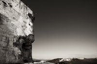
Discover Valdastico in Italy
Valdastico in the region of Veneto with its 1,480 habitants is a place located in Italy - some 281 mi or ( 453 km ) North of Rome , the country's capital .
Local time in Valdastico is now 05:19 AM (Monday) . The local timezone is named " Europe/Rome " with a UTC offset of 1 hours. Depending on your mobility, these larger cities might be interesting for you: Munich, Vicenza, Verona, Venice, and Vattaro. When in this area, you might want to check out Munich . We discovered some clip posted online . Scroll down to see the most favourite one or select the video collection in the navigation. Are you looking for some initial hints on what might be interesting in Valdastico ? We have collected some references on our attractions page.
Videos
Malga Millegrobbe Panorama
Panorama presso Malga Millegrobbe - Taken at 12:19 PM on February 01, 2009 - cameraphone upload by ShoZu ..
Forte Verle
..
Trincee austriache dal Basson, zona del Vezzena,Trento
..
Forte Luserna altopiano di Luserna, Trento
..
Videos provided by Youtube are under the copyright of their owners.
Interesting facts about this location
Monte Verena
Monte Verena is a mountain of the Veneto, Italy. It has an elevation of 2,015 metres .
Located at 45.93 11.41 (Lat./Long.); Less than 6 km away
Cima Portule
Cima Portule is a mountain in Italy, located in the province of Vicenza in the Veneto region. It has an elevation of 2310 metres.
Located at 45.97 11.43 (Lat./Long.); Less than 10 km away
Monte Priaforà
Monte Priaforà is a mountain of the Veneto, Italy. It has an elevation of 1659 metres.
Located at 45.79 11.32 (Lat./Long.); Less than 12 km away
Monte Novegno
Monte Novegno is a mountain of the Veneto, Italy. It has an elevation of 1552 metres.
Located at 45.77 11.32 (Lat./Long.); Less than 14 km away
Monte Summano
Monte Summano is a mountain of the Veneto, Italy. It has an elevation of 1296 metres.
Located at 45.76 11.39 (Lat./Long.); Less than 14 km away
Pictures
Historical Weather
Related Locations
Information of geographic nature is based on public data provided by geonames.org, CIA world facts book, Unesco, DBpedia and wikipedia. Weather is based on NOAA GFS.


