Discover Ofunato in Japan
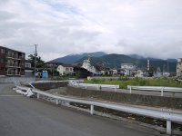
Ofunato in the region of Iwate with its 35,418 habitants is a town located in Japan - some 259 mi or ( 416 km ) North-East of Edo , the country's capital .
Local time in Ofunato is now 12:15 AM (Sunday) . The local timezone is named " Asia/Tokyo " with a UTC offset of 9 hours. Depending on your flexibility, these larger cities might be interesting for you: Yokohama, Edo, Kofu, Yamagata-shi, and Urahama. When in this area, you might want to check out Yokohama . We found some clip posted online . Scroll down to see the most favourite one or select the video collection in the navigation. Are you looking for some initial hints on what might be interesting in Ofunato ? We have collected some references on our attractions page.
Videos
東日本大震災からこうして避難・そして大津波
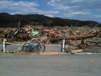
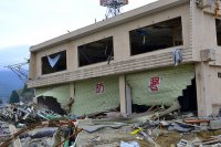
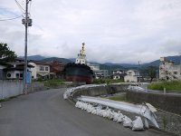
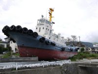
3月11日、強烈な地震のなか津波が来ることを予感し、仲間に避難を叫びながら高台に逃走。高台に着くと間もなく海面が盛り上がり、私たちの町を飲み込んでしまった。町の皆様の命や幸せ財産を一瞬にして飲み込んでしまった。 参)撮影場所大船渡市大船渡町字台地内、台ケ丘です。 お陰様で営業が再開致しました。さいとう製菓に関してはwww.saitoseika.co.jp へお願い致します。お問い合わせが出来ます。 ..
日本の列車 : 盛駅 2011年3月8日 三陸鉄道; JR and Sanriku Tetsudo at Sakari
The Sanriku Tetsudo ran along the east coast and two days after I shot this footage was totally devastated by the tsunami of March 11. JR KiHa 100 cars and Sanriku Tetsudo cars at Sakari. Sakari is on ..
日本の列車 : 盛駅 2011年3月8日 Iwate Kaihatsu Tetsudo 岩手開発鉄道
DD56 locomotives run a continuous service from the limestone quarry to the cement works at Sakari. The trains are seen here passing Sakari station. A Sanriku Tetsudo rail car is idling at the platform ..
日本の列車 : Iwate Kaihatsu Tetsudo 岩手開発鉄道 : Japan Rail
Another clip of loaded and empty limestone trains working between the quarry and the cement factory. Shot at Sakari station. ..
Videos provided by Youtube are under the copyright of their owners.
Interesting facts about this location
Rikuchu Kaigan National Park
Rikuchu Kaigan National Park is a national park in the Tohoku region of Honshū in northern Japan. The park extends for 180 kilometers from north to south along the coastline of the Pacific Ocean from northern Miyagi prefecture to northern Iwate prefecture. The park was created on May 2, 1955, and covers a land area of 121.98 square kilometres . The entire coastline is noted for examples of sea erosion, with numerous rock pillars and islands.
Located at 39.07 141.72 (Lat./Long.); Less than 0 km away
Ōfunato Station
Ōfunato Station is a train station located on the JR Ōfunato Line in Ōfunato, Iwate, Japan. The station was destroyed by the 2011 Tōhoku earthquake and tsunami and has now been replaced by a provisional Bus Rapid Transit line.
Located at 39.06 141.72 (Lat./Long.); Less than 1 km away
Sakari Station
Sakari Station is a train station located on the JR Ōfunato Line in Ōfunato, Iwate, Japan. This station is the largest in Ōfunato City.
Located at 39.09 141.71 (Lat./Long.); Less than 2 km away
Shimofunato Station
Shimofunato Station is a train station located on the JR Ōfunato Line in Ōfunato, Iwate, Japan. It is a 'ghost station', with no staff assigned to it. The station was destroyed by the 2011 Tōhoku earthquake and tsunami and has now been replaced by a provisional Bus Rapid Transit line.
Located at 39.04 141.72 (Lat./Long.); Less than 4 km away
Hosoura Station
Hosoura Station is a train station located on the JR Ōfunato Line in Ōfunato, Iwate, Japan. The station was destroyed by the 2011 Tōhoku earthquake and tsunami and has now been replaced by a provisional Bus Rapid Transit line.
Located at 39.02 141.71 (Lat./Long.); Less than 6 km away
Pictures
Historical Weather
Related Locations
Information of geographic nature is based on public data provided by geonames.org, CIA world facts book, Unesco, DBpedia and wikipedia. Weather is based on NOAA GFS.


