-
You are here:
- Homepage »
- Mexico »
- Baja California Sur » San Jose del Cabo

San Jose del Cabo Destination Guide
Discover San Jose del Cabo in Mexico
San Jose del Cabo in the region of Baja California Sur with its 48,518 habitants is a place located in Mexico - some 725 mi or ( 1167 km ) West of Mexico City , the country's capital .
Local time in San Jose del Cabo is now 05:16 AM (Thursday) . The local timezone is named " America/Mazatlan " with a UTC offset of -7 hours. Depending on your mobility, these larger cities might be interesting for you: Santa Anita, La Paz, La Canteria, El Tule, and El Salto. When in this area, you might want to check out Santa Anita . We discovered some clip posted online . Scroll down to see the most favourite one or select the video collection in the navigation. Are you looking for some initial hints on what might be interesting in San Jose del Cabo ? We have collected some references on our attractions page.
Videos
Total Solar Eclipse, Cabo Mexico
The longest Total Solar Eclipse until the year 2132 AD. San Jose del Cabo Mexico 1991. Party in the shadow. Dale Ireland ..
Total Solar Eclipse - July 11, 1991 (Mexico)
Total Solar Eclipse San Jose del Cabo, Baja California Sur, MEXICO VTR : SONY Handycam CCD-TR55 ..
DOWNTOWN / CENTRO SAN JOSE DEL CABO, BAJA, MEXICO
...Just another walk in a calm and warm Sunday afternoon. The video begins with the Church, following the Plaza Mijares with an event due to September, the mexican Patriotic Month. The last part is th ..
Cabo Azul Resort - Guest testimonies
We have just released this video. This contains comments from our guests and what they think about the resort. We hope that if you are considering a vacation to Los Cabos, Mexico, you consider Cabo Az ..
Videos provided by Youtube are under the copyright of their owners.
Interesting facts about this location
Los Cabos International Airport
Los Cabos International Airport is the seventh busiest airport in Mexico, located at San José del Cabo, Baja California Sur, Mexico. The airport serves Los Cabos area: San José del Cabo and Cabo San Lucas. This airport has three terminals with 4 concourses. Terminal 1 serves both domestic and international operations for various air carriers while Terminal 3 services Alaska Airlines, Delta Air Lines, Frontier Airlines and other seasonal international carriers.
Located at 23.15 -109.72 (Lat./Long.); Less than 11 km away
Los Cabos Corridor
The Los Cabos Corridor (Corredor Turistico) in Mexico, is an area on the southern coast of the Baja California Peninsula, facing the Gulf of California on the Transpeninsular Highway between San José del Cabo and Cabo San Lucas. It stretches about 30 kilometers along the highway and addresses within this area are usually specified in terms of distances from the start of Highway 1. The corridor is a popular tourist destination due to its many beach resorts, golf courses, and sport fishing.
Located at 23.16 -109.72 (Lat./Long.); Less than 11 km away
Santa Anita, Baja California Sur
Santa Anita is a village in Los Cabos Municipality, Baja California Sur, western Mexico, on the right bank of a river, the Arroyo San José. In 1968, it was described as a "little farming village". It is the type locality of the rice rat Oryzomys peninsulae, now possibly extinct. It had a population of 687 inhabitants in the 2010 census, and is situated at an elevation of 76 meters (249 ft. ) above sea level.
Located at 23.18 -109.70 (Lat./Long.); Less than 13 km away
Los Cabos (Baja California Sur)
Los Cabos is a municipality located at the southern tip of Mexico's Baja California Peninsula, in the state of Baja California Sur. It encompasses the towns of Cabo San Lucas and San José del Cabo (the municipal seat), as well as the Resort Corridor that lies between the two. The area's economy, like many resort areas in Mexico, was based on fishing but is now geared towards tourism, though sport fishing and golf are the area's main attractions. Also tourists can enjoy watching whales.
Located at 23.25 -109.75 (Lat./Long.); Less than 22 km away
El Arco de Cabo San Lucas
El Arco de Cabo San Lucas, or Lands End, Cabo San Lucas is a distinctive rock formation at the southern tip of Cabo San Lucas, which is itself the extreme southern end of Mexico's Baja California Sur Peninsula. The arch is locally known as El Arco in the town of Cabo San Lucas. It is here that the Pacific Ocean meets the Sea of Cortez. This spot is a popular gathering area for sea lions. It served as a backdrop for the Marshal Tucker Band's Third Album under the leadership of Billy Sanders.
Located at 22.88 -109.84 (Lat./Long.); Less than 25 km away
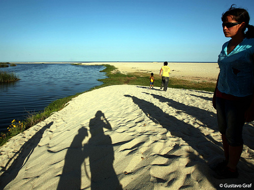
Pictures


Related Locations
Information of geographic nature is based on public data provided by geonames.org, CIA world facts book, Unesco, DBpedia and wikipedia. Weather is based on NOAA GFS.