
Discover Uzeta in Mexico
Uzeta in the region of Nayarit is a place located in Mexico - some 373 mi or ( 601 km ) West of Mexico City , the country's capital .
Local time in Uzeta is now 10:11 AM (Saturday) . The local timezone is named " America/Mazatlan " with a UTC offset of -7 hours. Depending on your mobility, these larger cities might be interesting for you: Zacatecas, Tepic, San Luis Potosí, San Jose del Conde, and Morelia. When in this area, you might want to check out Zacatecas . We discovered some clip posted online . Scroll down to see the most favourite one or select the video collection in the navigation. Are you looking for some initial hints on what might be interesting in Uzeta ? We have collected some references on our attractions page.
Videos
Ahuacatlan, Nayarit, Mexico
Aqui esta un poco de Ahuacatlan. ..
panoramica de tepic
vista desde el cerro de la cruz, en tepic, nayarit mexico ..
Videos provided by Youtube are under the copyright of their owners.
Interesting facts about this location
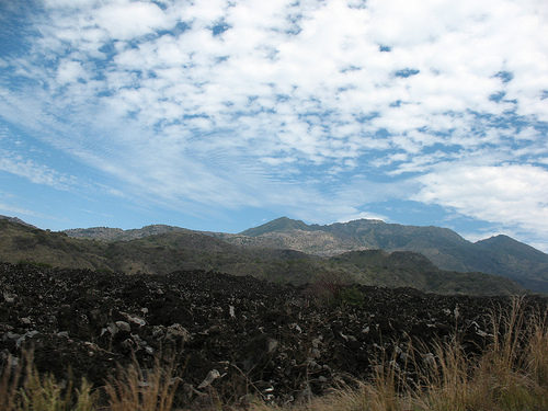
Ceboruco (volcano)
Ceboruco is a dacitic stratovolcano located in Nayarit, Mexico, northwest of the Trans-Mexican Volcanic Belt. The largest eruption, the Jala Plinian eruption, was around 930 AD ±200, VEI 6, releasing 11 cubic kilometres of tephra. The most recent and best documented eruption from Ceboruco lasted from 1870–1875, with fumarole activity lasting well into the 20th century.
Located at 21.13 -104.51 (Lat./Long.); Less than 10 km away
Ahuacatlán, Nayarit
Ahuacatlán is both a municipality and a municipal seat in the Mexican state of Nayarit. It is located in the southeastern part of the state and has boundaries with the following municipalities: in the north with San Pedro Lagunillas, Santa María del Oro and Jala; in the south with the state of Jalisco and the municipality of Amatlán de Cañas; in the east with Ixtlán del Río, Jala and Amatlán de Cañas; and in the west with San Pedro Lagunillas.
Located at 21.05 -104.49 (Lat./Long.); Less than 14 km away
San Pedro Lagunillas
San Pedro Lagunillas is both a municipality and the municipal seat of the same in the Mexican state of Nayarit. The population of the municipality was 7,155 (2005) in a total area of 520 square kilometers. The population of the town and municipal seat was 3,630 (2005). The population has been declining since 1980 when it was 8,308 inhabitants.
Located at 21.22 -104.77 (Lat./Long.); Less than 21 km away
Pictures
Related Locations
Information of geographic nature is based on public data provided by geonames.org, CIA world facts book, Unesco, DBpedia and wikipedia. Weather is based on NOAA GFS.