
Delve into Taquile in Peru
Taquile in the region of Puno with its 2,000 residents is located in Peru - some 556 mi or ( 894 km ) South-East of Lima , the country's capital .
Local time in Taquile is now 01:05 AM (Thursday) . The local timezone is named " America/Lima " with a UTC offset of -5 hours. Depending on your mobility, these larger destinations might be interesting for you: Arica, Potosí, La Paz, Cochabamba, and Uyuyo. While being here, you might want to check out Arica . We discovered some clip posted online . Scroll down to see the most favourite one or select the video collection in the navigation. Are you curious about the possible sightseeing spots and facts in Taquile ? We have collected some references on our attractions page.
Videos
Amantani and Taquile, islands in Lake Titikaka, Peru
Amantaní is an island on the Peruvian side of Lake Titicaca. According to a 1988 census, it has a population of 3663 Quechua speakers divided among about 800 families. The island is circular and about ..
Taquile, Peru. July festival
July festival on Taquile island, lake Titicaca, Peru 1988 ..
Peru Titicacasee Uros Part 1
Auf schwimmenden Schilfinsel lebt das Volk der Uros. ..
Peru Titicacasee Uros-Llachon
Auf schwimmenden Schilfinseln lebt seit viele Jahrhunderte noch immer das Volk der Uros. ..
Videos provided by Youtube are under the copyright of their owners.
Interesting facts about this location
Taquile Island
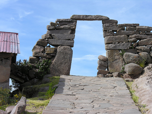
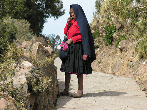
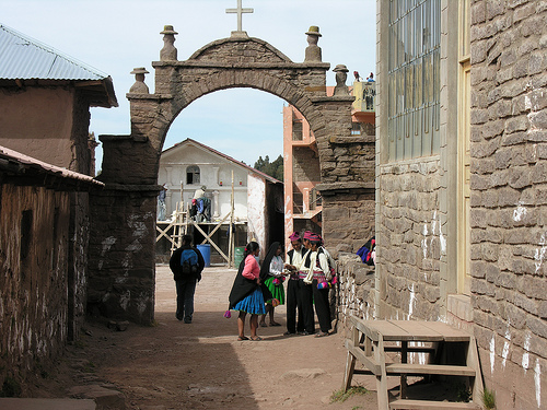
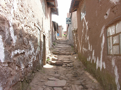
Taquile is an island on the Peruvian side of Lake Titicaca 45 km offshore from the city of Puno. About 2,200 people live on the island, which is 5.5 by 1.6 km in size (maximum measurements), with an area of 5.72 km². The highest point of the island is 4050 meters above sea level and the main village is at 3950 m. The inhabitants, known as Taquileños, are southern Quechua speakers.
Located at -15.78 -69.68 (Lat./Long.); Less than 1 km away
Amantaní
Amantaní is an island on the Peruvian side of Lake Titicaca. According to a 1988 census, it has a population of 3,663 Quechua speakers divided among about 800 families. The island is circular and about 9.28 km² in size. It has two mountain peaks, Pachatata (Father Earth) and Pachamama (Mother Earth), with ancient Inca and Tiwanaku ruins on top of both. The hillsides, are terraced mostly worked by hand and planted with wheat, quinoa, potatoes, and other vegetables.
Located at -15.66 -69.71 (Lat./Long.); Less than 12 km away
Amantaní District
Amantaní District is one of fifteen districts of the Puno Province in the Puno region, Peru.
Located at -15.66 -69.71 (Lat./Long.); Less than 12 km away
Pictures


Related Locations
Information of geographic nature is based on public data provided by geonames.org, CIA world facts book, Unesco, DBpedia and wikipedia. Weather is based on NOAA GFS.