
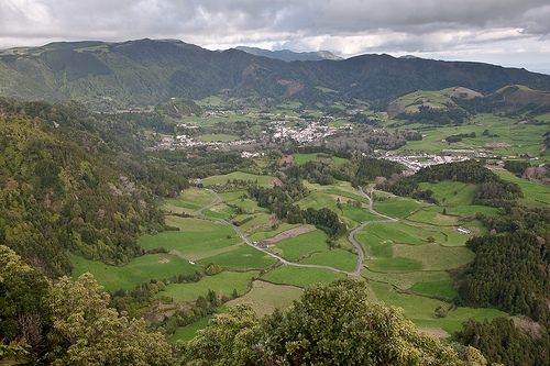
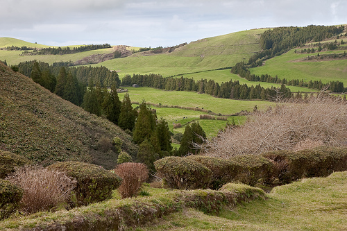
Discover Ponta Garca in Portugal
Ponta Garca in the region of Azores is a town located in Portugal - some 883 mi or ( 1421 km ) West of Lisbon , the country's capital .
Local time in Ponta Garca is now 11:14 AM (Saturday) . The local timezone is named " Atlantic/Azores " with a UTC offset of -1 hours. Depending on your flexibility, these larger cities might be interesting for you: Tras do Outeiro, Santo Antonio, Ribeirinha, Ribeira Seca do Porto, and Povoacao. When in this area, you might want to check out Tras do Outeiro . We found some clip posted online . Scroll down to see the most favourite one or select the video collection in the navigation. Are you looking for some initial hints on what might be interesting in Ponta Garca ? We have collected some references on our attractions page.
Videos
Sao Miguel - the Azores - EX1R
May 2010, I spent 11 days on the island of Sao Miguel in the Azores. It was supposed to have been 15 days but the volcanic ash from Iceland shot down the airport in Ponta Delgada (Sao Miguel). So, the ..
The Islet of Vila Franca do Campo by Gary Azores Taxitours
360º view of the litle island of Vila Franca do Campo. On www.azoreantours.com you can see 500 pictures,information and more videos of Azores. Personalized Taxitours on S.Miguel Azores Portugal. Look ..
2008 Vacation / Vila Franca do Campo, São Miguel - Açores, Portugal
2008 Vacation in Vila Franca do Campo São Miguel Açores ..
Thunfischfang auf Sao Miguel, Vila Franca do Campo, Azoren
Im Herbst jedes Jahres ist auf den Azoren Fangsaison für Thunfische. Die Gelbflossenthunfische werden mit einfachen Angeln gefangen. Hier einige Eindrücke aus dem neu erbauten Fischereihafen von Vila ..
Videos provided by Youtube are under the copyright of their owners.
Interesting facts about this location
José do Canto
José do Canto (20 December 1820, in Ponta Delgada – 10 July 1898, in Ponta Delgada) was an Azorean landowner and intellectual who distinguished himself as a bibliographer and promoter new agricultural technologies and species into the Azores. He was a renowned gardener and botanist responsible for the creation of botanical garden, that later bore his name (Jardim José do Canto), in Ponta Delgada.
Located at 37.75 -25.33 (Lat./Long.); Less than 5 km away
Lagoa do Fogo
Lagoa do Fogo (English: Lagoon of Fire) is a crater lake within the Agua de Pau stratovolcano in the center of the island of São Miguel Island in the Azores. The governmental authorities do not allow any modern construction around this lake. This lake is the highest above sea level on São Miguel Island.
Located at 37.75 -25.47 (Lat./Long.); Less than 10 km away
Água de Pau (volcano)
This article is about the volcano. For the parish of the same name, see Água de Pau. Água de Pau {{#invoke:InfoboxImage|InfoboxImage|image=Lagoa do Fogo. jpg|size=|maxsize=280px|alt=}}Lagoa do FogoElevation 947 m (3,107 ft)LocationLocation São Miguel Island, AzoresCoordinates {{#invoke:Coordinates|coord}}{{#coordinates:37|45|44|N|25|28|25|W|type:mountain_region:PT | |name= }}GeologyType StratovolcanoLast eruption 1564 Água de Pau is a stratovolcano in central part of São Miguel Island.
Located at 37.76 -25.47 (Lat./Long.); Less than 11 km away
Pico da Vara
Pico da Vara is the highest mountain on the Portuguese island of São Miguel, in the Azores archipelago of Macaronesia in the Atlantic Ocean. It lies in the east of the island in the Serra da Tronqueira range in the municipality of Nordeste. The area around the mountain includes the largest remaining stand of the native laurisilva forest on the island, which is home to the critically endangered endemic bird species, the Azores Bullfinch.
Located at 37.79 -25.22 (Lat./Long.); Less than 15 km away
1949 Air France Lockheed Constellation crash
The 1949 Air France Lockheed Constellation crash occurred on 28 October 1949 when a Lockheed L-749A-79-46 Constellation of Air France crashed whilst attempting to land at Santa Maria Airport, Azores, Portugal on a scheduled international passenger flight from Paris-Orly Airport to New York, United States, with a stopover at Santa Maria, Azores, Portugal. The aircraft crashed into a mountain whilst attempting to land at Santa Maria. All 48 people on board were killed.
Located at 37.80 -25.20 (Lat./Long.); Less than 17 km away
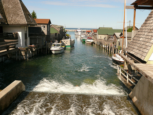
Pictures
Related Locations
Information of geographic nature is based on public data provided by geonames.org, CIA world facts book, Unesco, DBpedia and wikipedia. Weather is based on NOAA GFS.