
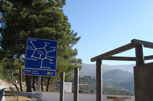
Explore Seia in Portugal
Seia in the region of Guarda with its 7,082 inhabitants is a town in Portugal - some 140 mi or ( 225 km ) North-East of Lisbon , the country's capital city .
Current time in Seia is now 05:58 AM (Thursday) . The local timezone is named " Europe/Lisbon " with a UTC offset of 0 hours. Depending on the availability of means of transportation, these more prominent locations might be interesting for you: Santarém, Lisbon, Unhais da Serra, Senhorim, and Sao Romao. Since you are here already, make sure to check out Santarém . We encountered some video on the web . Scroll down to see the most favourite one or select the video collection in the navigation. Where to go and what to see in Seia ? We have collected some references on our attractions page.
Videos
GOUVEIA ART ROCK 2010 on RTP-N TV (2)
Gouveia Art Rock 2010's first day had to deal with the unexpected cancellations of two of the main artists in the lineup: Mats & Morgan (Sweden) and After Crying (Hungary). The festival had to make an ..
Beiras, Center of Portugal // Beiras, o centro de Portugal
www.bookportugal.com Aveiro, Coimbra, Guarda, Viseu and Castelo Branco are some of the main cities located in the centre of Portugal. In this region you can also find Serra da Estrela, the highest poi ..
ISILDURS BANE live at GOUVEIA ART ROCK 2004 - Unity/The Pilot
This is an exclusive Gouveia Art Rock official YouTube channel video. Isildurs Bane are a swedish progressive avantgarde ensemble. IB have been around since the second half of the 1970s, as a progress ..
salto de cabeça
candao / parente city ..
Videos provided by Youtube are under the copyright of their owners.
Interesting facts about this location
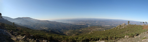
Serra da Estrela Subregion
District of Serra da Estrela Serra da Estrela is a NUTS3 statistical subregion of Portugal integrated in the NUTS2 Centro region that takes its name from the largest mountain range in Portugal - the Serra da Estrela.
Located at 40.42 -7.70 (Lat./Long.); Less than 1 km away
São Romão (Seia)
São Romão is a parish in the municipality of Seia, with a land area of 17.92 km, 6,500 inhabitants and a density of 362 inhabitants/Km It was the county seat from the 13th century until 1836. It consisted of one parish and had, in 1801, 1426 inhabitants. Location of São Romão on Google Maps: http://maps. google. com/maps?f=q&hl=pt-PT&geocode=&q=Sao+Romao+-++Seia&sll=-6.982778,-39.660833&sspn=0.006784,0.009356&ie=UTF8&ll=40.401961,-7.717381&spn=0.08327,0.149689&z=13
Located at 40.40 -7.72 (Lat./Long.); Less than 2 km away
Sazes da Beira
Sazes da Beira is a Portuguese parish, located in the municipality of Seia. It has a total area of 6,39 km² and 341 inhabitants (2001). Sazes’ mines were already explored by the Romans in V b.C. The village was founded by families of shepherds who come from Sandomil and Corgas (closest town and village respectively) looking for fertile territories near water.
Located at 40.35 -7.74 (Lat./Long.); Less than 8 km away
Travancinha
Travancinha is a village in the Portuguese municipality of Seia, with 12.66 km² area and 546 inhabitants (2001). It has a population density of 43.1 inhabitants per km².
Located at 40.42 -7.82 (Lat./Long.); Less than 10 km away
São Gião
São Gião is a parish (freguesia in Portuguese), in the North of Portugal, on Serra da Estrela, the highest mountain range in Portugal. It belongs to the municipality of Oliveira do Hospital, and the district (distrito) of Coimbra. It is located at 40°20'11.93N, 7°47'57.43W and lies at an altitude of 704m, in the Beira region. It is an old Roman trading post. The old Roman bridge is still visible and in use to this day.
Located at 40.34 -7.80 (Lat./Long.); Less than 12 km away
Pictures
Related Locations
Information of geographic nature is based on public data provided by geonames.org, CIA world facts book, Unesco, DBpedia and wikipedia. Weather is based on NOAA GFS.