-
You are here:
- Homepage »
- Spain »
- Canary Islands » Puerto del Rosario

Puerto del Rosario Destination Guide
Explore Puerto del Rosario in Spain
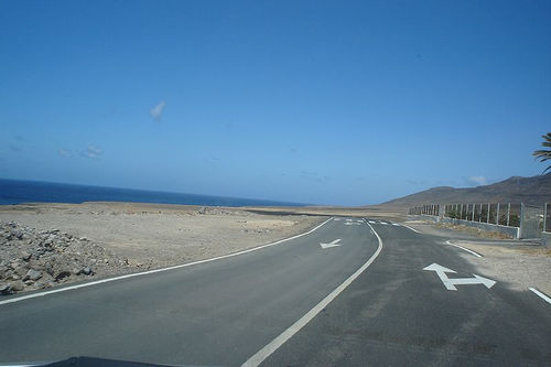
Puerto del Rosario in the region of Canary Islands with its 35,667 inhabitants is a town in Spain - some 1,005 mi or ( 1617 km ) South-West of Madrid , the country's capital city .
Current time in Puerto del Rosario is now 11:27 AM (Tuesday) . The local timezone is named " Atlantic/Canary " with a UTC offset of 0 hours. Depending on the availability of means of transportation, these more prominent locations might be interesting for you: El Aaiún, Villaverde, Valles de Ortega, Tuineje, and Triquivijate. Since you are here already, make sure to check out El Aaiún . We saw some video on the web . Scroll down to see the most favourite one or select the video collection in the navigation. Where to go and what to see in Puerto del Rosario ? We have collected some references on our attractions page.
Videos
Fuerteventura Lanzarote Island Canary
One of paradises on earth ..
Visual Approach Fuerteventura A320 Noseview Landing
The Swiss A320-200 Noseview Landing in Fuerteventura, in HD. I do hope you enjoy the Landing, Long Version following in due time. All my Videos were filmed under supervision of swiss international air ..
Landing with A320 in Fuerteventura
Landing with an Airbus A320 from Lauda Air in Fuerteventura (Spain) ..
Boeing 737 landing at Fuerteventura
In spring 2007 I flew to Fuertenventura. At the beach I saw a F-18 over the sea. ..
Videos provided by Youtube are under the copyright of their owners.
Interesting facts about this location
Puerto del Rosario
Puerto del Rosario is a Canarian municipality in the northern portion of the island of Fuerteventura in the Las Palmas province in the Canary Islands. Puerto del Rosario is also the capital of the island of Fuerteventura since 1835. The population is 28,357, with a density of 39.43/km² which is expected to reach 100/km². The area is 289.95 km². It is located on the main highway linking north to Puerto del Rosario and southwest to Tuineje, as well as Betancuria.
Located at 28.50 -13.87 (Lat./Long.); Less than 0 km away
Fuerteventura Airport
Fuerteventura Airport, also known as El Matorral Airport, is an airport serving the Spanish island of Fuerteventura. It is situated in El Matorral site, 5 km southwest of the capital city Puerto del Rosario. It was built in the mid-1960s with the arrival of tourism.
Located at 28.45 -13.86 (Lat./Long.); Less than 5 km away
Caleta de Fuste
Caleta de Fuste (also known as El Castillo and Costa Caleta) is the largest community in the municipality of Antigua, Las Palmas, Spain on the island of Fuerteventura in the Canary Islands. The area is frequented by a variety of tourists and has numerous hotels, shops, boutiques, bars, cafes, and restaurants on or near the beaches. In the main harbour is a castle built as a martello tower by the military engineer Claudio de Lisne in 1743.
Located at 28.38 -13.87 (Lat./Long.); Less than 13 km away
Montaña de Tindaya
The Montaña de Tindaya is a mountain located in the Spanish island of Fuerteventura, one of the Canary Islands in the Atlantic Ocean off the coast of Africa. It was considered a sacred place by the pre-Spanish local population, and is also known as the Sacred Mountain today.
Located at 28.58 -13.97 (Lat./Long.); Less than 14 km away
Antigua, Fuerteventura
Antigua is a Canarian municipality in the central and the eastern portion of the island of Fuerteventura in the Las Palmas province in the Canary Islands. The population is 6,587, its density is 26.29/km² and the area is 250.56 km². It is located a main highway linking north to Puerto del Rosario and to Tuineje and a small highway linking to Betancuria. The main industry are agriculture and tourism. The Atlantic Ocean is to the east, the mountains covers the western portion.
Located at 28.42 -14.02 (Lat./Long.); Less than 18 km away
Pictures
Related Locations
Information of geographic nature is based on public data provided by geonames.org, CIA world facts book, Unesco, DBpedia and wikipedia. Weather is based on NOAA GFS.