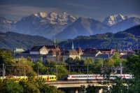
-
You are here:
- Homepage »
- Switzerland »
- Bern » Urtenen

Urtenen Destination Guide
Explore Urtenen in Switzerland
Urtenen in the region of Bern with its 5,258 inhabitants is a place in Switzerland - some 6 mi or ( 10 km ) North-East of Berne , the country's capital city .
Time in Urtenen is now 07:52 PM (Tuesday) . The local timezone is named " Europe/Zurich " with a UTC offset of 1 hours. Depending on your budget, these more prominent locations might be interesting for you: Zurich, Urtenen, Schonbuhl, Muri bei Bern, and Konolfingen. Since you are here already, consider visiting Zurich . We saw some hobby film on the internet . Scroll down to see the most favourite one or select the video collection in the navigation. Where to go and what to see in Urtenen ? We have collected some references on our attractions page.
Videos
Vogelzwitschern im Wald
Vogelzwitschern im Wald. Aufgenommen am 09.05.2010 ..
Hochwasser in Bern 2005: Heli-Evakuierung
Das Aare-Hochwasser 2005 in Bern: BewohnerInnen werden mir zwei Rega-Helis aus dem Matte-Quartier evakuiert (Video vom 24.8.2005) ..
Demontage Wolffkran
Demontage durch Frutiger Uetendorf. ..
Berufsfeuerwehr Bern - Einsatz im Breitenrain
umgefallenes Gerüst in der Rodtmattstrasse ..
Videos provided by Youtube are under the copyright of their owners.
Interesting facts about this location
Moossee
Moossee (or Grosser Moossee) is a lake in the Canton of Berne, Switzerland. Its surface area is 0.31 km². The lake gives the name to Moosseedorf (literally "village of Moossee") on its southern shore. The golf course Moossee is located east of the lake at Münchenbuchsee. The Urtenen drains Chli Moossee before flowing into Grosser Moossee 400 m further.
Located at 47.02 7.48 (Lat./Long.); Less than 2 km away
A1 motorway (Switzerland)
The A1 is a motorway in Switzerland. It follows Switzerland's main east-west axis, from St. Margrethen in northeastern Switzerland's canton of St. Gallen through to Geneva in southwestern Switzerland. The motorway spans over 200 kilometres through Switzerland. With the build of the third Baregg Tunnel tube, the traffic jams in this area were reduced, but the Gubrist Tunnel remains with the old capacity as a new point of heavy traffic.
Located at 47.03 7.53 (Lat./Long.); Less than 2 km away
Hofwil
Hofwil is a village in the canton of Berne, Switzerland, part of the municipality of Münchenbuchsee.
Located at 47.02 7.46 (Lat./Long.); Less than 3 km away
List of Aar bridges in Bern
This is a list of the 18 bridges spanning the river Aar on the territory of the city of Bern, Switzerland. Map of all coordinates from GoogleMap of first 200 coordinates from Bing Export all coordinates as KML Export all coordinates as GeoRSS Map of all microformatted coordinates Place data as RDF With the historical city core situated on a steeply-flanked peninsula formed by the river, the Aar is a defining part of Bern's cityscape and features prominently in the city's 800-year history.
Located at 46.99 7.45 (Lat./Long.); Less than 6 km away
Bantiger TV Tower
Bantiger TV Tower is a 196 metre tall tower used for FM- and TV-transmission at {{#invoke:Coordinates|coord}}{{#coordinates:46|58|40|N|7|31|43|E|type:landmark_region:CH-BE_source:dewiki |primary |name= }} on the Bantiger mountain, a mountain east of Berne situated in the municipality of Bolligen. The Bantiger TV Tower was built between 1991 and 1996 as replacement of a 100 metres tall radio tower, built in 1954.
Located at 46.98 7.53 (Lat./Long.); Less than 6 km away
Pictures
Historical Weather
Related Locations
Information of geographic nature is based on public data provided by geonames.org, CIA world facts book, Unesco, DBpedia and wikipedia. Weather is based on NOAA GFS.

