-
You are here:
- Homepage »
- Switzerland »
- Glarus » Elm

Elm Destination Guide
Explore Elm in Switzerland
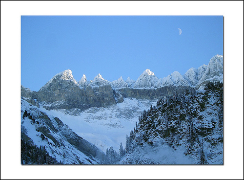
Elm in the region of Glarus with its 729 inhabitants is a place in Switzerland - some 81 mi or ( 131 km ) East of Berne , the country's capital city .
Time in Elm is now 02:15 AM (Friday) . The local timezone is named " Europe/Zurich " with a UTC offset of 1 hours. Depending on your budget, these more prominent locations might be interesting for you: Zurich, Winterthur, Sool, Schwanden, and Rüti. Since you are here already, consider visiting Zurich . We saw some hobby film on the internet . Scroll down to see the most favourite one or select the video collection in the navigation. Where to go and what to see in Elm ? We have collected some references on our attractions page.
Videos
Brits Wintersports Festival 2008 Snowboard Ski Music
The Brits Wintersports & Music Festival. 29th March - 5th April 2008, Laax, Switzerland. Holiday Packages from just £179 (includes 7 nights acomodation, 6 days lift pass, Festvial Wristband & Event Ba ..
Hotel Sunstar**** Flims
Das Hotel Sunstar**** in Flims ist ein gepflegtes, gemütliches Hotel und liegt zentral am Waldrand. Die Zimmer sind komfortabel eingerichtet. Vom Balkon geniessen Sie den Blick in die Berge. Erholung ..
Panixerpass: Tour von Ilanz Graubünden ins Glarner Sernftal nach Elm / Schwanden
Tour über den Panixerpass Von Ilanz Graubünden ins Glarnerland Sernftal nach Elm / Schwanden Auf den Spuren vom Russischen General Suworow. Vom Bündner Rheintal über den Panixerpass ins Glarner Sernft ..
Flims Podcast #2/2010 - Runcatrail
Runcatrail - die ausgewogene Mischung aus Freeride- und Cruising-Elementen bietet viel Abwechslung. Länge: 7.4 km. Höhenmeter: 780 m. Schwierigkeitsgrad: mittelschwer. ..
Videos provided by Youtube are under the copyright of their owners.
Interesting facts about this location
Chüebodensee
Chüebodensee is a lake above Elm in the Canton of Glarus, Switzerland. Its surface area is 1.4 ha. Swimming and fishing (with a license from Elm city offices) are allowed. There are about 8 km of well established trails around the lake. As the lake lies in the oldest wildlife preserve in Europe, the Glarner Freiberg, it is home to many alpine animals including marmots, chamois, alpine ibex, deer and birds of prey.
Located at 46.94 9.13 (Lat./Long.); Less than 3 km away
Vorab Glacier
The Vorab Glacier is a 2 km long glacier (2005) situated in the Glarus Alps in the cantons of Glarus and Graubünden. It lies on the east side of the Vorab, between 2,600 and 3,000 metres above sea level. In 1973 it had an area of 2.17 km².
Located at 46.88 9.16 (Lat./Long.); Less than 5 km away
Sernftal
The Sernftal or Kleintal is an alpine valley within Glarus Süd, in the canton of Glarus, Switzerland. It is formed by the Sernf, a right tributary of the Linth. Situated in the Sernftal are the villages of Elm (977 m) and Engi (812 m). The Panix Pass at 2407 m connects the Sernftal with the anterior Rhine valley in Grisons.
Located at 46.96 9.17 (Lat./Long.); Less than 5 km away
Glarus thrust
The Glarus thrust is a major thrust fault in the Alps of eastern Switzerland. Along the thrust the Helvetic nappes were thrusted more than 100 km to the north over the external Aarmassif and Infrahelvetic complex. The thrust forms the contact between older (Helvetic) Permo-Triassic rock layers of the Verrucano group and younger (external) Jurassic and Cretaceous limestones and Paleogene flysch and molasse. The Glarus thrust crops out over a relatively large area in the cantons Glarus, St.
Located at 46.92 9.25 (Lat./Long.); Less than 6 km away
Garichtisee
Garichtisee is a reservoir on Mettmenalp above Schwanden in the Canton of Glarus, Switzerland. The lake's surface area is 0.16 km².
Located at 46.96 9.10 (Lat./Long.); Less than 7 km away
Pictures
Historical Weather
Related Locations
Information of geographic nature is based on public data provided by geonames.org, CIA world facts book, Unesco, DBpedia and wikipedia. Weather is based on NOAA GFS.