-
You are here:
- Homepage »
- Switzerland »
- Uri » Andermatt

Andermatt Destination Guide
Discover Andermatt in Switzerland
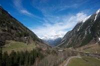
Andermatt in the region of Uri with its 1,258 habitants is a town located in Switzerland - some 58 mi or ( 94 km ) East of Berne , the country's capital .
Local time in Andermatt is now 03:47 AM (Monday) . The local timezone is named " Europe/Zurich " with a UTC offset of 1 hours. Depending on your flexibility, these larger cities might be interesting for you: Zurich, Silenen, Realp, Orello, and Nieder Surenen Alp. When in this area, you might want to check out Zurich . We found some clip posted online . Scroll down to see the most favourite one or select the video collection in the navigation. Are you looking for some initial hints on what might be interesting in Andermatt ? We have collected some references on our attractions page.
Videos
MGB Glacier-Express Andermatt-Oberalppass (2046 m) Part1
Siehe / view: www.youtube.com/watch?v=w6rYZMRT3Bk Parallelfahrt mit Glacierexpress auf der Strecke der Zahnradbahn von Andermatt zum Oberalppass ..
09 MGB Glacier Express-Andermatt Oberalppass
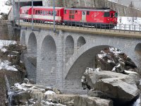
Von Andermatt (1436 m) im Kanton Uri klettert der Zug auf der Zahnradstrecke (Spurweite 1000 mm) auf einer Strecke von ca 4,5 km bis Nätschen zunächst auf 1843 m (Höhenunterschied 407 m) und bis zum O ..
FO-Balkonlok in Andermatt
HGe4/4 I Nr. 33 beim Abstoßen eines Güterwagens im Bahnhof Andermatt ..
Svizzera 1990 - Furka-Oberalp: sui tornanti di Andermatt
La linea inizia dalla stazione di Disentis, nel Cantone dei Grigioni, dove si connette alla Ferrovia Retica (RhB), arrampicandosi sul Passo dell'Oberalp, con l'aiuto della cremagliera data la pendenza ..
Videos provided by Youtube are under the copyright of their owners.
Interesting facts about this location
Andermatt railway station
Andermatt railway station is an important railway junction on the metre gauge Furka Oberalp Bahn (FO). It serves the municipality of Andermatt, in the Canton of Uri, Switzerland. Since 2003, the FO, including Andermatt station and the lines and trains serving it, has been owned and operated by the Matterhorn Gotthard Bahn (MGB).
Located at 46.64 8.59 (Lat./Long.); Less than 0 km away
Naetschen
Nätschen is a mountain and ski area located in Andermatt, in the Canton of Uri, Switzerland. Higher up on Nätschen the mountain is known as Gütsch. Its highest point is 2,344 m . It is one of the mountains in the Gotthard Oberalp Arena, as is Gemsstock, which is on the other side of Andermatt. It has 11 ski runs, totaling approximately 21 km of ski pistes, and 4 ski lifts, including a Detachable 4-man Chairlift.
Located at 46.64 8.61 (Lat./Long.); Less than 1 km away
Teufelsbrücke
The Teufelsbrücke ('Devil's Bridge') is a bridge over the Schöllenen Gorge in the Swiss canton of Uri. The bridge provides access to the St. Gotthard Pass by crossing the gorge and the Reuss River below. It is named for an old local legend regarding its construction by the Devil, one of many old European Devil's Bridges with similar creation myths.
Located at 46.65 8.59 (Lat./Long.); Less than 1 km away
Schöllenen Gorge
Schöllenen Gorge is a gorge located in the Swiss canton of Uri between the towns of Göschenen to the north and Andermatt to the south. It is 5 km long along the Reuss River in central Switzerland, and provides access to the St. Gotthard Pass. Enclosed by sheer granite walls, its road and railway require several spectacular bridges and tunnels, of which the most famous is a stone bridge known as the Teufelsbrücke.
Located at 46.65 8.59 (Lat./Long.); Less than 1 km away
Göschenen railway station
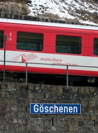
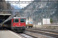
Göschenen is a railway station in the Swiss canton of Uri and municipality of Göschenen. Situated on the Gotthard railway, at the northern mouth of the Gotthard Tunnel, the station is also the junction point with the Schöllenenbahn. The Gotthard railway connects Göschenen via Immensee with Zürich in the north, and via the Gotthard Rail Tunnel and Chiasso with Milan in the south. This very heavily trafficked standard gauge line is operated by the Swiss Federal Railways.
Located at 46.67 8.59 (Lat./Long.); Less than 3 km away
Pictures
Historical Weather
Related Locations
Information of geographic nature is based on public data provided by geonames.org, CIA world facts book, Unesco, DBpedia and wikipedia. Weather is based on NOAA GFS.


