-
You are here:
- Homepage »
- United Kingdom »
- England » Christow

Christow Destination Guide
Explore Christow in United Kingdom
Christow in the region of England is a town in United Kingdom - some 164 mi or ( 264 km ) West of London , the country's capital city .
Current time in Christow is now 05:46 AM (Tuesday) . The local timezone is named " Europe/London " with a UTC offset of 0 hours. Depending on the availability of means of transportation, these more prominent locations might be interesting for you: Whitestone, Trusham, Teignmouth, Swansea, and Plymouth. Since you are here already, make sure to check out Whitestone . We saw some video on the web . Scroll down to see the most favourite one or select the video collection in the navigation. Where to go and what to see in Christow ? We have collected some references on our attractions page.
Videos
How to set up a single travel hammock
This short video demonstrates how easy it is to set up a parachute travel hammock, including how to fix the hooks to the fixing rope which has been attached to trees. To buy a travel hammock; go to ww ..
Driving On The A38 From M5 Junction 31 To Heathfield, Devon, England 22nd April 2011
Driving on the A38 from M5 Junction 31 to Heathfield, Devon, England Videoed on Friday, 22nd April 2011 Playlist: www.youtube.com ..
How to pack away a single travel hammock
This short video demonstrates how easy it is to pack away a parachute travel hammock. To buy a travel hammock; go to www.paradisehammocks.co.uk. ..
Driving On The A38 From M5 Junction 31 To Heathfield, Devon, England 21st October 2011
Driving on the A38 from M5 Junction 31 to Heathfield, Devon, England Videoed on Friday, 21st October 2011 Playlist: www.youtube.com ..
Videos provided by Youtube are under the copyright of their owners.
Interesting facts about this location
Christow
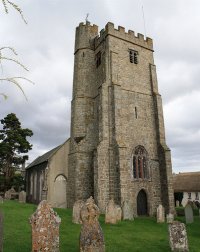
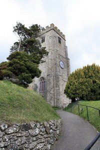
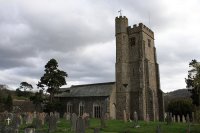
Christow is a village located on the edge of Dartmoor National Park, England. It has been around for hundreds of years nestled on the side of the Teign Valley. The village is presently home to around 850 people and grows slowly. It is situated 5 miles from the small town of Chudleigh and 8 miles from Exeter (this being about 30 minutes travelling time). It has one shop, a post office, two pubs, a pet crematorium, a surgery and a Community Hall.
Located at 50.65 -3.65 (Lat./Long.); Less than 0 km away
Ashton, Devon
Ashton is a civil parish in the Teignbridge district of Devon, England. According to the 2001 census it had a population of 174. The parish consists of two villages, Higher Ashton and Lower Ashton, and is on the edge of the Dartmoor National Park. The church of St John Baptist is according to John Betjeman "the typical Devon church at its best ... [with with] rich colouring ... and lavish carved woodwork".
Located at 50.65 -3.62 (Lat./Long.); Less than 2 km away
Trusham
Trusham is a small village in the Teign Valley just outside of Chudleigh between Newton Abbot and Exeter in Devon. It has one pub which claims to be the oldest in Devon named The Cridford Inn. It is believed that the main site of the now, Cridford Inn, dates back to 1086 and was probably one of the nine small-holdings mentioned in the “Domesday Book”, which belonged to the Abbey of Buckfast in the Manor of Trusham.
Located at 50.63 -3.62 (Lat./Long.); Less than 3 km away
Great Rock Mine
Great Rock Mine is a disused micaceous haematite mine about 3 km north of the town of Bovey Tracey in Devon, England. It was worked from the 19th century until 1969, and was the last active mine in the Dartmoor National Park area. At its most active during the 1940s, the mine produced 2,500 tons of micaceous haematite per year.
Located at 50.62 -3.66 (Lat./Long.); Less than 3 km away
Cotley Castle
Cotley Castle is a large Iron Age Hill fort near Dunchideock in Devon and close to Exeter. It occupies a significant hilltop at 220 metres above sea level, just to the north of Great Haldon, part of the same ridge of the Haldon Hills.
Located at 50.69 -3.62 (Lat./Long.); Less than 5 km away
Pictures
Related Locations
Information of geographic nature is based on public data provided by geonames.org, CIA world facts book, Unesco, DBpedia and wikipedia. Weather is based on NOAA GFS.


