-
You are here:
- Homepage »
- United Kingdom »
- England » Grain

Grain Destination Guide
Explore Grain in United Kingdom
Grain in the region of England is a town in United Kingdom - some 36 mi or ( 58 km ) East of London , the country's capital city .
Current time in Grain is now 12:10 PM (Sunday) . The local timezone is named " Europe/London " with a UTC offset of 0 hours. Depending on the availability of means of transportation, these more prominent locations might be interesting for you: Stoke, Southend-on-Sea, South Benfleet, Rayleigh, and Peterborough. Since you are here already, make sure to check out Stoke . We saw some video on the web . Scroll down to see the most favourite one or select the video collection in the navigation. Where to go and what to see in Grain ? We have collected some references on our attractions page.
Videos
Punto GT 2L 16VT First Run 3
Punto GT 2L 16VT First Run 3 ..
Halfway Houses ; from top to bottom
A high-speed journey through Halfway Houses, Isle of Sheppey from Telegraph Hill to Sheerness East. ..
queenborough to leysdown under the sheppey bridge 13/09/2009
Trip from Queenborough to Leysdown on sea in darrens boat ..
Exploring the abandoned Grain fort
Exploring a spooky abandoned fort which is in the sea and can only be reached when the tide is out. it was a very muddy walk to get to the fort. and some of the fort looked like it was breaking up. th ..
Videos provided by Youtube are under the copyright of their owners.
Interesting facts about this location
Grain Fort
Grain Fort was built in the 1860s on the eastern end of the Hoo peninsula to control the entrance to the Medway, Kent, England. All surface structures were demolished in the 1960s, so all that remains are underground passages. Nearby is the 1855 Grain Tower Battery, an extensively remodelled East Coast type Martello Tower. Garrison Point Fort lies the other side of the Medway.
Located at 51.46 0.72 (Lat./Long.); Less than 1 km away
London Thamesport
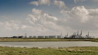
London Thamesport is a container seaport on the River Medway, serving the North Sea. It is located on the Isle of Grain, in the Medway unitary authority district of the English county of Kent. The area was formerly called Port Victoria.
Located at 51.44 0.69 (Lat./Long.); Less than 2 km away
Garrison Point Fort
Garrison Point Fort in Sheerness on the Isle of Sheppey in Kent was built on the recommendations of the Royal Commission report in the 1860s opposite Grain Fort to control the entrance to the Medway, Kent. It originally contained 36 Rifled Muzzle Loaders with calibres from 9in to 12in. Three Brennan Torpedo ramps were added in 1885. Garrison Point Fort is now part of Sheerness docks, with the ferry access cutting across it, and no public access.
Located at 51.45 0.74 (Lat./Long.); Less than 3 km away
Isle of Grain
The Isle of Grain, (OE Greon meaning gravel) is the easternmost point of the Hoo Peninsula in the unitary authority of Medway in South East England. It was, until 1998, part of Kent and is still ceremonially associated via the Lieutenancies Act. No longer an island, the Isle is almost all marshland and the Grain Marshes are an important habitat for birdlife. The Isle constitutes a civil parish, which at the 2001 census had a population of 1,731.
Located at 51.43 0.70 (Lat./Long.); Less than 3 km away
Battle of the Medway
The Battle of the Medway took place in 43 AD on the River Medway in the lands of the Iron Age tribe of the Cantiaci, now the English county of Kent. It was an early battle in the Claudian invasion of Britain, led by Aulus Plautius.
Located at 51.44 0.74 (Lat./Long.); Less than 3 km away
Pictures
Historical Weather
Related Locations
Information of geographic nature is based on public data provided by geonames.org, CIA world facts book, Unesco, DBpedia and wikipedia. Weather is based on NOAA GFS.

