-
You are here:
- Homepage »
- United Kingdom »
- England » Terrington Saint Clement

Terrington Saint Clement Destination Guide
Discover Terrington Saint Clement in United Kingdom
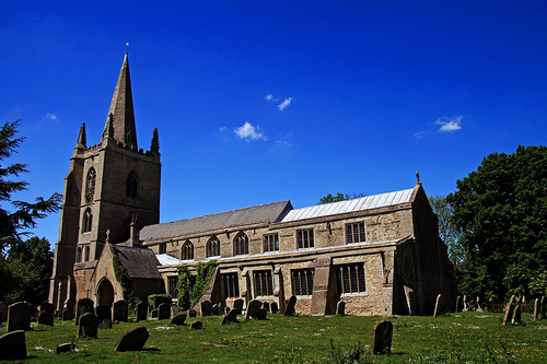
Terrington Saint Clement in the region of England with its 3,176 habitants is a place located in United Kingdom - some 88 mi or ( 141 km ) North of London , the country's capital .
Local time in Terrington Saint Clement is now 01:23 PM (Friday) . The local timezone is named " Europe/London " with a UTC offset of 0 hours. Depending on your mobility, these larger cities might be interesting for you: Wisbech, West Walton, Watlington, Sutton Bridge, and Stowbridge. When in this area, you might want to check out Wisbech . We discovered some clip posted online . Scroll down to see the most favourite one or select the video collection in the navigation. Are you looking for some initial hints on what might be interesting in Terrington Saint Clement ? We have collected some references on our attractions page.
Videos
Viewers' Points of View Answered
Mark responds to points made by viewers of his bbc.co.uk/markkermode blogs. ..
Wiggenhall Wave Chase From Kings Lynn To Stowbridge On A Mountain Bike.
Best scenes at 03:57 & 09:25 Audio at 10:00 Mad Dog at 04:48!! LOL!! Low resolution sd card camera mounted on the cycle frame and an old camcorder used freehand without its monitor screen. Sequences w ..
Green Island in the Wash Norfolk UK
This was a ride out to the wash in Norfolk to look at the strange green island seen in the wash on google earth. ..
Vlog: Dancing, Tuna and Bubbles
A vlog, and that is all. Mwah ha ha haaaa! ..
Videos provided by Youtube are under the copyright of their owners.
Interesting facts about this location
Terrington railway station
Terrington railway station is a former station in Terrington St Clement, Norfolk. It opened in the 1880s and was closed in 1959. It was on the Midland and Great Northern Joint Railway between the Midlands and Melton Constable. Former Services Preceding station Disused railways Following station Walpole Midland and Great Northern Clenchwarton
Located at 52.75 0.30 (Lat./Long.); Less than 0 km away
Clenchwarton railway station
Clenchwarton railway station is a former station in Clenchwarton, Norfolk. It was part of the Midland and Great Northern Joint Railway line from the Midlands to Great Yarmouth. Former Services Preceding station Disused railways Following station Terrington Midland and Great Northern South Lynn
Located at 52.75 0.33 (Lat./Long.); Less than 2 km away
St Mary's Church, Islington, Norfolk
For the church with a similar name in London, see St Mary's Church, Islington St Mary's Church, Islington, Norfolk, is a ruined redundant Anglican church in the civil parish of Tilney St Lawrence, Norfolk, England. It has been designated by English Heritage as a Grade II* listed building, and is under the care of the Churches Conservation Trust. The ruins stand in an isolated position adjacent to Islington Hall Farm, immediately to the south of the A47 road between King's Lynn and Wisbech.
Located at 52.73 0.32 (Lat./Long.); Less than 3 km away
Walpole railway station
Walpole railway station was a station in Norfolk. It is now disused. First opened in 1882, it was part of the Midland and Great Northern Joint Railway line between the Midlands and the Norfolk coast. It took its name from the cluster of villages surrounding Walpole Hall, being nearest to Walpole Cross Keys. It was located very close to the Lincolnshire border. It closed along with the rest of the line in 1959.
Located at 52.75 0.25 (Lat./Long.); Less than 3 km away
King's Lynn Rural District
King's Lynn Rural District was a rural district in Norfolk from 1894 to 1935. It was situated on the west bank of the River Great Ouse, opposite the town of King's Lynn, and comprised the then single civil parish of West Lynn. The district was split in 1935 with the urban part becoming part of the borough of King's Lynn, and the rest becoming part of Marshland Rural District. Today the area covered by the old rural district is within the district of King's Lynn and West Norfolk.
Located at 52.75 0.37 (Lat./Long.); Less than 5 km away
Pictures

Historical Weather
Related Locations
Information of geographic nature is based on public data provided by geonames.org, CIA world facts book, Unesco, DBpedia and wikipedia. Weather is based on NOAA GFS.