-
You are here:
- Homepage »
- United Kingdom »
- England » Westerham

Westerham Destination Guide
Delve into Westerham in United Kingdom
Westerham in the region of England with its 3,048 residents is a city in United Kingdom - some 19 mi or ( 30 km ) South-East of London , the country's capital .
Current time in Westerham is now 04:18 PM (Friday) . The local timezone is named " Europe/London " with a UTC offset of 0 hours. Depending on your travel modalities, these larger destinations might be interesting for you: West Wickham, Tatsfield, London Borough of Sutton, Sidcup, and Reading. While being here, make sure to check out West Wickham . We encountered some video on the web . Scroll down to see the most favourite one or select the video collection in the navigation. Are you curious about the possible sightseeing spots and facts in Westerham ? We have collected some references on our attractions page.
Videos
WELCOME TO BEAST
A video for welcome to beast competition (KSI) we did this is up in covent garden on a photography trip ..
MG Lollop Run 08
A Drive around the local SE area New MG dealers to celebrate the launch of the new MGTF LE500. ..
Flying to England, September 2008
In September 2008 Frans, Leon and I flew to England in the Piper Archer PH-BVT. We landed at Biggin Hill airport for a two days sightseeing by foot and underground in London. The next day we flew to B ..
0˚00 Navigation (2010) [London extract], Simon Faithfull
0˚00 Navigation (commissioned by Landscape and Arts Network Services), an intriguing and obsessive journey exactly along the Greenwich Meridian from Peace Haven in Hampshire to Cleethorpes in Lincolns ..
Videos provided by Youtube are under the copyright of their owners.
Interesting facts about this location
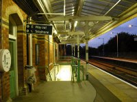
Westerham railway station
Westerham railway station served the village of Westerham in Kent from 1881 until its closure in 1961.
Located at 51.27 0.07 (Lat./Long.); Less than 1 km away
Pilgrims' Way
The Pilgrims' Way (also Pilgrim's Way or Pilgrims Way) is the historic route supposed to have been taken by pilgrims from Winchester in Hampshire, England, to the shrine of Thomas Becket at Canterbury in Kent. This name, of comparatively recent coinage, is somewhat misleading as the route follows closely a pre-existing ancient trackway dated by archaeological finds to 500–450 BC, but probably in existence since the stone age.
Located at 51.28 0.07 (Lat./Long.); Less than 2 km away
River Darent
The River Darent or River Darenth is a Kentish tributary of the River Thames in England. Its name is believed to be from a Celtic word meaning 'river where oak-trees grow'. The tidal part of the river is known as the Dartford Creek.
Located at 51.25 0.07 (Lat./Long.); Less than 2 km away
River Eden, Kent
The River Eden in West Kent is a tributary of the River Medway. It travels through the Weald of Kent from the border with Surrey, rising from the source in Titsey parish, Surrey, grid reference TQ 420 551, about 350 metres north of Clacket Lane motorway services, and flowing eastward through the Wealden clay to join the River Medway near Penshurst, Kent, grid reference TQ 537 434. The section from its source to where the Gibbs Brook joins it is also known as the Broadmead Water.
Located at 51.26 0.01 (Lat./Long.); Less than 4 km away
Sundridge with Ide Hill
Sundridge and Ide Hill is a civil parish in the Sevenoaks District of Kent, England. It is located in the Darenth valley and lies between Sevenoaks and Westerham. The parish contains the two villages, Sundridge and Ide Hill, and is in an Area of Outstanding Natural Beauty, within London’s Metropolitan Green Belt. The parish, created in 1894, is one of the oldest in the country. Between the two villages is Emmetts Garden, a National Trust property.
Located at 51.28 0.13 (Lat./Long.); Less than 4 km away
Pictures
Historical Weather
Related Locations
Information of geographic nature is based on public data provided by geonames.org, CIA world facts book, Unesco, DBpedia and wikipedia. Weather is based on NOAA GFS.


